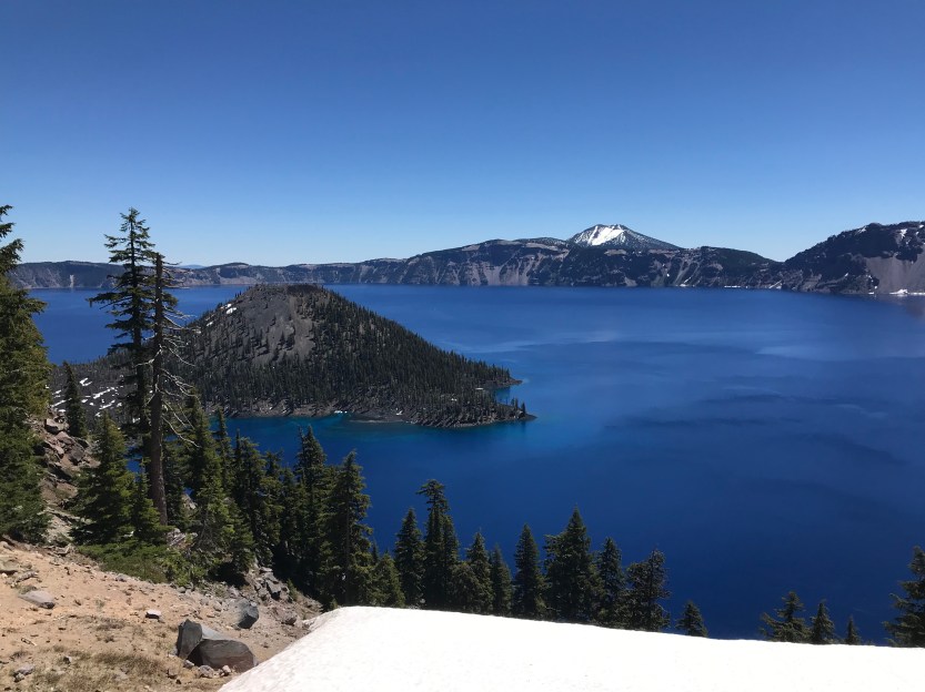
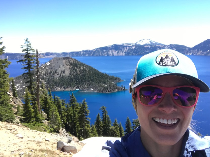
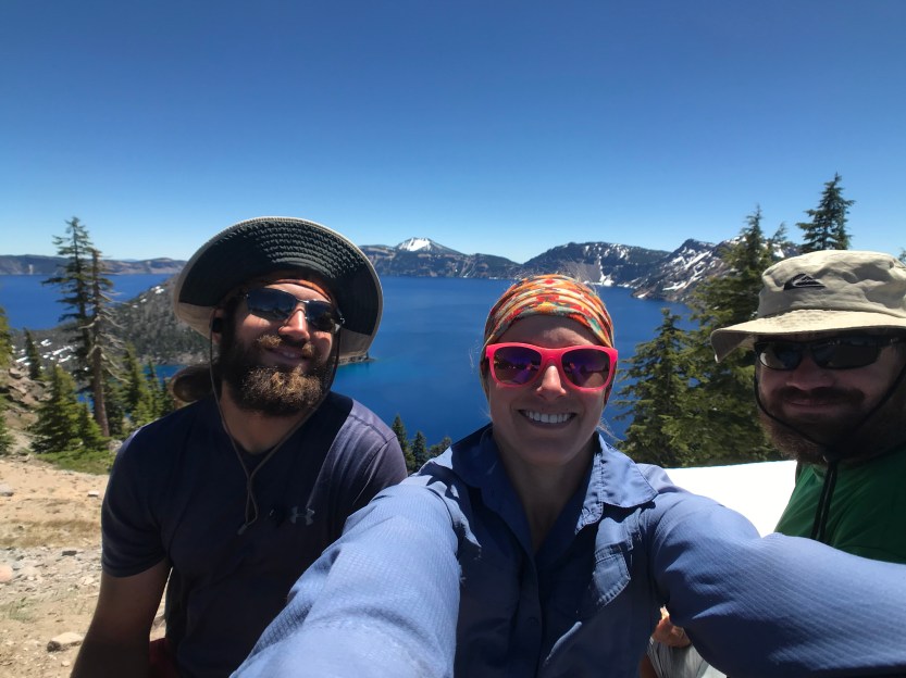
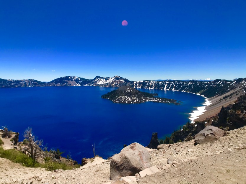
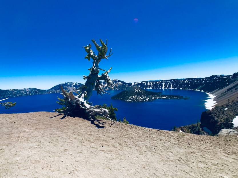
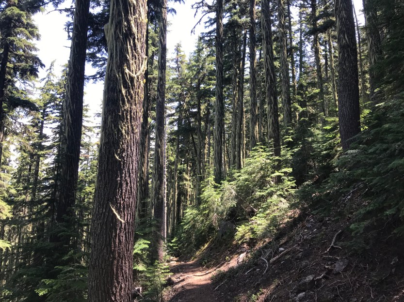
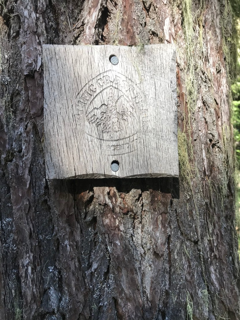
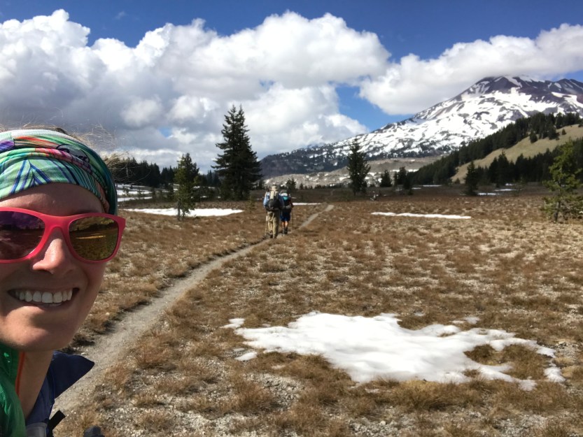
Day 64: 17 miles hiked. We woke up and walked back up to Crater Lake from our campsite. As we approached the lake, I saw that the color had changed to be an even deeper shade of blue than the day before. “Whoa!” I exclaimed and Beast and Savior nodded in agreement. We made our way around the lake, admiring it from all the viewpoints along the way. The PCT is an equestrian trail and doesn’t actually go around the lake because no horses are allowed on the rim of the lake (it goes through the national park land, but if you stay on trail, you’d never see the lake!), so we took an alternate route as we didn’t want to miss it! While at the viewpoints we had several people offer up trail magic, by way of pineapple slices and spare bananas. After many an hour hanging out admiring the view (and eating alllll of the fresh fruit), we finally made our way back to the official PCT. We got a ride to the parking lot where it met back up, and as we were trying to get organized to start walking, two people pulled in and offered us some more trail magic! They had just finished their own PCT section hike, and gave us some grapes and took our trash. I have to say, I generally hate taking out the trash in real life, but now throwing away trash that I would otherwise have to carry around is one of my most satisfying chores. We said goodbye to the angels and started to make our way to Mt. Thielson, our next adventure. We were in the middle of a dry stretch, and as we crossed a dirt road, we were happy to find a water cache. We sat and ate dinner at the cache before heading back into the woods to camp for the night. It was around this point that the 3 of us realized we shouldn’t hike together, because if we did, we’d have to walk in someone else’s cloud of mosquitoes that were following them. As the sun began to set, the hoards began to worsen and we took refuge in our tents after a quick setup.
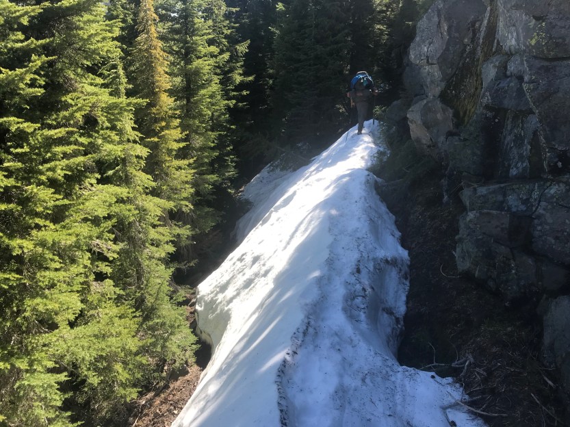
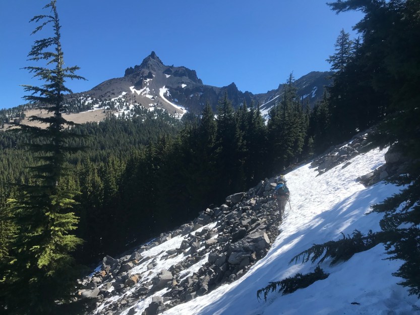
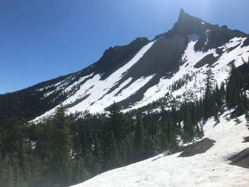
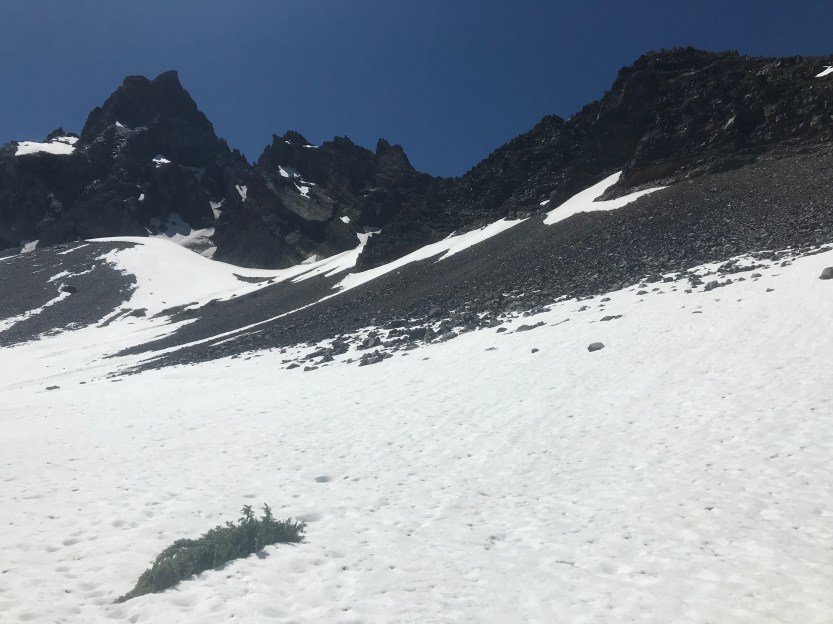
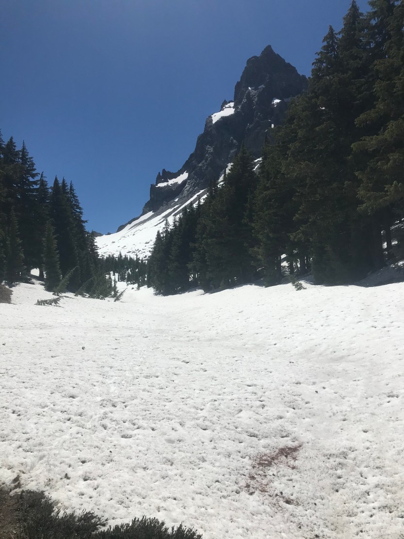
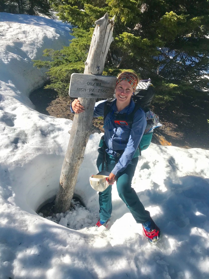
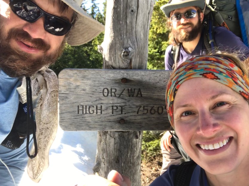
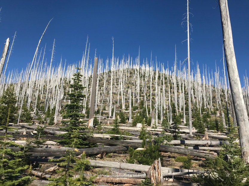
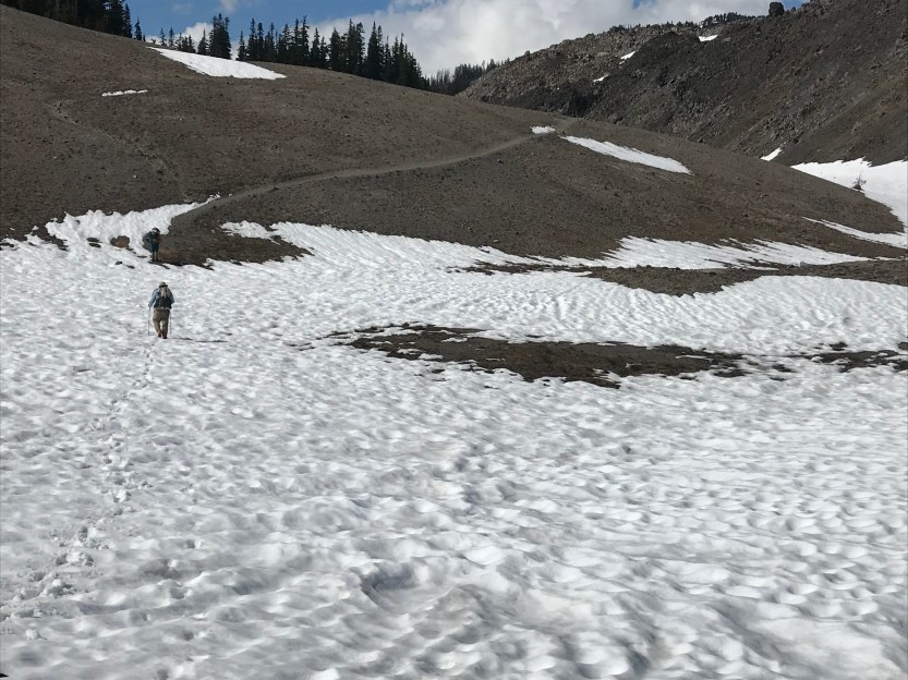
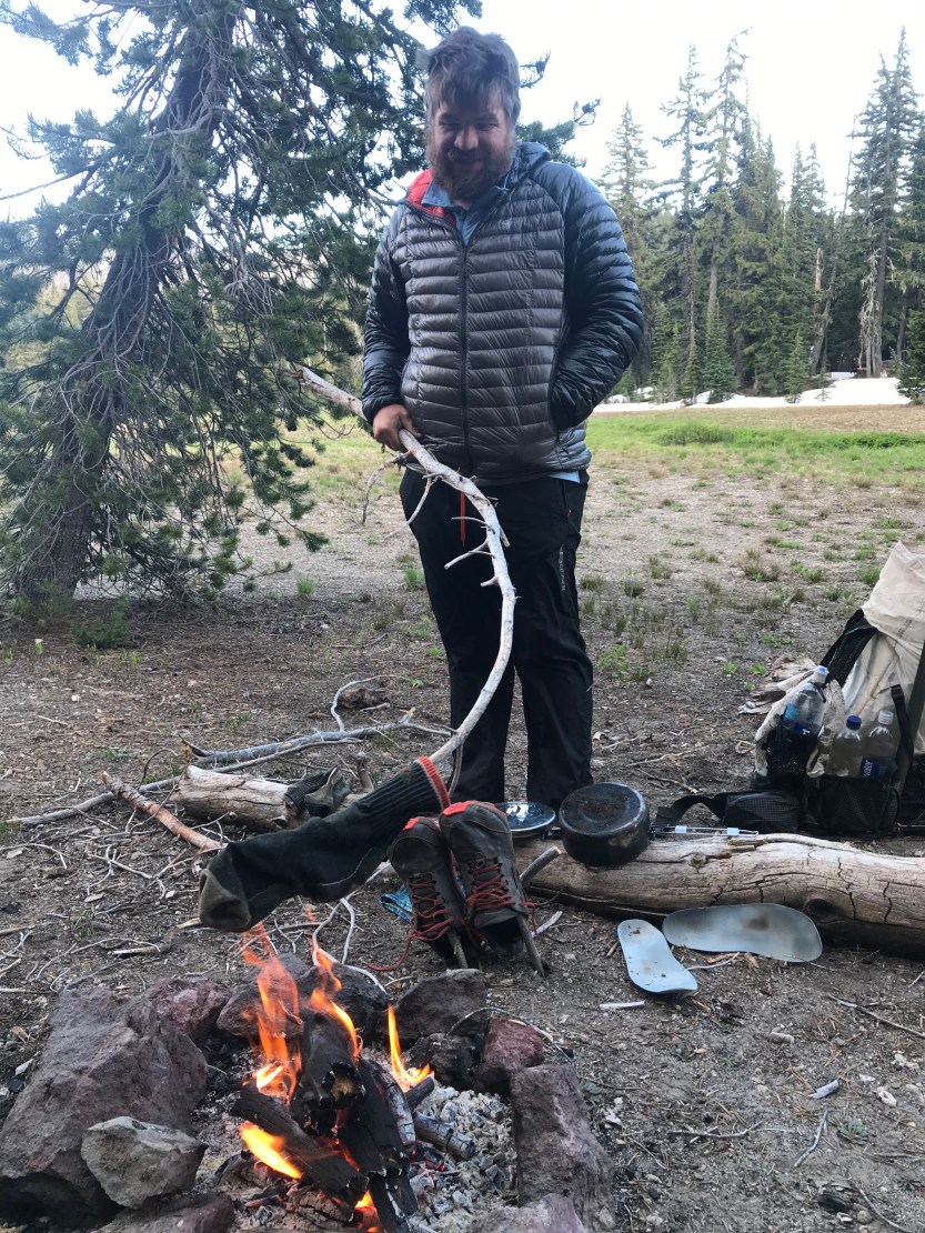
Day 65: 16 miles hiked. I woke and saw the mosquitoes were gone, “what good fortune!” I naively thought. As I started to pack, a nice solid layer of mosquitoes began to cling to the netting around my tent, as if they could sense my imminent danger. I resigned myself to hiking in my rain gear and headnet for the remainder of the PCT so that I would avoid the terrible fate of death by blood loss due to mosquito. As we began our climb around Mt. Thielson, the snow picked up and the mosquitoes thankfully lessened (I’m not sure I could’ve handled the mental challenge of both slippery snow hiking and mosquito dive bombs). We navigated our way through snow fields and around snow boulders as we climbed around the base of the mountain. This was an extremely challenging day, as almost all of it was spent on snow. Snow hiking is difficult, especially when one foot is in slush (the sun), and the next is on ice (the shade). It makes it hard to constantly be balanced, and I was happy that we were doing this sort of hiking in Oregon, where the trail is relatively flat. Even with the added traction of my micro spikes (which we put on about an hour into the day, and didn’t take off until 30 minutes before camp), I was still slip sliding around, and fell so often, I can no longer remember how many times I slammed my elbow into the ice. Additionally, the trail was always on the western edge of the mountain, so my right leg (which was always my uphill leg) was getting much more of a work out than my left, and my right elbow was paying the price for every slip. We walked along the base of Mt. Thielson, and saw a really cool, and yet eerie avalanche path, where all of the trees were broken 2-3 feet from the ground, and were just laying next to their broken stumps. After what seemed like forever, we made our way around Mt. Thielson, and found our way to the next water source. We were at the end of a 20 mile carry for water, and we were all out of water by the time we got to lunch. We found the spring, but it was covered in several feet of snow and ice. Having had such a bad time melting snow just a few days prior, we were very hesitant to melt some more. The melting of snow had ruined 2 of our 3 water filters (they now permanently tasted of smoke, no matter how much we tried to clean them out), and we didn’t want to ruin the last one! We walked along what was clearly the flow path of the spring for about 200 yards, hoping that our feet would break through, but it was still too deeply covered with ice and snow. We were all mentally and physically tired at this point, so we decided to take eat lunch on some nearby boulders while we figured out what to do. We saw a low point for the spring path, and I made my way over to it with my ice axe, in the hopes that I could dig for only a little bit and find some of that liquid gold. After one swing, I could see and hear it! I continued to dig so we could fit Beasts water bag in it, and then we spent the remainder of our break filtering water for everyone. Beasts filter was going rather slow, so it actually took several hours for us all to get water! We continued onward, in the hopes of getting up and over the Oregon highpoint before dark. This was one of the more difficult days on trail. There was a lot of uphill slogging through snow. With every step we took, we’d slide back a half step, so progress was extremely slow going and very tiring. Additionally, the trail was completely covered in snow, so we were constantly getting lost and having to check ourselves on our GPS devices (we found out later that 3 people had to be rescued in the 4 days after us because they all got lost in the snow fields and ended up in precarious situations). We eventually made it to the high point, but we were all mentally and physically drained by this time. From here it was all downhill, which in someways is harder in the snow because you’re slipping everywhere. We developed a sort of ski maneuver, where we’d plant our poles and slide our way down the mountain. Many falls occurred during this as well, but hey! at least the mosquitoes were mostly gone! We eventually got down far enough on the mountain that we could mostly walk on the ground. We were soaked by the time we got to camp because of all of the slush, and we had to make a campfire to dry off our socks and shoes (the first of many times). At least there was snow everywhere, so we could put out the fire easily! 😂
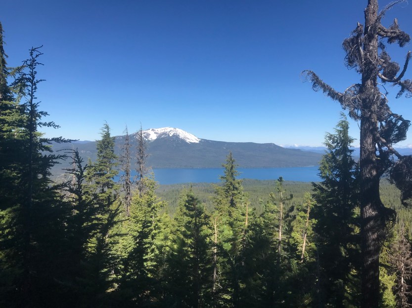

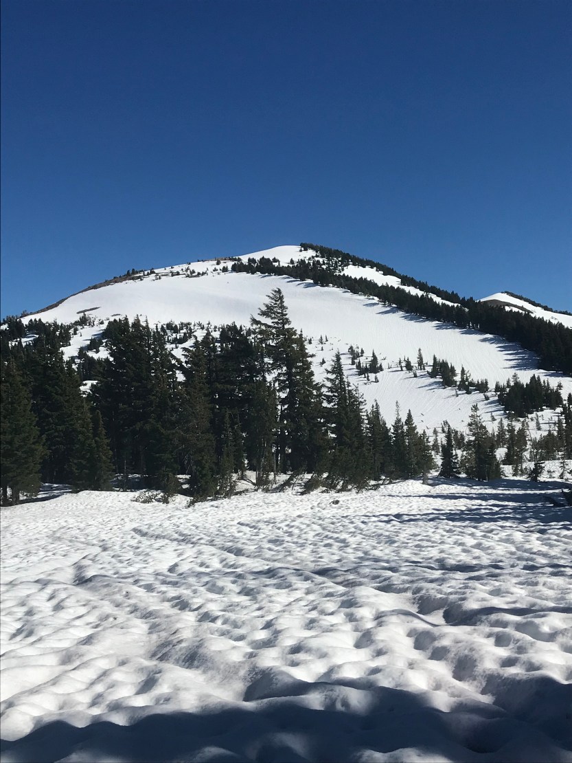
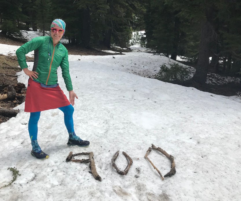
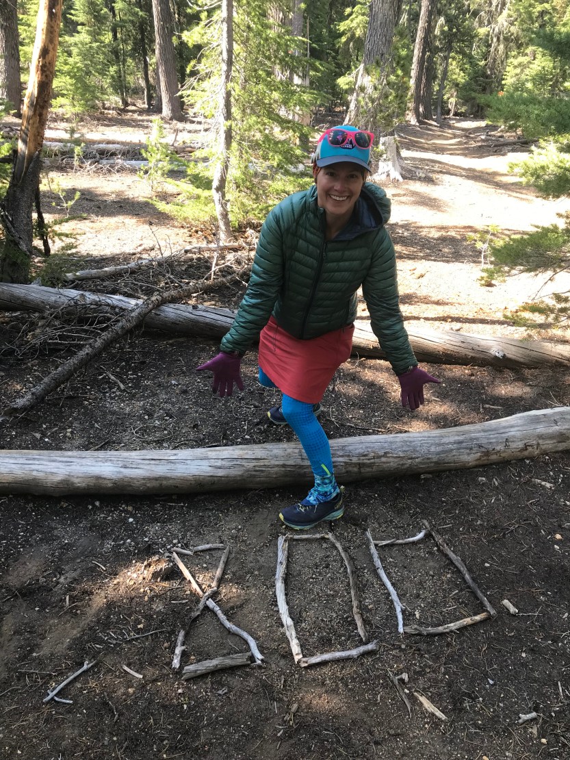
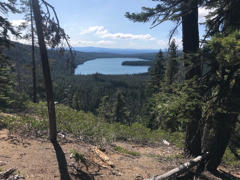
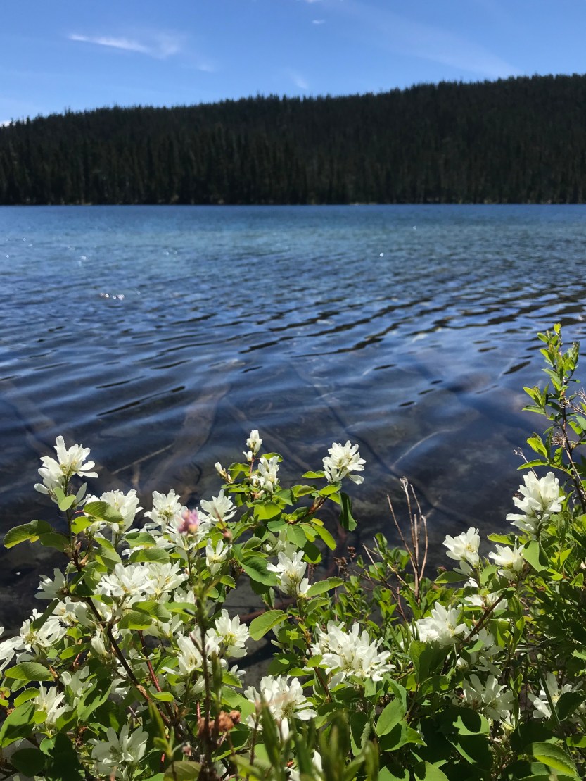
Day 66: 20 miles hiked. We had camped at mile 800, so in the morning, I got to work on making our sign. I honestly don’t remember much about this day, except for that the snow was gone, and the mosquitoes returned. Being surrounded by mosquitoes meant that I didn’t really stop to enjoy much, and the pictures are few. We hiked through the forest for most of the day, and didn’t get views of anything beyond trees, except for one lake off in the distance. We made the decision to take an alternate footpath (along the Oregon Skyline Trail) into the next resort of Shelter Cove. We did this for one main reason: we were all tired of snow! The PCT went along a route that was higher in elevation, and was still completely covered in snow. In looking at the snow maps, I could see that the OST had none, and we all jumped at the chance to walk on solid ground for a day. My stabilizer muscles appreciated the rest day! We camped along the OST with 14 remaining miles to get to the resort.
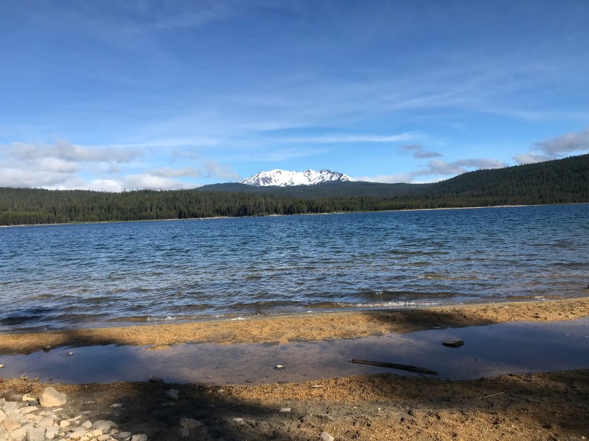
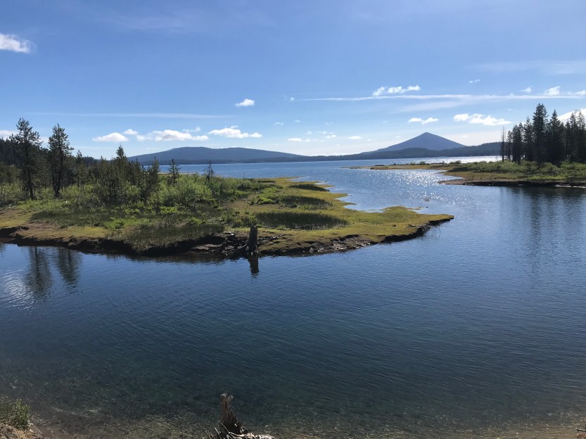
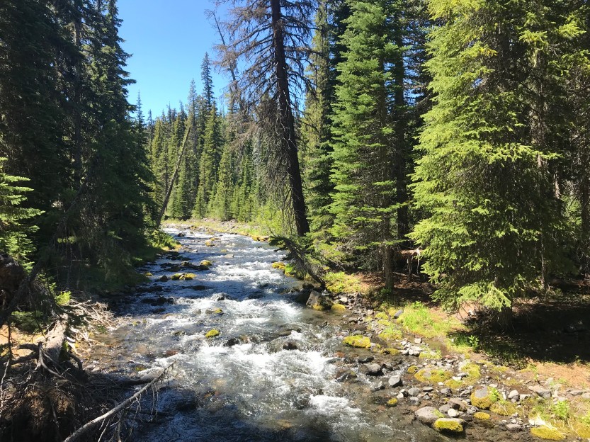
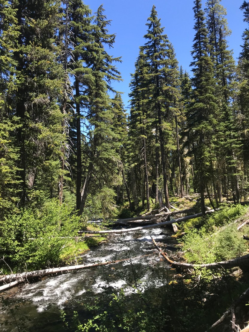
Day 67: 20 miles hiked. I woke up with soooooo much motivation to get to Shelter Cove resort. I had heard that their burgers were spectacular, and we had had no good food to speak of for 11 days very long days. I was incredibly happy that we had opted for the OST! I counted steps on snow for the day: 19! There were lakes everywhere, some of which offered a view of diamond peak, where the PCT went around. It looked snowy, so I was grateful to be on the ground. We also got to walk next to a raging river, with waterfalls along the way for the last 6 or so miles, and it was a great change of scenery from the snowcaps we had spent the last several days navigating around. We got into Shelter Cove, and I was happily surprised to see our friends Oreo and Sunshine (who we’d met at Crater Lake)! I inhaled an amazing burger, caught up with everyone, resupplied, and did all of the chores. It was a great stop in town, and I vowed to come back and have fun at this resort sometime when I wasn’t trying to hike crazy mileage. Oreo and Sunshine met a woman named Bookworm, and the three of them headed out, while we promised to try and catch them later that night. We were waiting for our laundry to finish when another person, Starr Baby, came in and we chatted over some beers. It was so nice to see and meet new people! Savior, Beast, and I have mostly been all on our own since we started in Oregon, and it was great to chat with some new people and hear some new stories! Eventually our chores were finished, and we hiked out of the resort, determined to catch up with our friends. We did find them, but it was after dark, and they were all sleeping by the time we arrived (thru-hikers are usually sleeping by 8 or 9pm). Nevertheless, I was pretty proud of us: we had managed to hike 20 miles, while doing a full resupply and all of our chores too! This is what we call a hero (minimum of 20 miles, and all chores done too), and it was the first time we had managed to accomplish it!
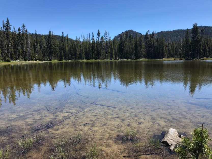
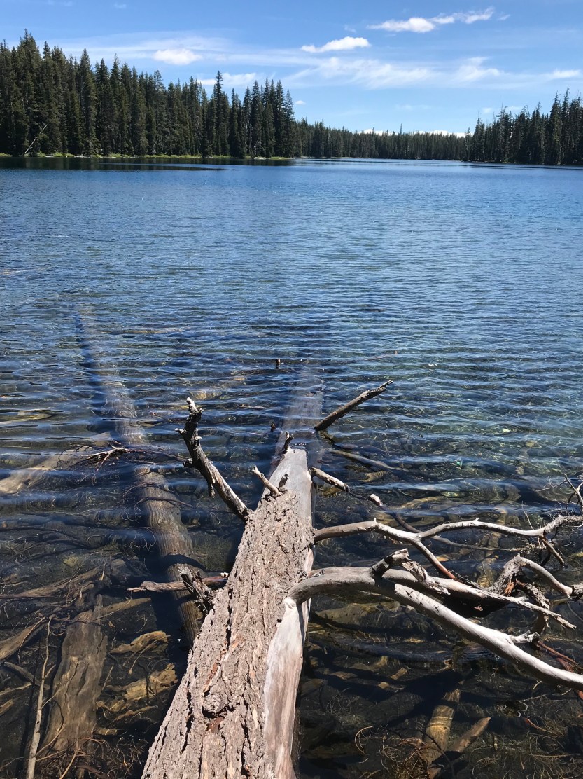
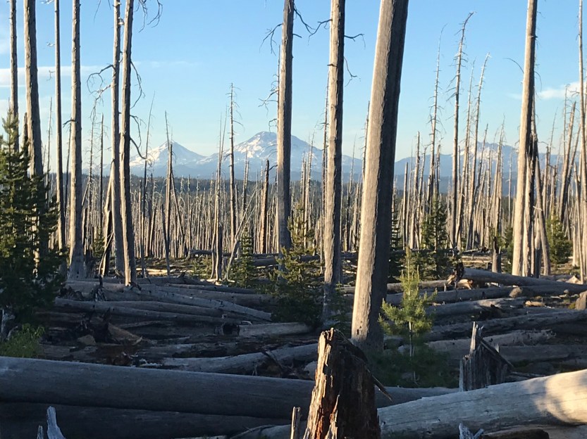
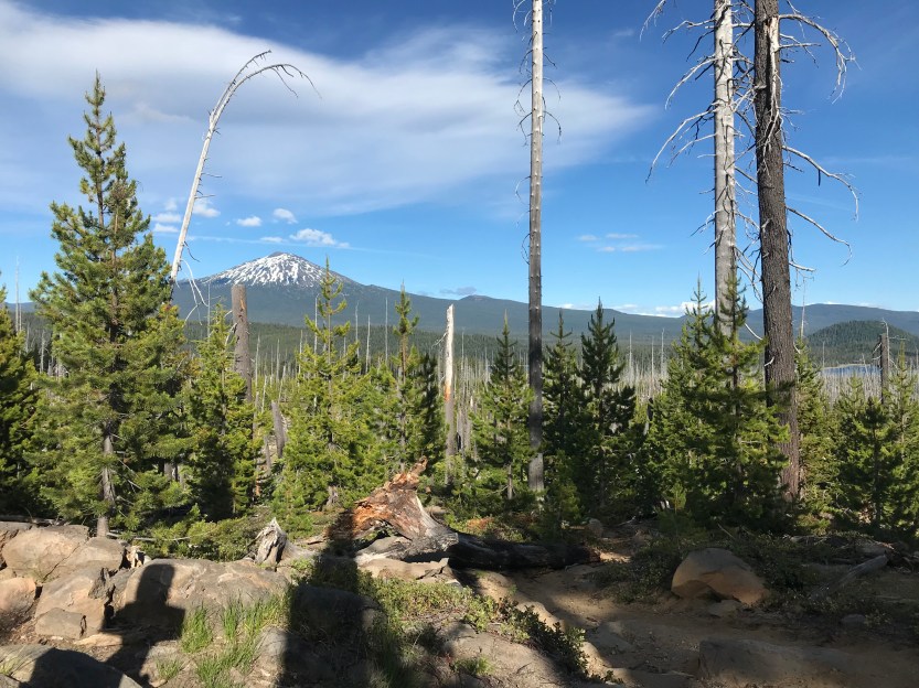
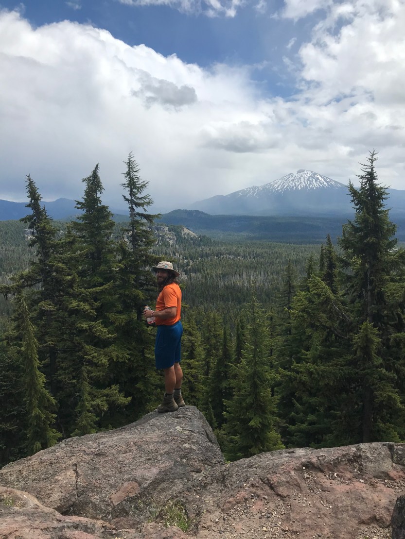
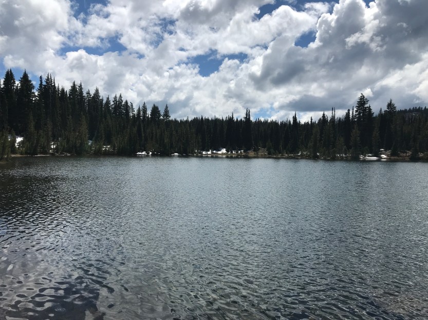
Day 68: 19 miles hiked. We were just starting to pack up, as Sunshine, Oreo, and Bookworm passed our campsite. We talked about where we thought we’d camp for the day, and made tentative plans to try and meet up again at night, this time hopefully before bedtime and then they headed off while we continued packing! We made our way to a shelter that is used by backcountry skiers during the winter. This was the first shelter that we’d seen along the trail, and it was quite the treat. It was a log cabin that smelled like and reminded me of our family’s cottage in the Upper Peninsula. Much of Oregon reminded me of the UP. There are trees and lakes everywhere (not to mention the mosquitoes and snow in June). It all made me a bit homesick, but also made me think of happy thoughts of my family. We ran into Starr Baby again at the shelter, and spent far too much time chatting the day away. Eventually we remembered that we shouldn’t take hours long breaks, and made our way to leave, with Starr Baby saying he’d catch up to us later. After leaving the shelter behind, we walked to Bobby Lake, where we had a great lunch. I really love all the lakes that Oregon has to offer! It basically means I can go for a swim anytime I want a break or get too sweaty. It also means I get to eat lunch on a lake, everyday. Unfortunately, all the water also means that all of these breaks come with swarms of the flying terrorists, but I’m just going to try to block that from my memory… As we continued on in our day, we ended up in another burn area. The burns are kind of nice, as it’s the only time that you can actually see off in the distance and what you’re hiking next to! It offered us our first glimpse of the Three Sisters which are volcanoes that we were going to hike along side in the next leg of the trip. We stopped for a break and Starr Baby caught back up to us. While we were resting, I made myself an electrolyte drink, and unfortunately, I didn’t wait enough time for the tab to dissolve before I drank it. As we started to hike again, I started to get dizzy and nauseous (the tabs were fizzing and dissolving in my stomach which was screwing with my ability to breath properly!) and I had to stop several times to restore balance. Savior and Starr Baby hiked on ahead in the hopes of getting out of the exposed sun, while Beast and I stayed behind until I could start walking again. We eventually came across some cell service, which was great because we needed to book a hotel or AirBnB for the next stop (Bend, OR). As we were walking, Beast was looking at hotels on his phone and stepped on the end of a dead branch. This branch flipped up and smashed in his knee, and which then started to gush blood everywhere! We eventually caught up to Starr Baby and Savior, who had stopped at the first campsite they came across in order to wait for us. I think we looked like a sorry sight, with Beast bleeding all over his leg, and me nonstop burping/desperately trying to not throw up. We decided to call it a night, despite the fact that the mosquitoes were even worse than normal (I renamed the lake Mosquito Hell Lake, since that was more accurate than Taylor Lake) because neither of us were in any shape to continue on!


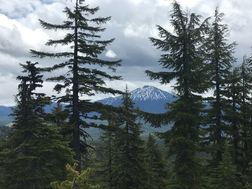
Day 69: 24 miles hiked. We said goodbye to Starr Baby for good in the morning, as he was going to push on while we went into town. We were 24 miles away from Elk Lake Resort, where we had arranged to have my brother, Jordan, come and pick us up. We were all motivated to get to the resort, as we were going to take our first zero in Oregon! We left in the cold of the morning, and literally 200 yds into the hike, we saw a sign that Oreo and Sunshine drew to point us to their campsite… we were so close, yet we still missed them! 😩 As we hiked along, we were met with on/off snow on the ground. It was difficult to hike through, but we were so motivated to take a day off, that we still managed to get 20+ miles in for the day. We stopped at a series of several lakes for all of our breaks, including my favorite lake so far, Dumbbell Lake! The first lake was freezing cold, the second lake was warmer, but full of mosquitoes, and the third lake was perrrrrfect! No mosquitos and warm and beautiful! Another place I could spend an entire day, if I had the time! We moved on, trying to hike fast enough to not be late in meeting Jordan. We passed by several meadows and fields with snowmelt rivers winding their way through them until we came out on a ridge where we saw Mount Bachelor off in the distance. From there it was all downhill into Elk Lake Resort, where we found Oreo and Sunshine camping out at the trail junction. We lamented about the fact that we kept missing each other, and tried to make plans to meet up when we all got back on trail. We found Jordan waiting for us at the resort, and had a beer to celebrate! Somehow we crammed all of our stuff and the 4 of us into his tiny Jetta, and made our way to Bend, where we were going to spend the next 2 nights. There’s an amazing Thai restaurant in town that we hit up and then we proceeded to pass out pretty quickly after getting to our AirBnB.


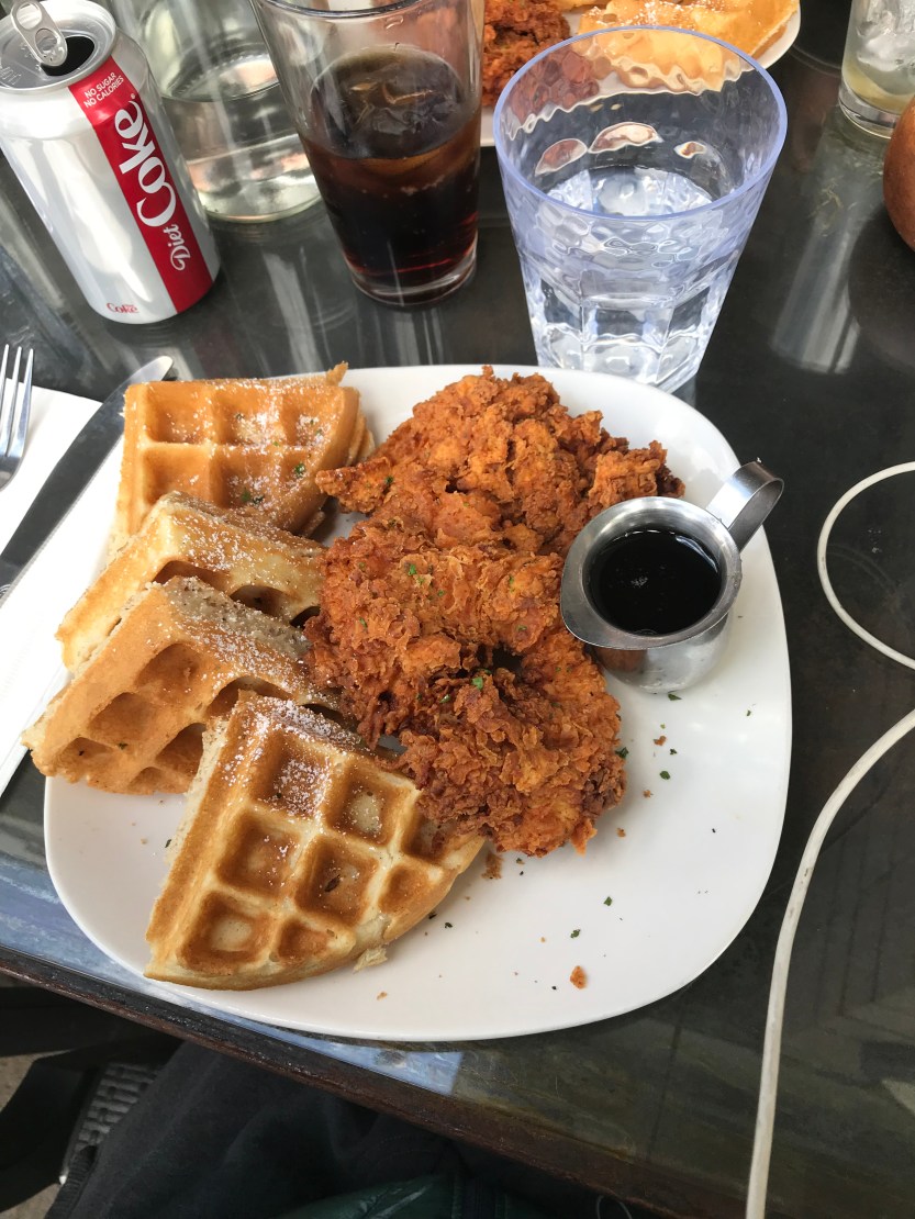
Day 70: 0 miles hiked. We spent the day in Bend, eating things (like chicken and waffles), doing chores (like buying new water filters), and hanging out. Before I started my hike, I had given Jordan my passport to bring to me when I got close to the Canadian border in Washington, which turned out to be a great thing, because he brought it with him to Bend! I still had no wallet at this point, and was relying on Venmo to pay Savior and Beast back for everything I needed. It was really nice to have an ID again because that meant my mom could take money out of my checking account (thankfully I had added her to all of my bank accounts before I left!), wire it to me, and with my ID, I would now be able to get some ca$h! I had lots of fun hanging out with Jordan, and it helped me get over some of my feelings of homesickness I’d been feeling a few days prior. ❤️
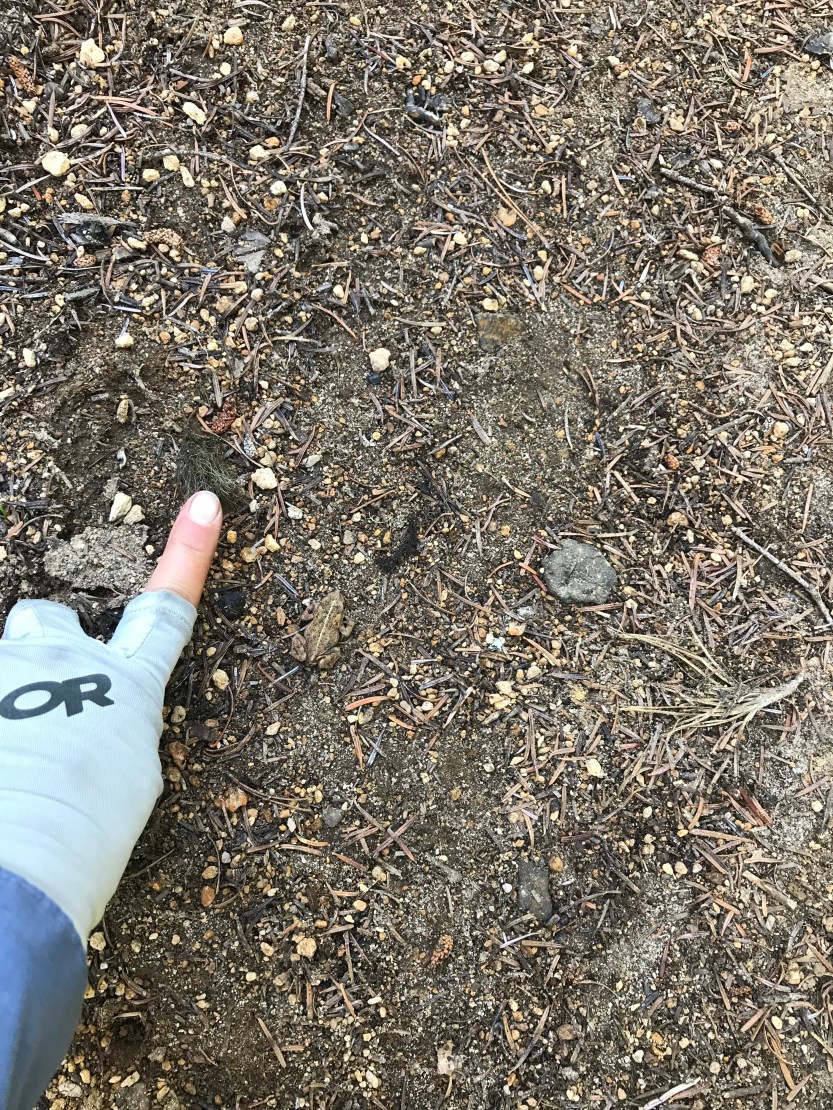
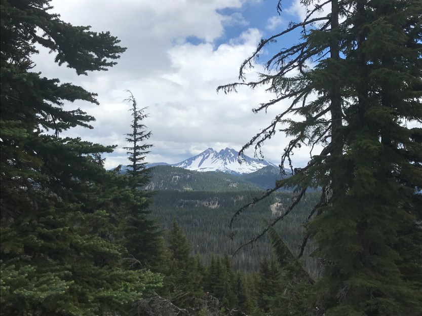
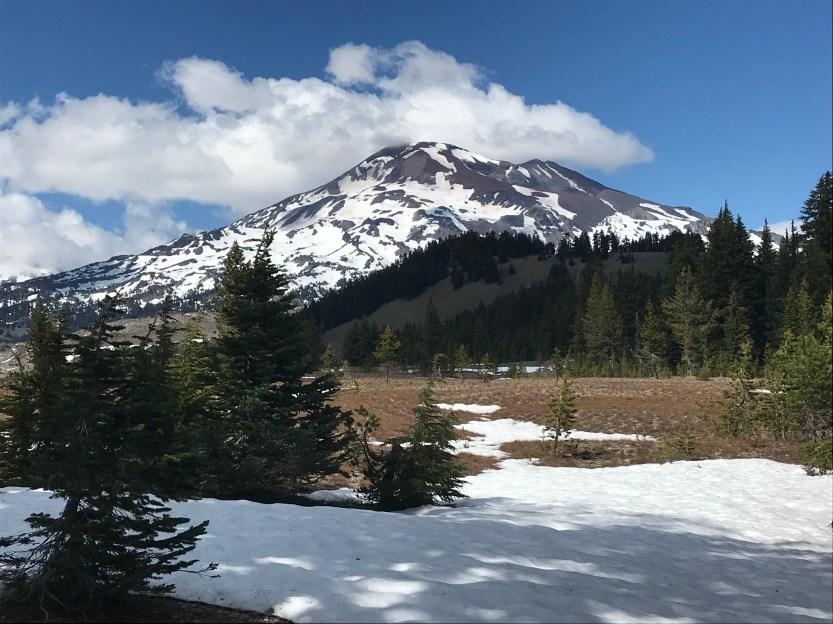
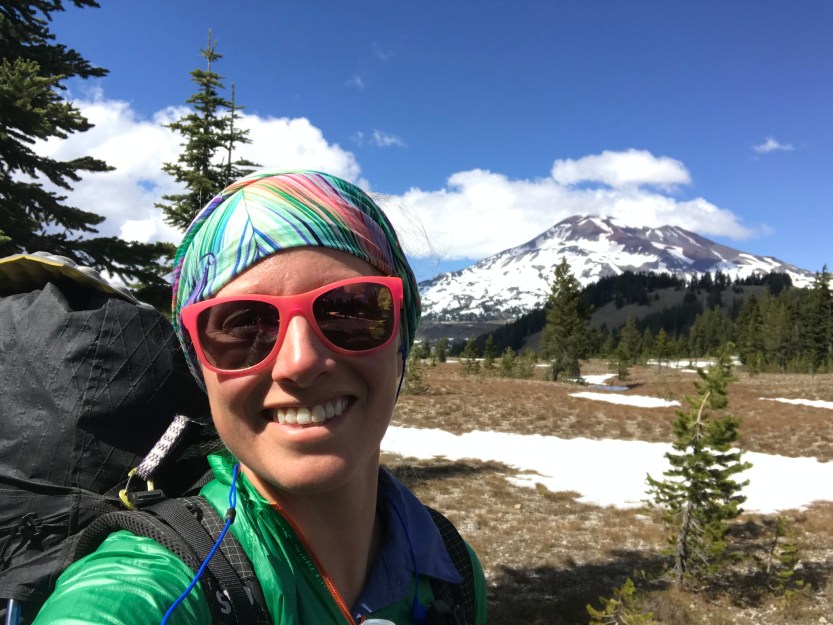
Day 71: 10 miles hiked. We finished up the last of our chores, and Jordan dropped us back off at Elk Lake. We knew that the upcoming section was going to have a lot of snow, and that it would be difficult to find places to camp that weren’t covered. We also knew that the snowfields were going to start to be really bad about 10 miles ahead of us, so we planned to only go 10 miles in order to avoid snow camping. I was having issues with getting a new credit card from one of my banks (this whole missing wallet thing turned out to be one giant headache…), so we stopped at Mirror Lake for several hours to eat lunch while I was on hold with them to try and get a new card. It eventually got all sorted out, and we continued on. As we made our way towards the Three Sisters (creatively named: South Sister, Middle Sister, and North Sister), we could see all sorts of mountains around and ahead of us, including Broken Top and Mount Bachelor. It was incredibly beautiful, and I was really excited for all of the scenery we were about to walk through. As we hiked along, we saw a lot of elk tracks, but no elk :(. We got to our campsite for the night and started a campfire to dry off all of our soaking gear that had gotten wet in the slush fields we had crossed earlier in the day.


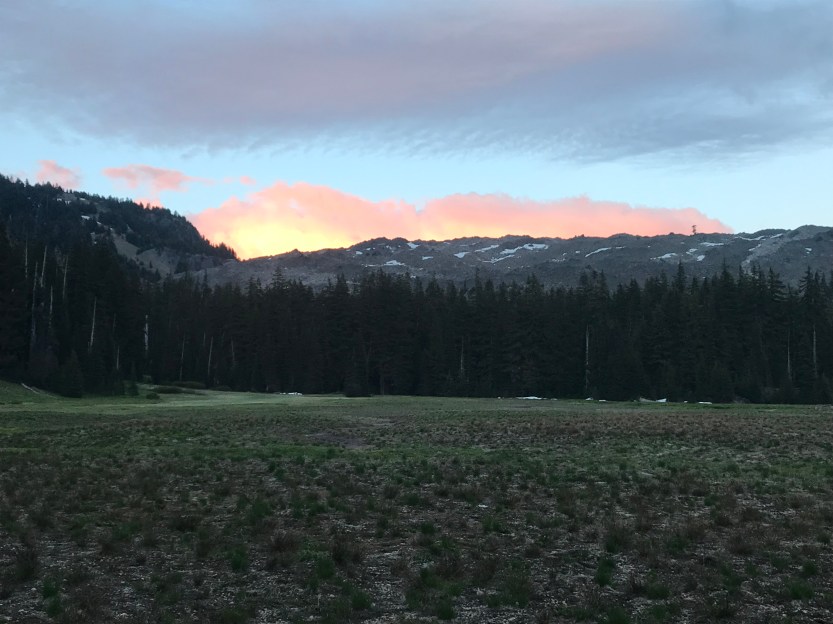
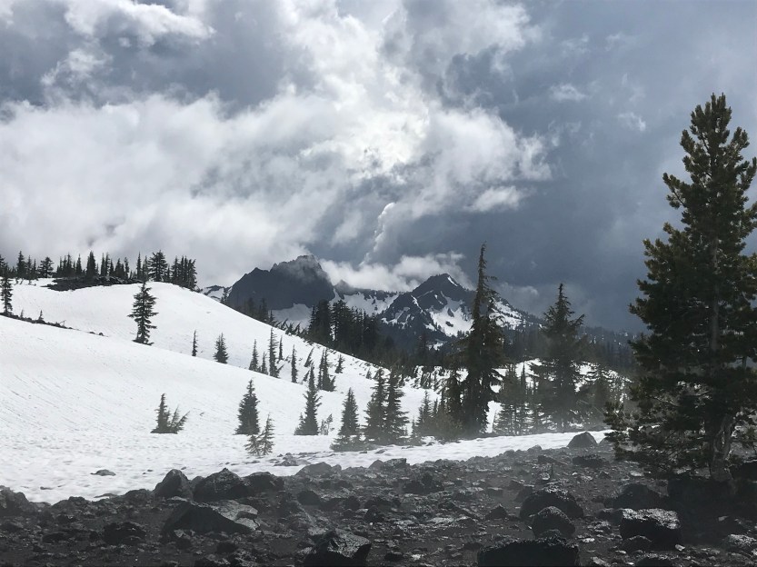
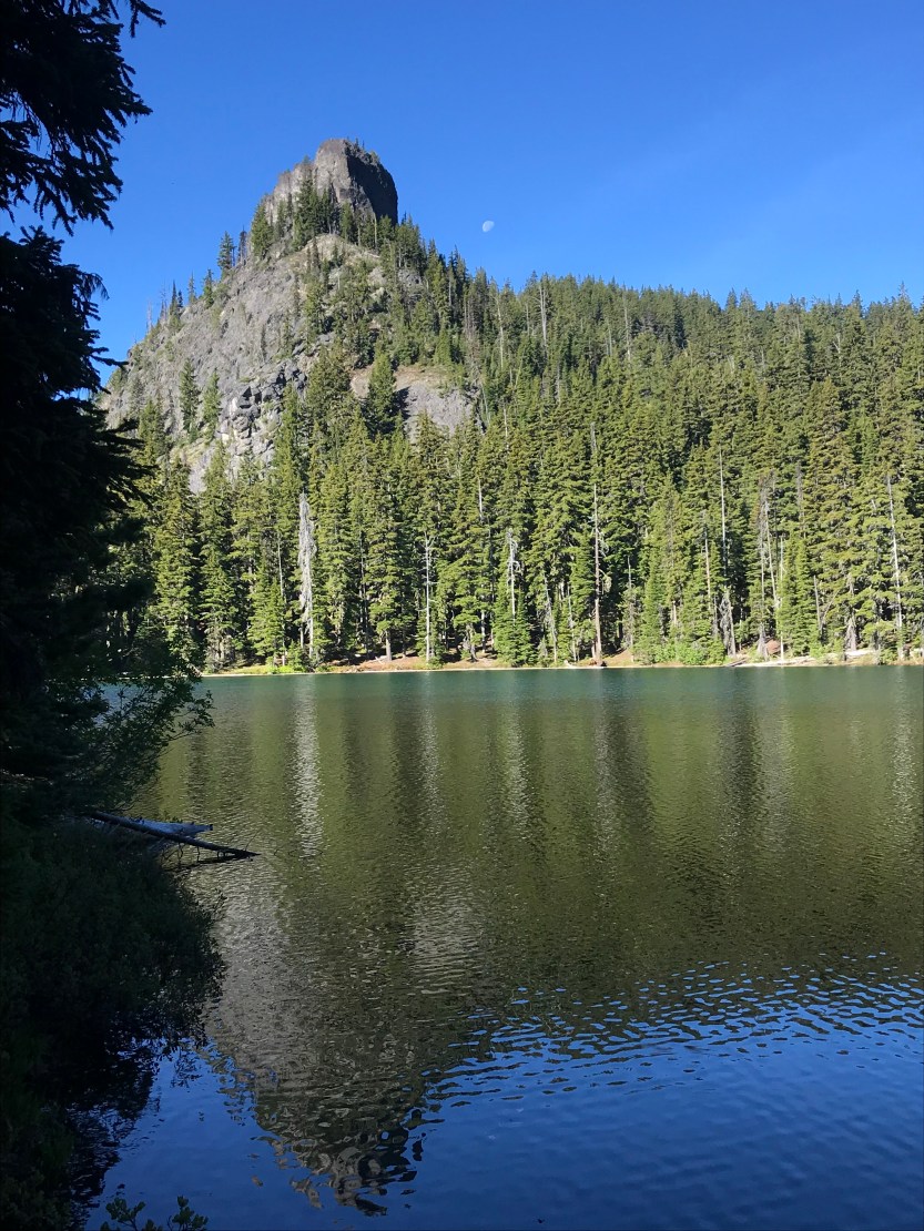
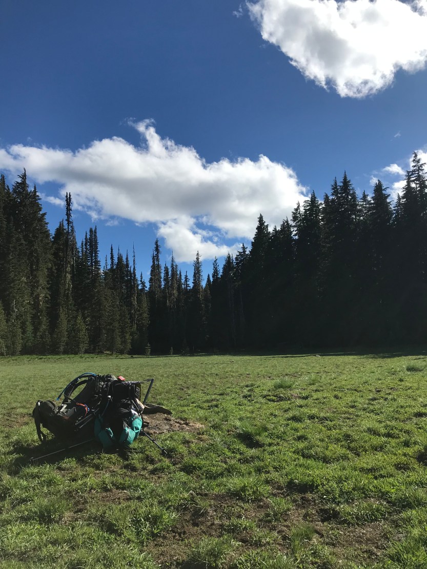
Sunset view
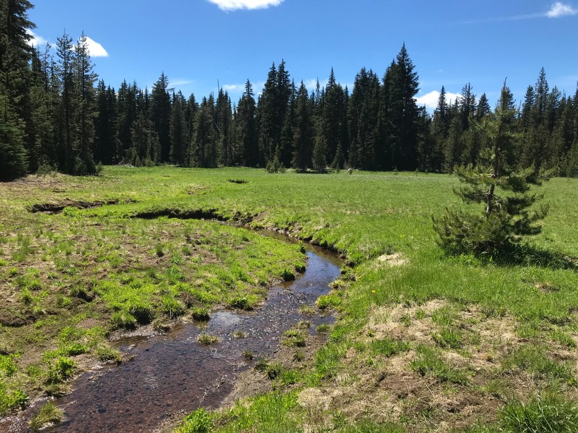
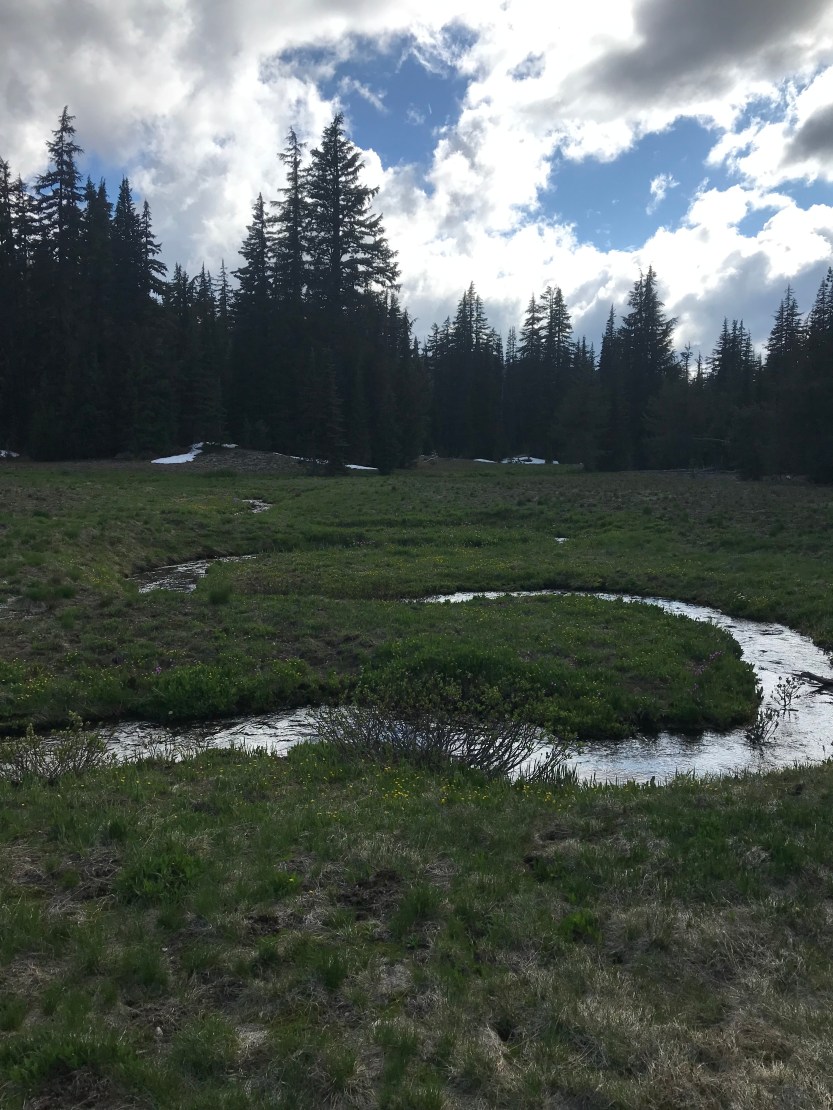
Day 72: 9 miles hiked. We had planned to hike about 15 miles today, as we knew it would be slow going with all the upcoming snow. Things didn’t work out that way though, as we were waylaid by several storms throughout the day. As we left our campsite, we crossed a beautiful little stream that zigged and zagged all the way along the meadow. Almost immediately we were surrounded by a snow field that would only occasionally let up for the remainder of the day. After what seemed like an age, we crossed the 900 mile marker! Only 100 more miles until we reach 4 digits! As we continued hiking, thunder storms kept on rolling through, but the closest ones were a minimum of 15 miles away and they would dissipate after a few hours. We changed the routes that we would walk along, since the trail mainly went across wide open snow fields. The safest place to be in a lightning storm is not anywhere outside. In lieu of this option, squatting amongst trees, in an area of lots of trees, is one of the safer places to be, though it is still very unsafe. We took several breaks when the storms got closer, just so we could remain in the trees while the clouds rolled overhead. It was on and off raining on us all day as well, and the breaks were nice to get some shelter from that too! Eventually, it seemed like the storms had broken and we were in the clear, so we walked along a field, passing by Middle Sister. As we entered a limited area (no camping allowed), we could see another storm cloud coming in, though it looked like it too would miss us. Within 30 minutes, we realized this was not the case, and we hung out in some more trees to try and wait it out. This was by far the scariest thing I’ve encountered on trail! There was no pause between the lightning and the thunder, meaning the storm was directly overhead, and the trees we were in offered very little protection. I squatted out in the center of a triangle formed by three trees in the hopes that if one of them was struck, one of the other two would catch it instead of it falling on me. Somehow I had cell service in this area, and I began texting with my friends, Caitlyn and Dorothee, which helped to calm my nerves down a bit! At this point we were all soaked from the storm and shivering, and the best way to warm up is to start moving. Once the thunder was a few seconds behind the lightning, we decided to start walking again, in order to avoid the hypothermia that was rapidly approaching. About 2 minutes after we started walking again, the sky opened up and nickel-sized hail started to downpour all around us. We were still in the area where camping was expressly forbidden, but at this point it was a survival situation (in which case camping becomes legal). I couldn’t stop shivering and by then I hadn’t been able to feel my hands for several hours. There were only 2 ways to warm up: continue hiking (not possible in the bruising hail) or set up camp and dry off, so set up camp we did! Without thinking, I dove into my tent as soon as it was setup, which made the inside of my tent soaked. Note to self, take off wet clothes in my tent vestibule before leaping into my tent next time, regardless of if it’s hailing out. Everything I had was soaked, except for the stuff that needed to be kept dry in order to keep me alive. I spent forever trying to wick up the mess I made before I could get out of my wet clothes and unpack my dry stuff. It took so long because I moving slow with how cold I was, and my fingers were barely functioning! Eventually I got dry, changed clothes, and ate some soup, which made me feel infinitely better! I had hoped that the storm would pass and we could pick up camp and move out of the no camping area, but I fell asleep as I waited for it to let up.