Day 89-23 miles hiked. We woke up at the beautiful Blue Lake, just 23 miles from the town of Trout Lake. I had spent the night tossing and turning, trying to decide if I should continue my hike or not. My ankle appeared to be infected in the two places where my blisters were the worst and were now open sores, rubbing against my socks every time I took a step. When I woke up this morning, I decided that I would walk the rest of the summer, regardless of how miserable I felt, or the weather was. I had made it 3 months, and I had only 1.5 months remaining. My stubbornness kicked in, and I became determined to try and make the best of it and to not let the trail defeat me. It was unlikely that I’d be able to finish the whole trail this summer, but that wasn’t what was important. What was important was pushing through the hardship and coming out on the other side, growing with the discomfort I was feeling, and not quitting just because it had been tougher than what I had mentally prepared for.
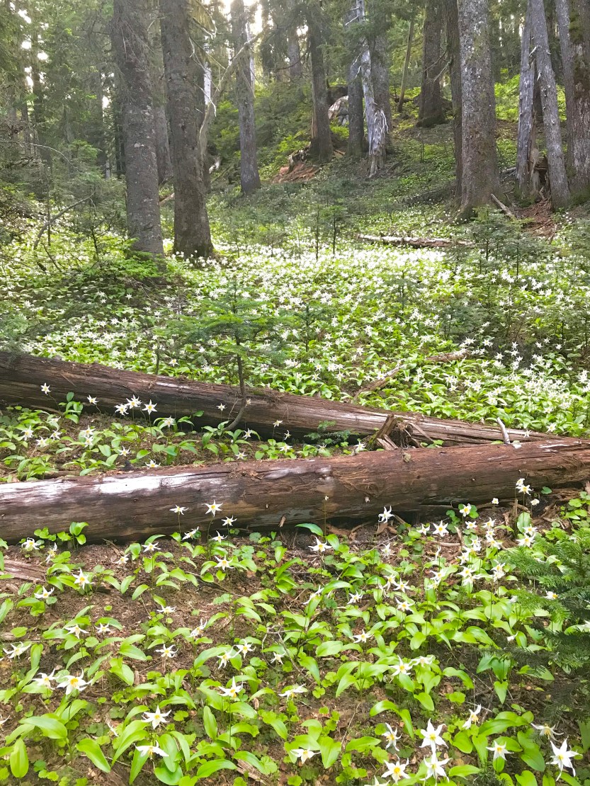
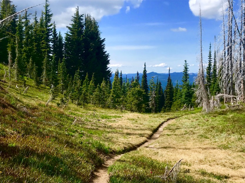
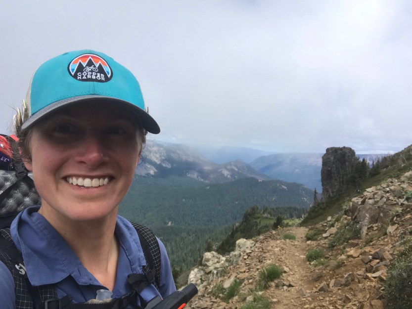
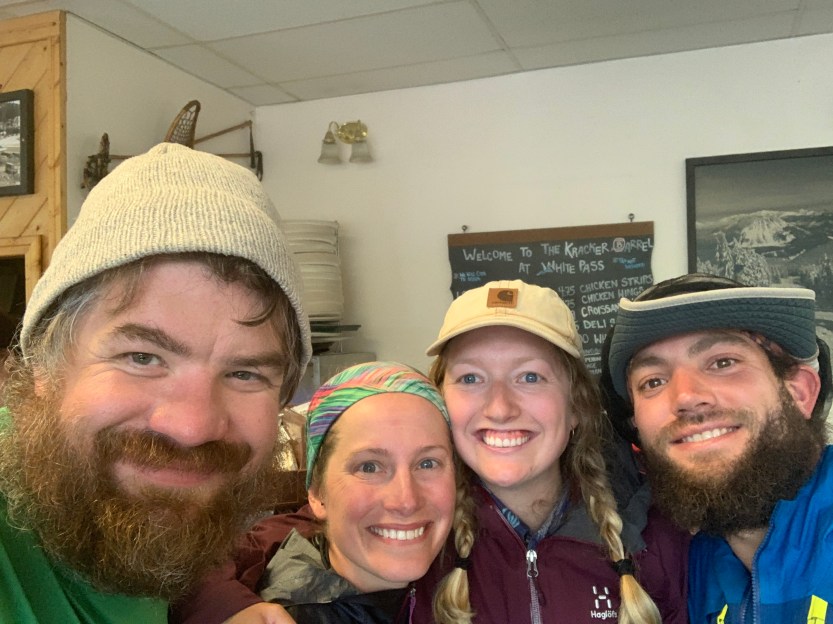
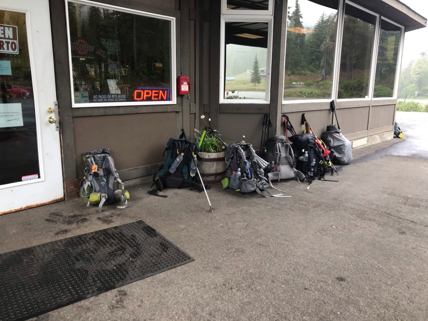
I was really looking forward to Trout Lake. A shower would likely help with my infection, and I had sent two new ankle braces there that were designed for hiking and would allow for a bit more flexibility in walking. As I walked, it became clear that the snow had only just melted in this area, as we were at times in whole seas of avalanche lilies as well as surrounded by swarms of mosquitoes for most of the day. We passed by countless ponds, rivers, lakes, and snow melt puddles. We walked through several lava fields and spent most of the day leapfrogging with several section hikers (people that were only hiking the state of Washington, as opposed to the whole PCT). Despite my recent injection of determination, I couldn’t help but feeling endlessly jealous of the section hikers… they had so much energy and they were soooooo excited to be out hiking. They were on day 4 of their adventure, they were 60 miles in, with only 450 miles remaining and their constant chipper-ness caught me off guard. We stopped at a dirt road for a break, and I took the opportunity to change my bandages on my ankle. My wounds were oozing, and I needed to change the gauze (and add new antibiotic ointment) as often as possible. This was a pretty excruciating process that I won’t describe because it was also very gross, but suffice it to say, I was not in the best of moods. While I was in the middle of doing this, the section hikers walked by to comment on how wonderful it is to take a break from life and hike… oh to remember that feeling of excitement! After three months straight of hiking, it had started to feel like a job instead of a hobby. Most of the day was pretty flat and downhill, except for one 2.5-mile section that was very steeply up. Today I decided that I would no longer stop on any uphill section (unless it was longer than 6 miles, but that’s only because I like to take a break every 6 miles). This was entirely based on stubbornness. I felt like the trail was defeating me if I had to stop to catch my breath when I was going up, and well, I wasn’t going to let it break me. I put some Lady Gaga on in my ears and sprint walked up the hill, knowing I would soon be taking a break in town, with a burger and beer in my hands! We pushed all the way to the road to town, and we were fortunate enough to have a trail angel show up right then to pick up some other hikers. He had enough room in the bed of his truck for all of us, so we climbed in and made our way to town. We resupplied on food, picked up packages, did laundry, charged our electronics, showered, ate burgers, and had a few beers. Two hours later, we were making our way to get back on trail (we’ve got this whole town thing down to a science). Our second hero (hero= 20+ miles, get all of your chores done, back on trail)!
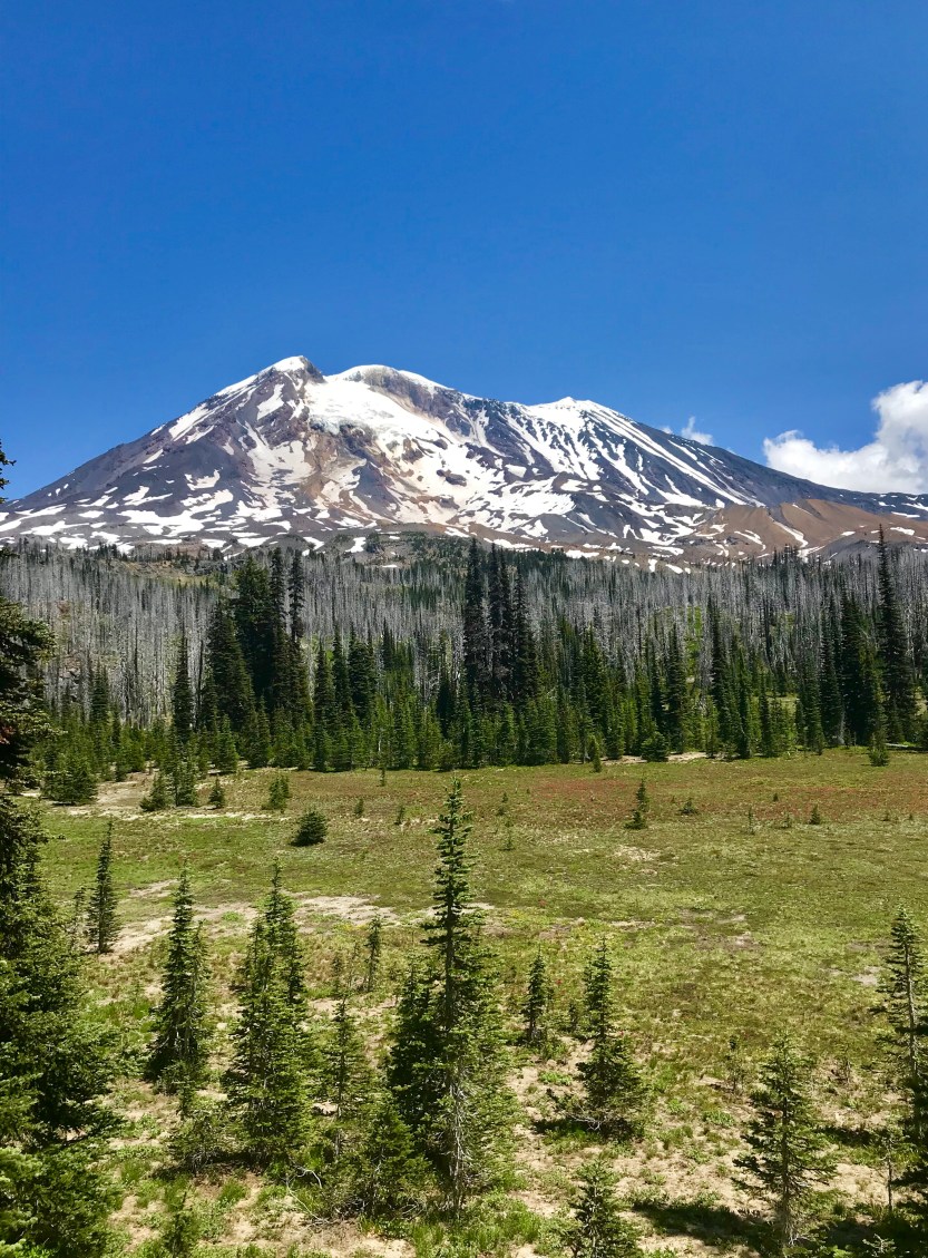
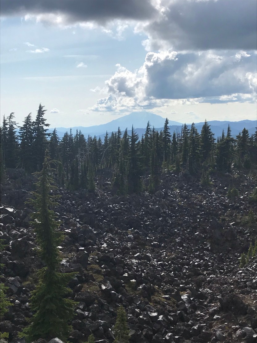
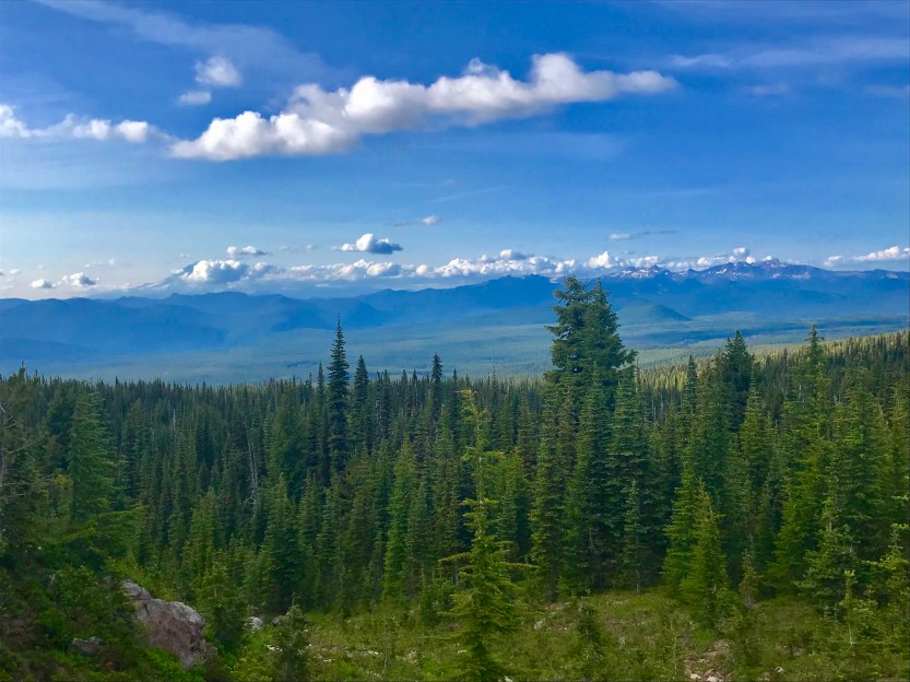
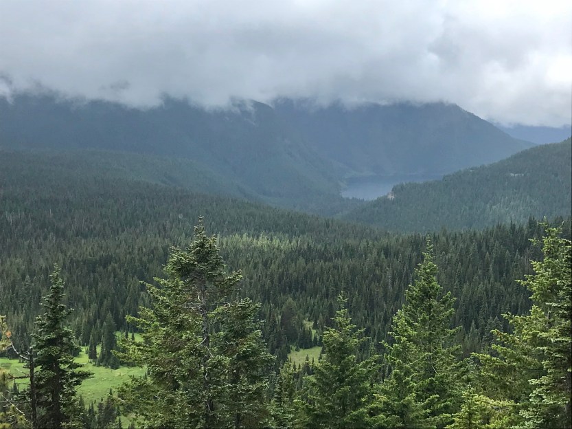
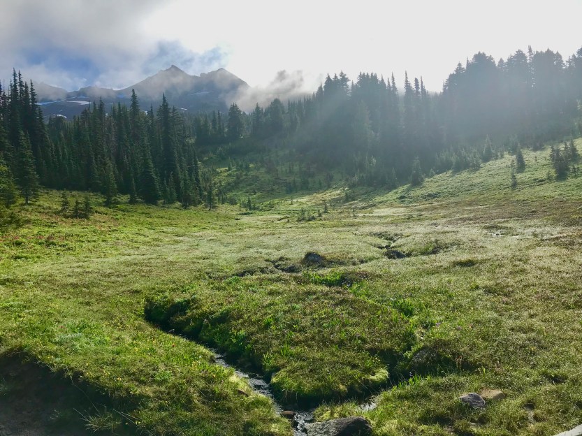
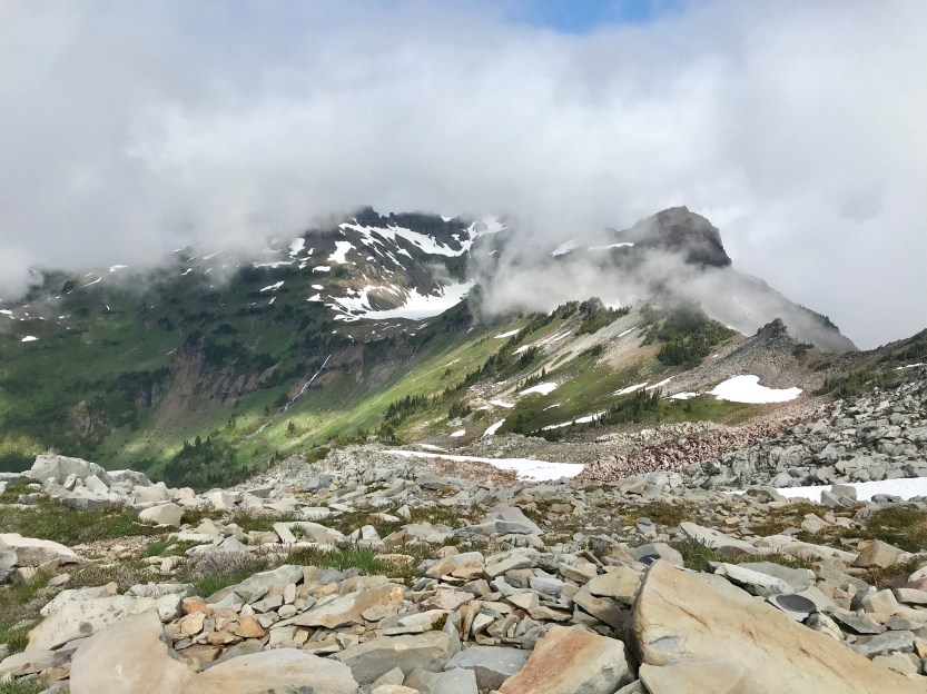
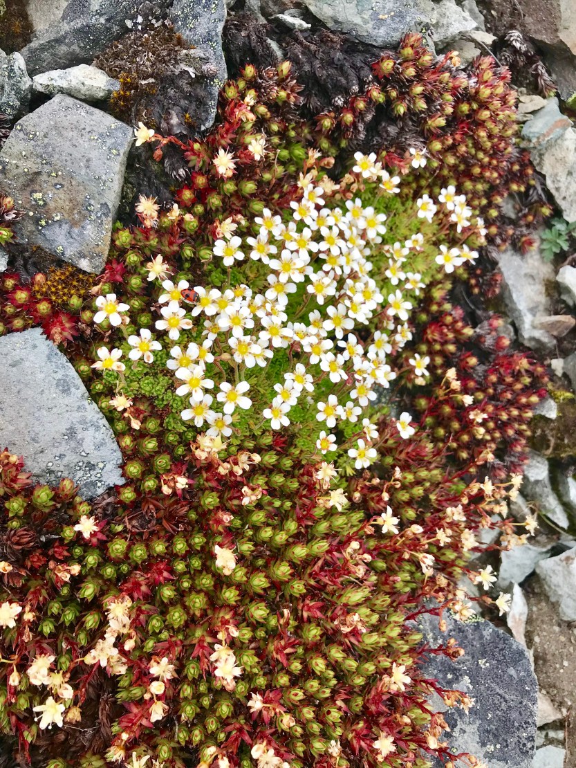
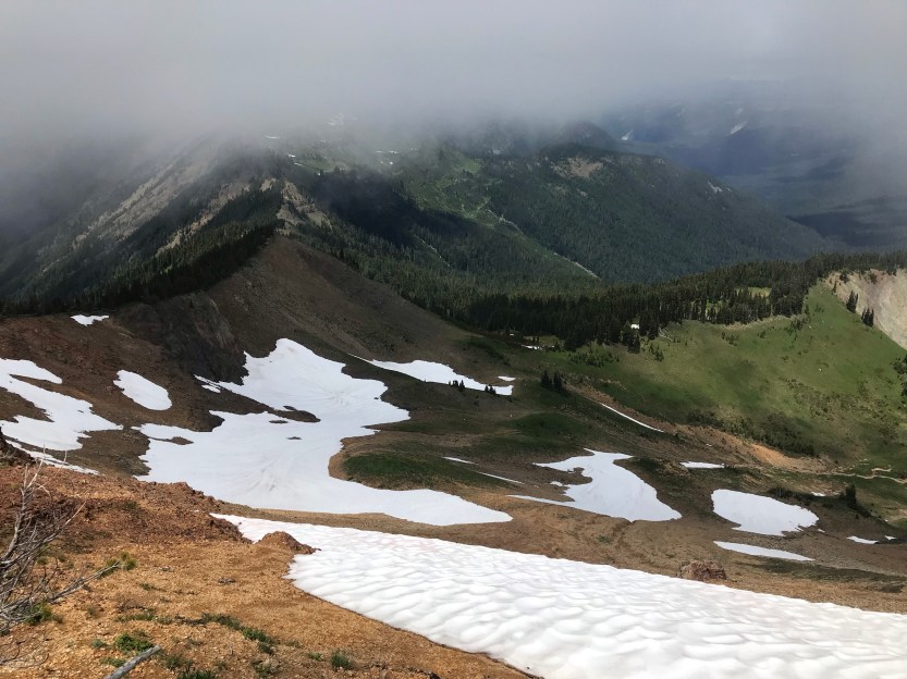
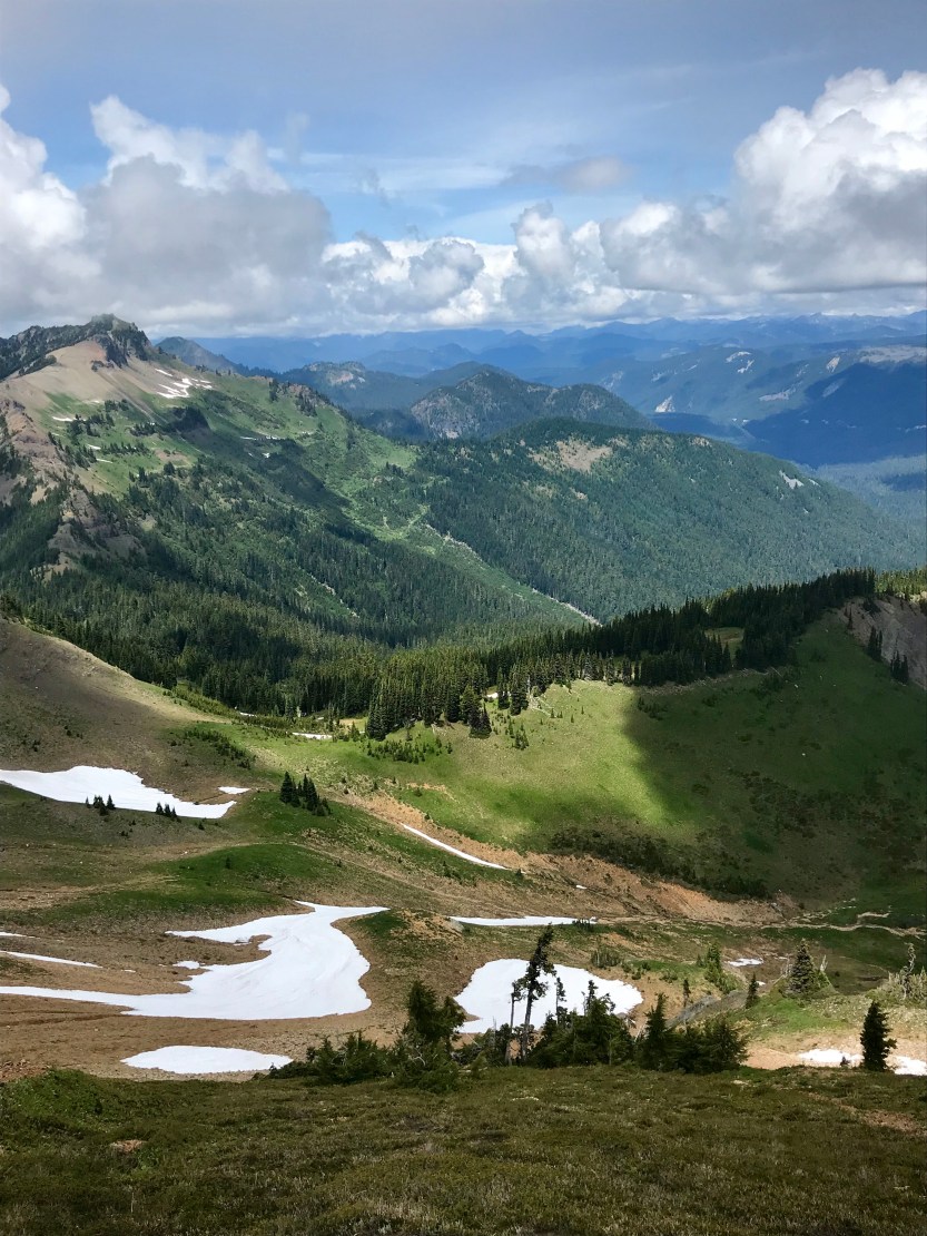
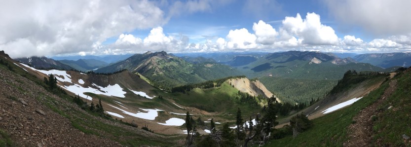
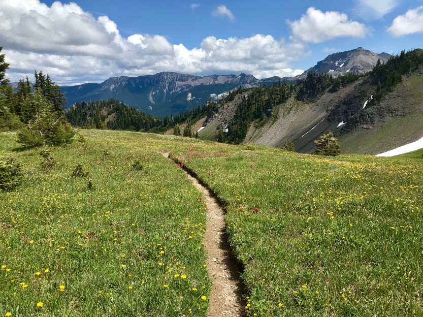
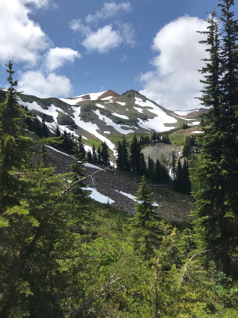
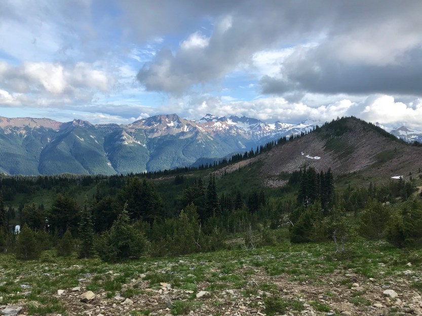
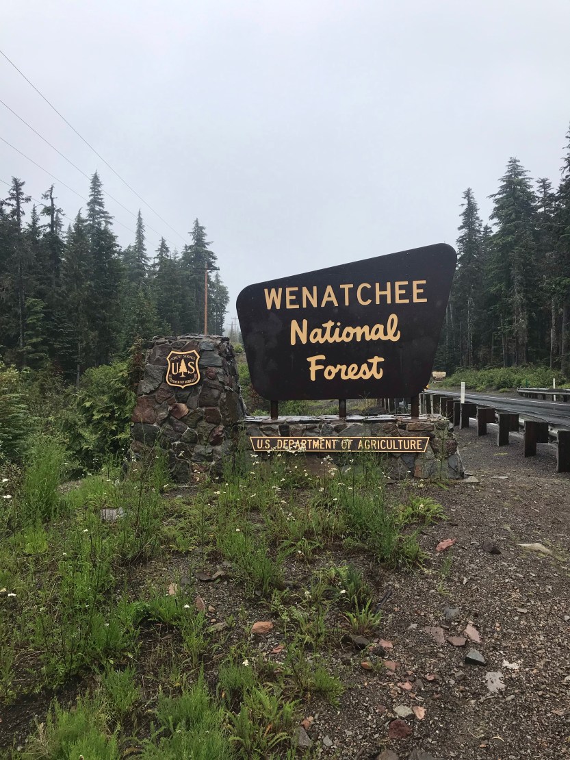
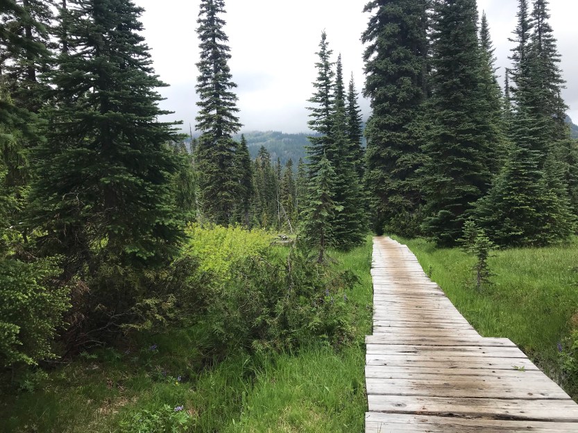
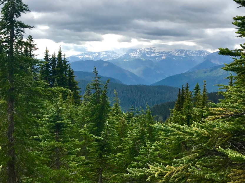
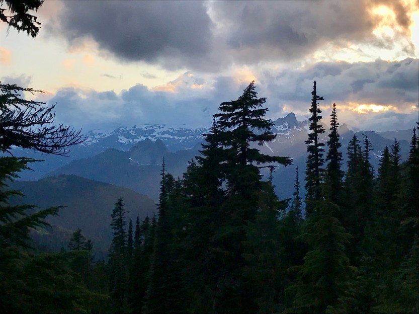
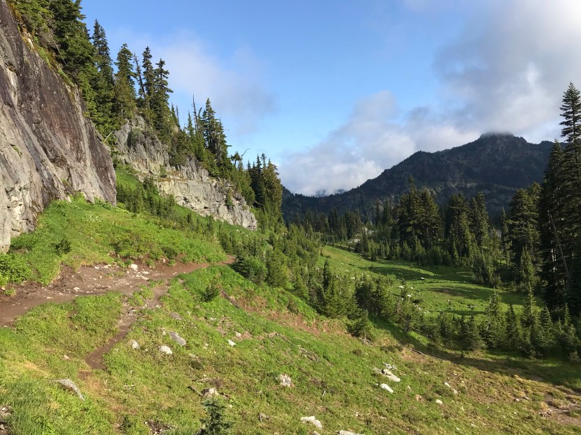
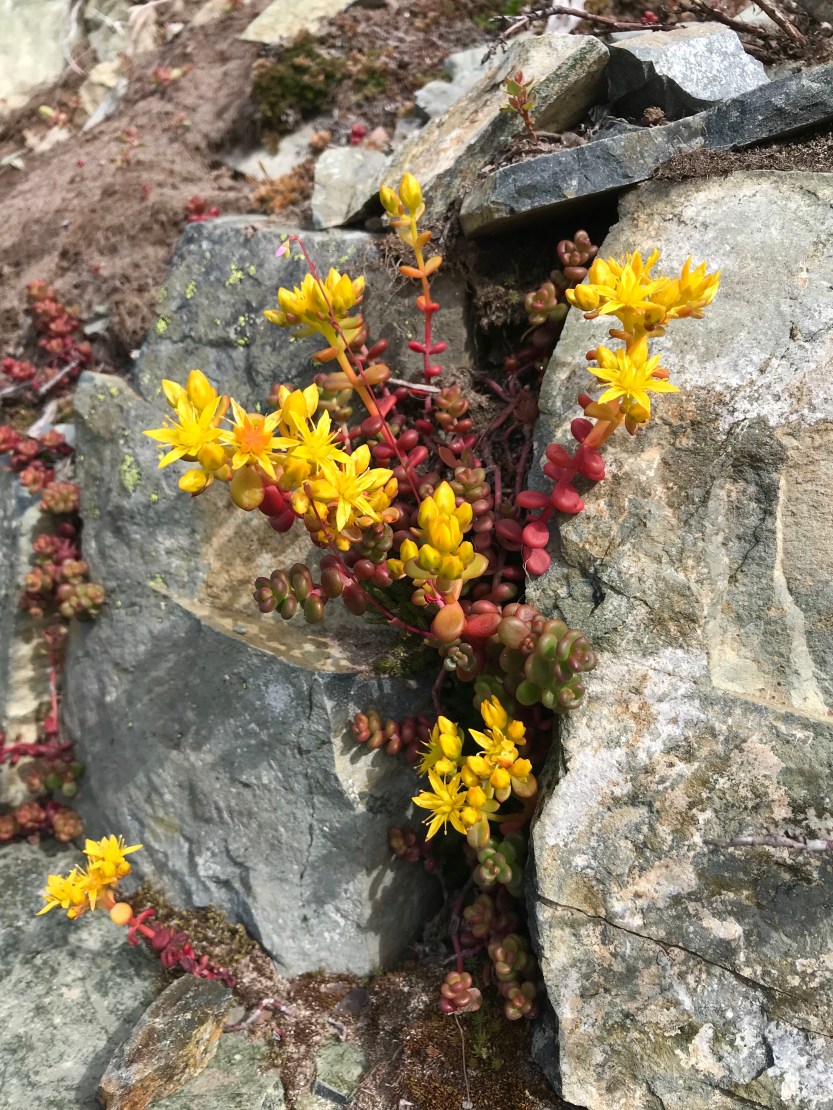
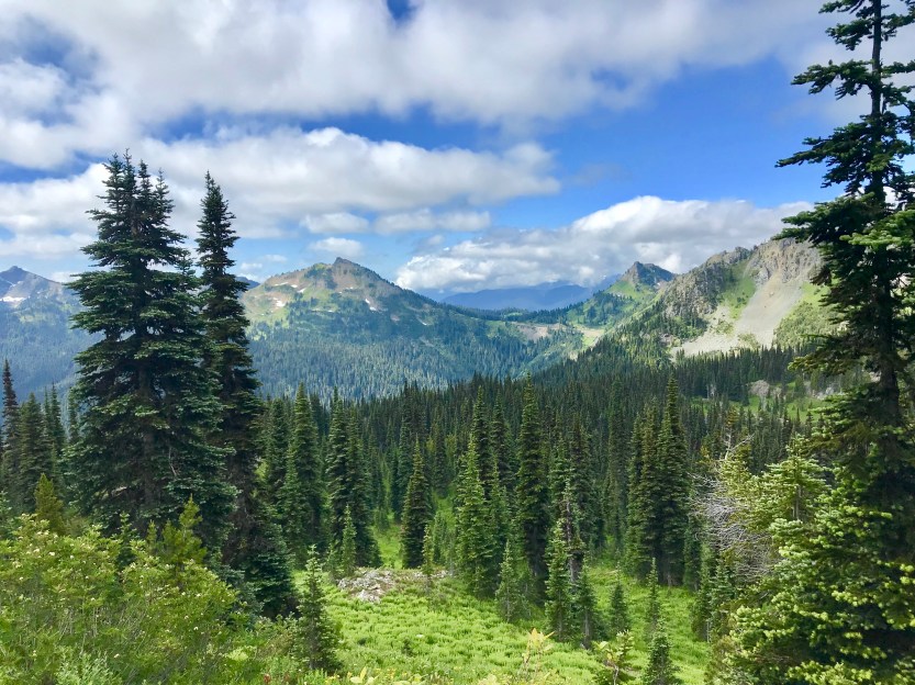
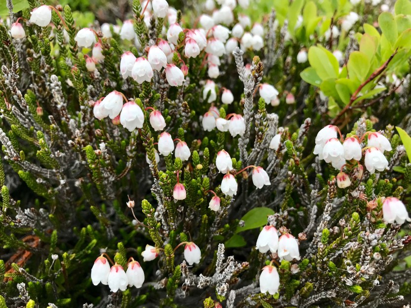
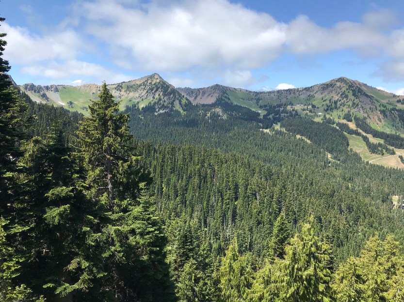
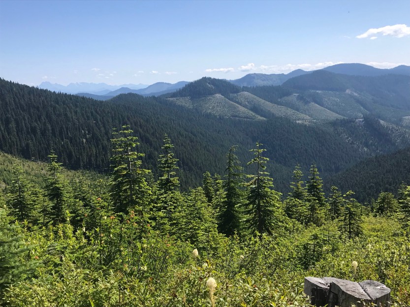
Day 90- 21 miles hiked. Today was just absolutely spectacular. We started out by climbing up towards Mount Adams, and then spent the rest of the day skirting around its base. The sun was out, making the day rather hot, but it also meant that the scenery was just stunning, with blue skies offsetting the greenery that surrounded us. As we hiked, we could alternately see Mount Hood behind us, Mount St. Helens off to our west, and every so often, we’d see Mount Rainer looming in our not so distant future. We passed by many glacier rivers and lava fields, constant reminders that we were, in fact, hiking on a potentially active volcano. The snow had just melted, so there were waterfalls everywhere, and the meadows we walked through were just SO green! We walked through an old burn and it was quite the contrast, with everything being very white. My ankle felt much better with my new brace, as it was rubbing less on my open wounds. I decided I wanted to try and push miles so that I could see my brother in a few days when he had day off from work. We walked until just after nightfall and camped at a spring that was coming directly out of the base of a lava flow (aptly named as lava spring). I went to bed extremely excited for the next couple of days, as we were entering into one of the prettiest parts of Washington, the legendary Goat Rocks!

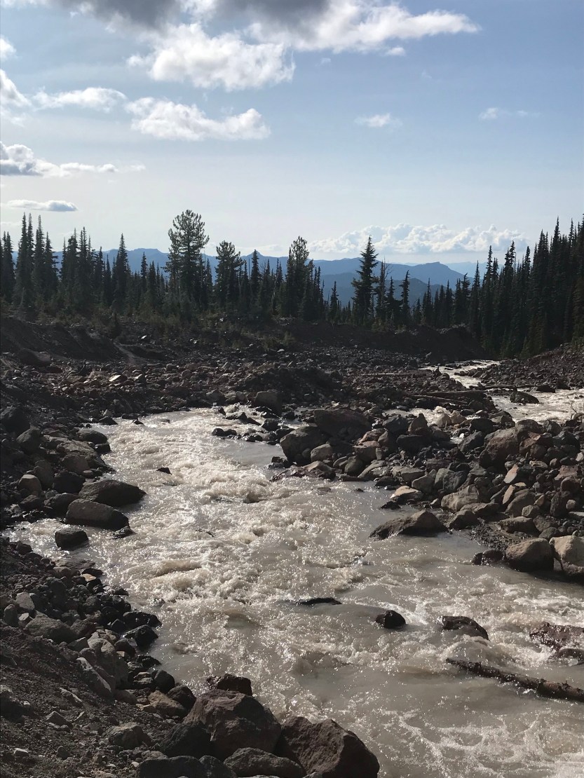

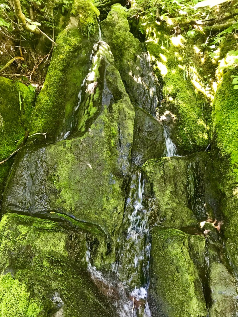
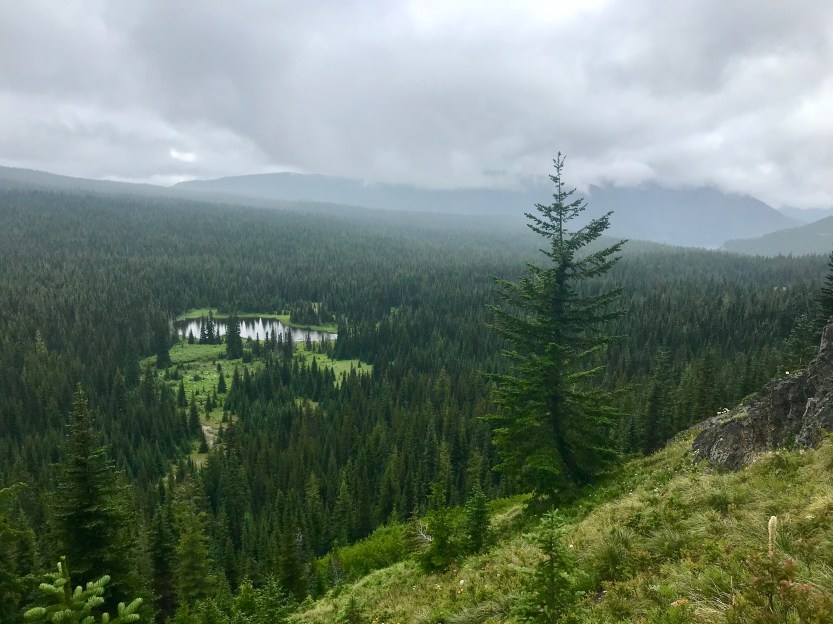
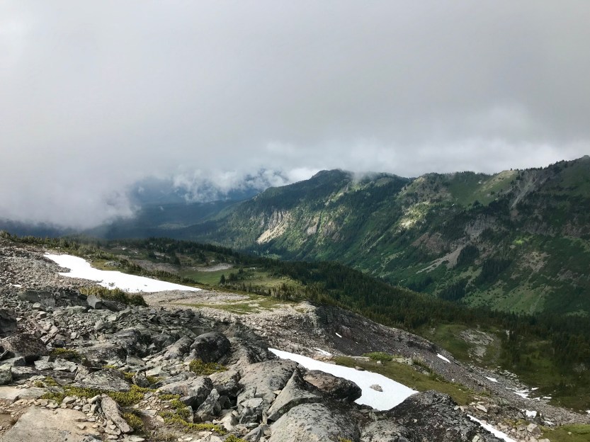
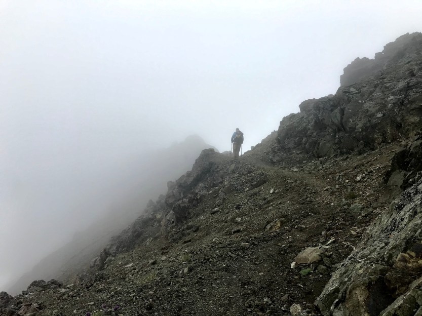
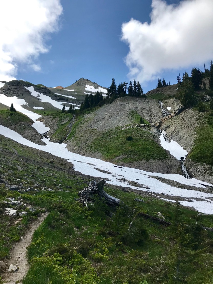
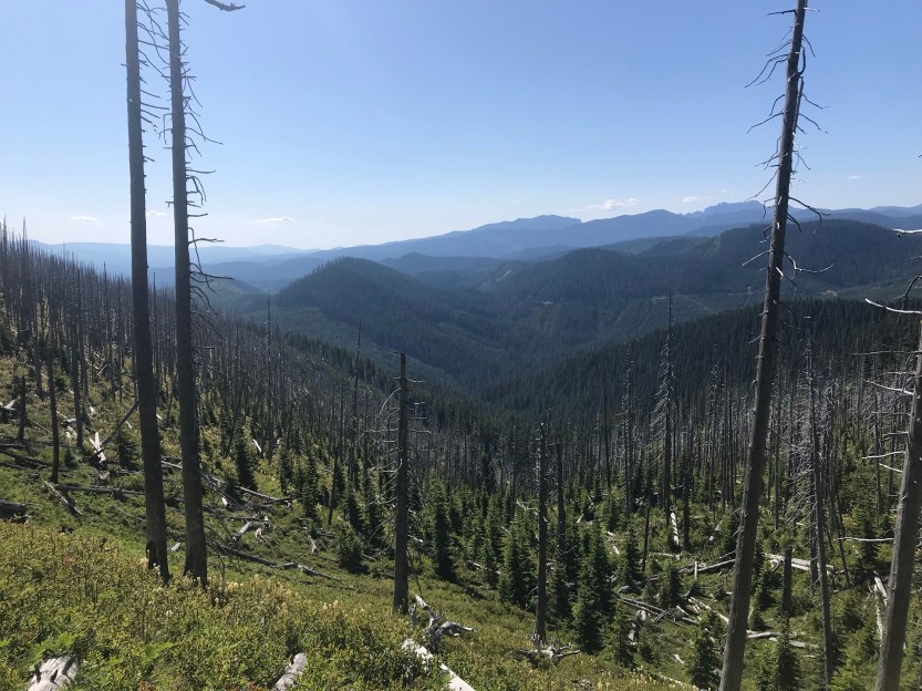
Day 91- 24 miles hiked. I woke up confused, as it sounded like it was pouring rain out. The rain from early Washington had finally cleared up for the last several days, and I naively thought for sure we were done with it, but alas, we were not. I packed up and hoped against all hopes that the rain would clear, since I didn’t want my views of Goat Rocks to be hindered. Unfortunately, my wishes did not come true. It absolutely poured on us all day. At times, it would rain so hard that it hurt my skin to walk in it, and I would have to find a tree to wait under for it to change from torrential to heavy rain. It was a pretty depressing day, and I was absolutely soaked for much of it. I had managed to keep my feet dry, but then about 10 miles into the day, the trail went through a bunch of overgrown bushes. The bushes were also soaked, and they managed to transfer all of that wetness to the inside of my shoes, so my socks were soaked and squishy for the remaining 14 miles. To make matters worse, every time we stopped to take a break, we were swarmed by mosquitos, so we had to keep moving as much as possible. We stopped and ate lunch at our 1200-mile marker, but none of us had the energy to make a sign to celebrate it. The clouds were ever present, but I could make out some scenery off in the distance. We climbed up to Cispus pass, alledgely one of the most beautiful sights on trail, and there was nothing to be seen because we were in a cloud. I was feeling rather low, and the guys hiked on up ahead of me. At this point, my rain gear was saturated, so everything I was wearing underneath my rain jacket and pants was also soaked. Between the cold and wet weather and the wet clothes, I was constantly shivering, so I knew it was important to keep walking in order to keep warm. I passed by a series of waterfalls and rivers. Everything was slick and it didn’t feel safe to try and pick my way across rocks when crossing the rivers, so I just walked straight across the rivers… everything was already soaked, so what difference would it make to wade across a river?
We had hoped to do 26 miles, but at mile 24, I saw Beast and Savior had decided to call it a day. I’ve never been happier to see them call it early than I was today, as it was indescribably miserable out. Beast had set up his tarp so I could keep my dry stuff dry while I unpacked. As I setup my stuff, Savior relayed a story that he had just walked past a dad and a son setting up for camp. The son was standing there, shirtless, hugging himself, shivering, and not moving otherwise. The dad was setting up the tent and yelling at the son saying, “don’t just stand there, get the rest of your clothes off and get into the tent”. We all chuckled at the terribleness of today, because at this point it was better to laugh than cry. We were all shivering, and ready to be warm and dry. Little did we know that that situation would repeat itself, when, after getting set up, I could no longer move enough to get out of my wet clothes. I had stopped moving for long enough that my body got too cold and my own shivering became uncontrollable. Beast and Savior would pop their heads out of their tents, see me still sitting under the tarp and would yell at me to take my wet clothes off so I could get in my tent and dry off/warm up. They repeatedly told me that they knew it was hard to fathom, but I’d actually feel warmer without my wet stuff on. Every inch movement was such a struggle, being both very difficult and exhausting, and I honestly just wanted to sleep right then and there. It took me about an hour to strip down to my skivvies (for reference, I had on 5 pieces of clothing that needed to be taken off) so I could finally get into my sleeping bag. In there, I shivered in for another 40 minutes before one of my hands was finally warm enough to use a lighter to make some ramen. Let me tell you, that was the best ramen I have EVER had. The ramen warmed me up, to the point that I finally stopped shivering for the first time in a few hours. We checked in with each other, to make sure we were all warm and dry. Savior had had a nearly devastating realization when he found out that the inside of his backpack had been leaking and a lot of his things were completely soaked. Thankfully, somehow his sleeping bag managed to stay dry, which I was beyond grateful for because otherwise the 3 of us would’ve had to pile into our 2 sleeping bags to make it through the night! I drifted off to sleep, happy to know for the first time today that my tiredness was not actually hypothermia trying to lure me to my death.
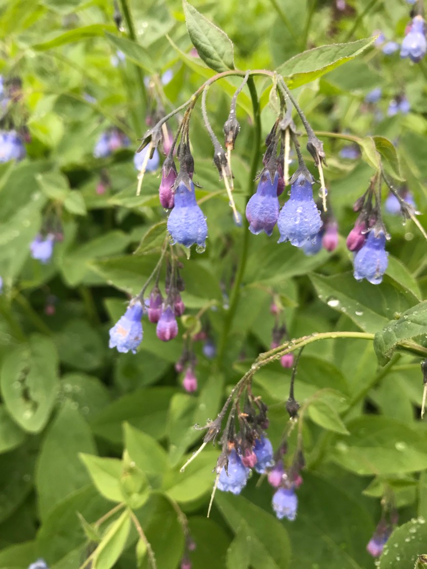

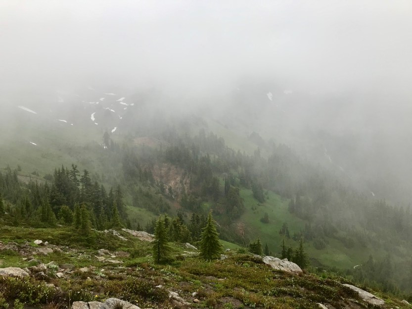
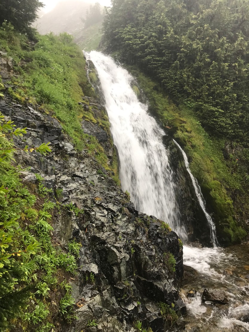
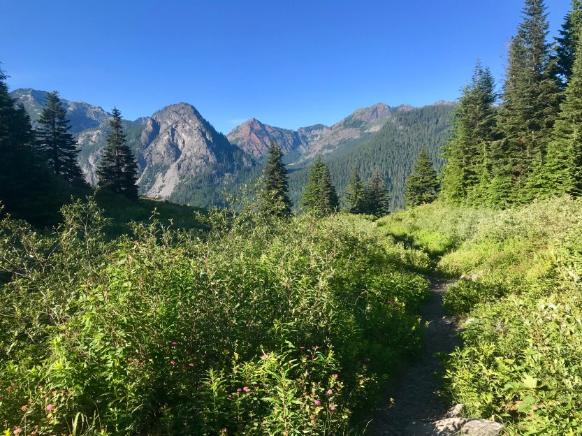
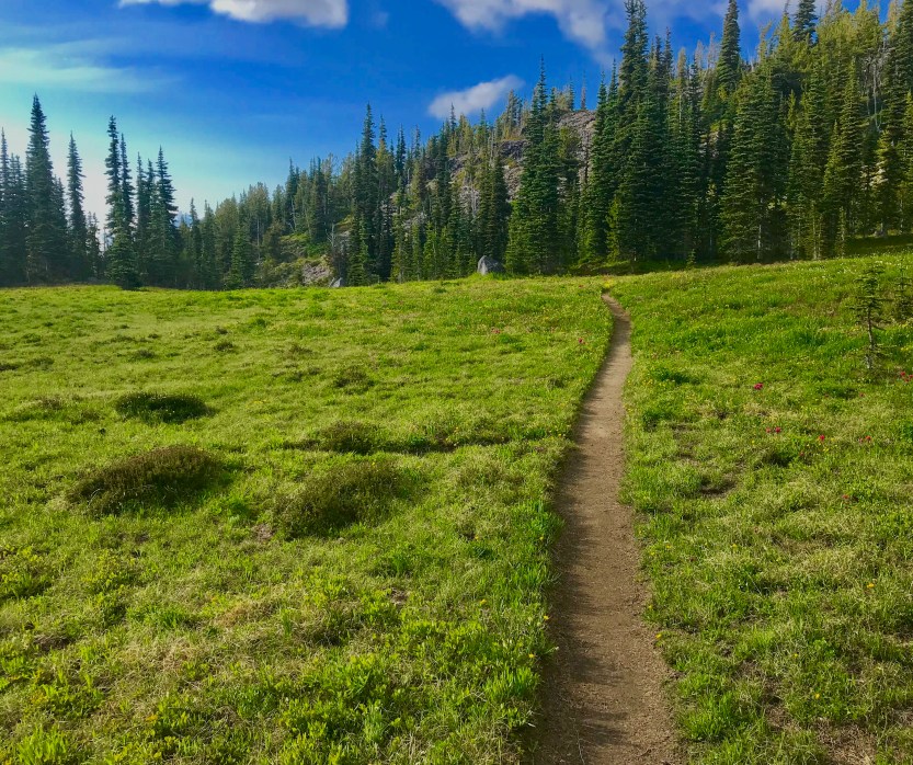
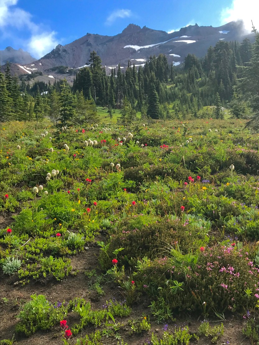
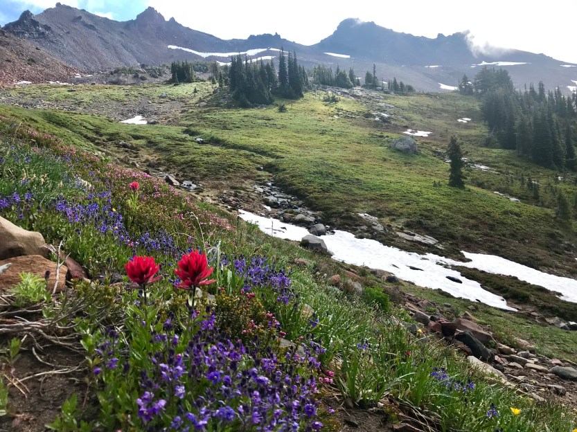
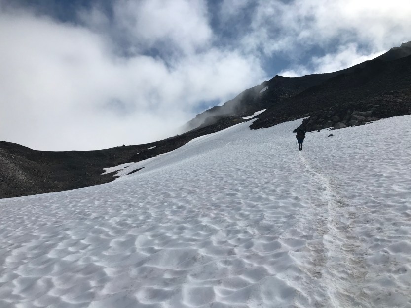
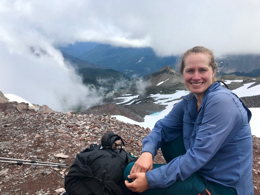
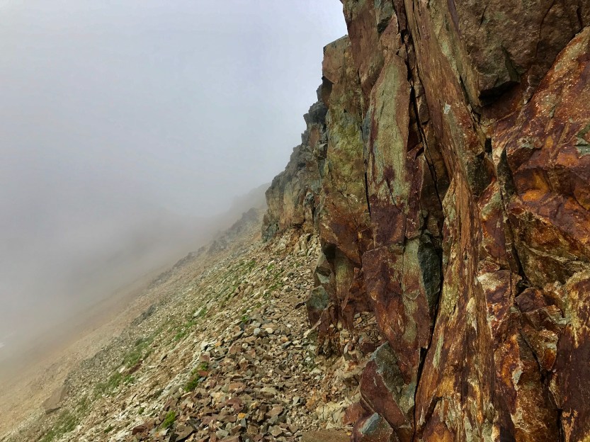
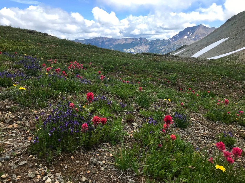
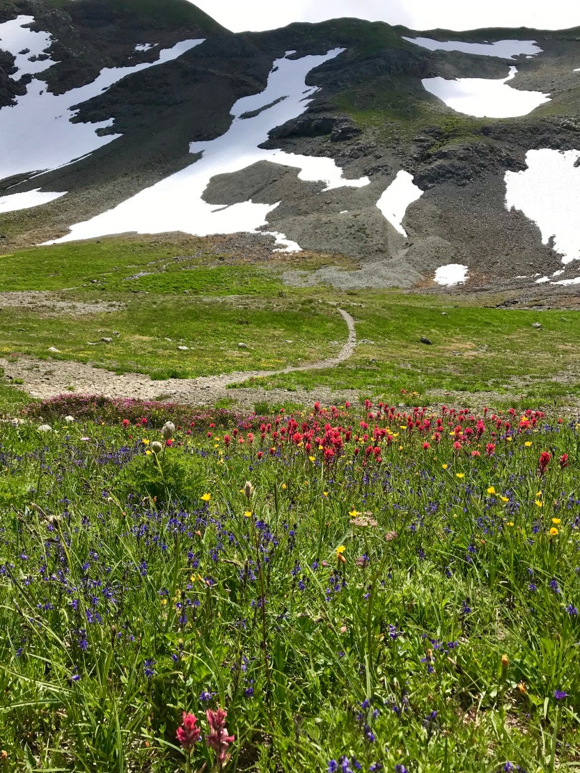
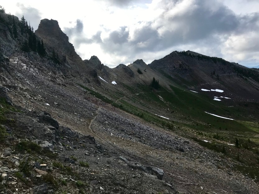
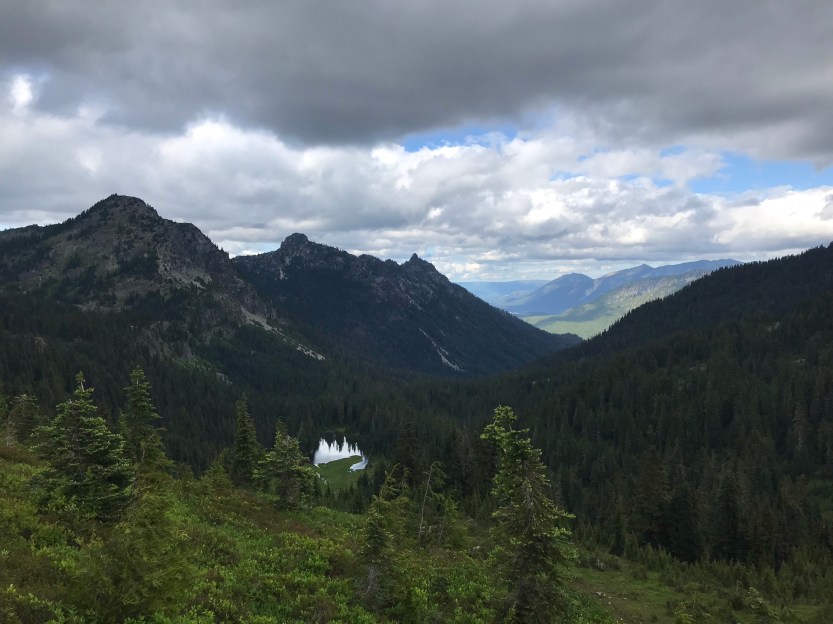
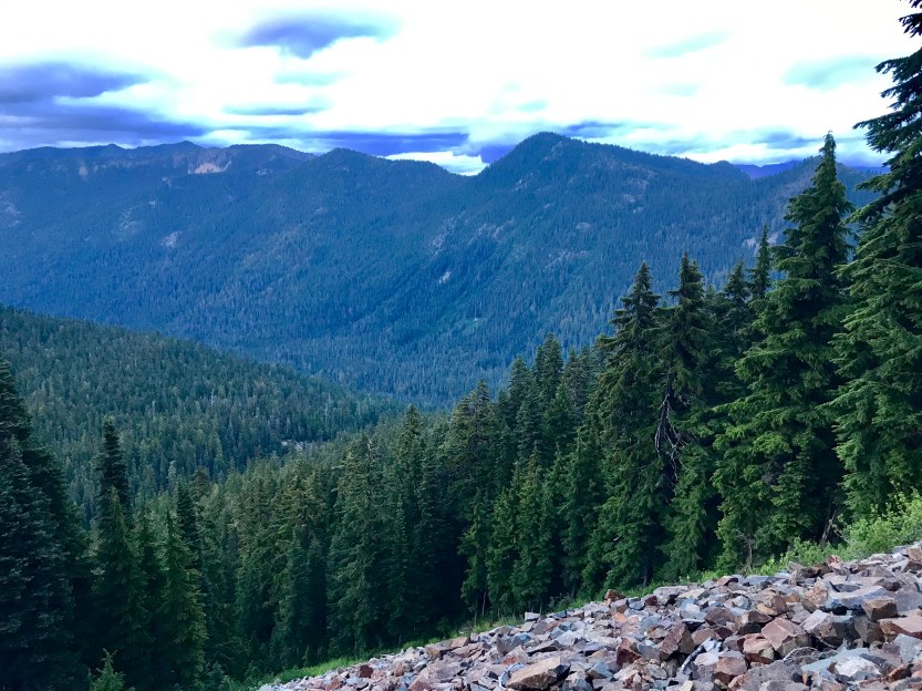
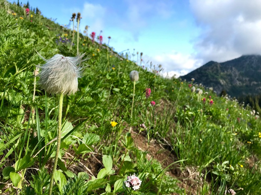
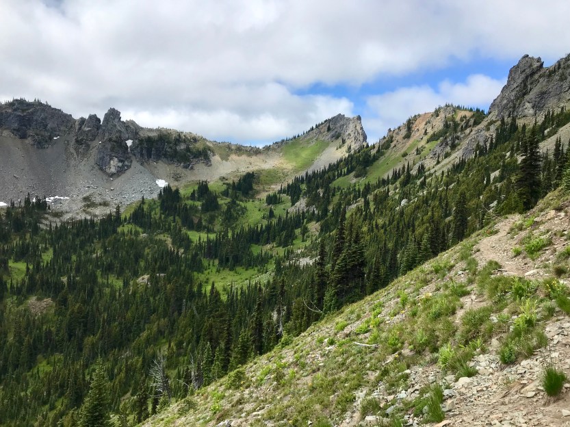
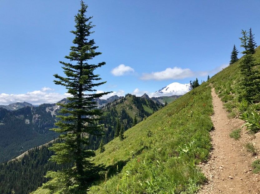
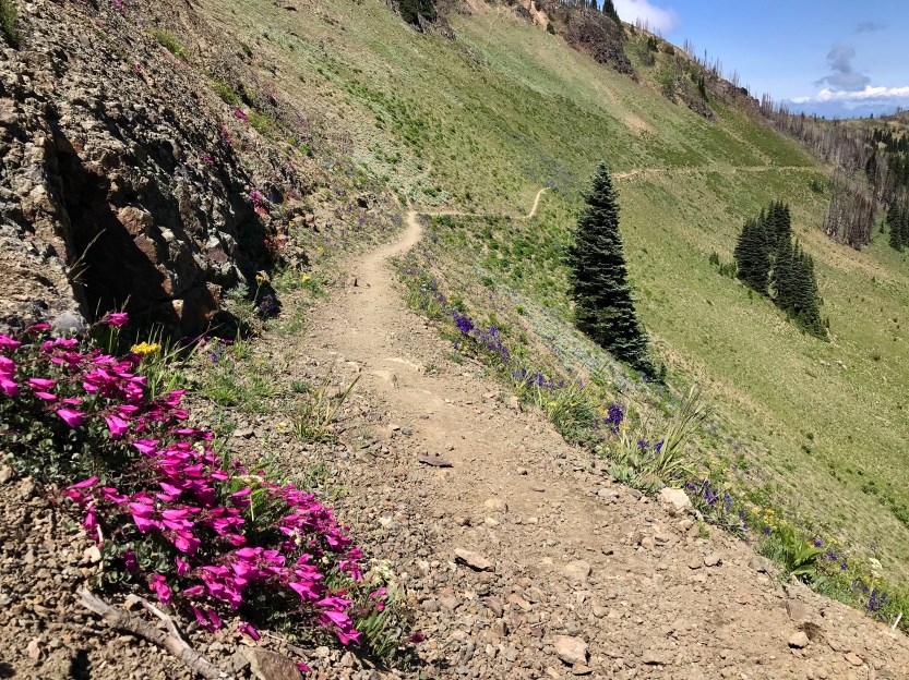
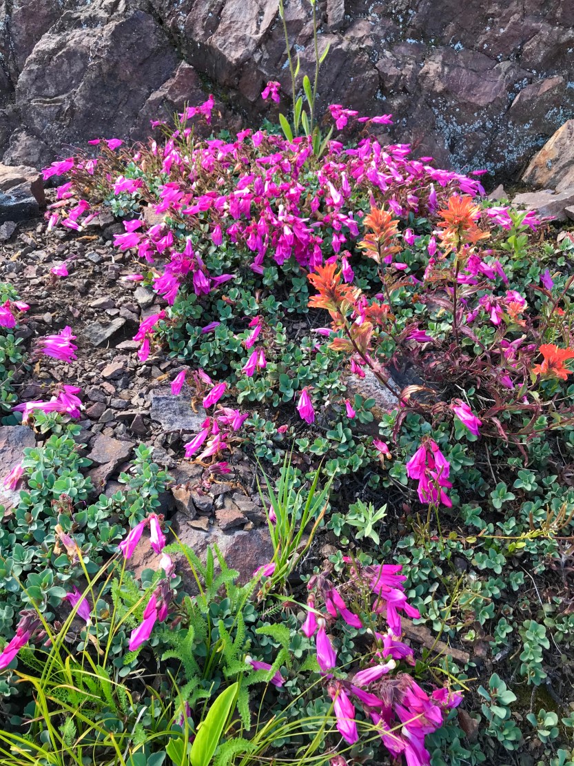
Day 92- 21 miles hiked. The rain stopped sometime during the night, and we woke up to the sun trying to make its way through the clouds. We had apparently slept next to a cliff that had an amazing view of the valley below. I was excited that the weather had cleared up some, and I was hoping that it meant that I would be able to see some of the epic views of Goat Rocks. Packing up today was slow going and hard. My clothes were still soaked from the storm the day before and putting on cold wet stuff first thing in the morning was pretty demoralizing. I left camp before the guys, as it was very cold once I had all my wet clothes on, and I needed to keep warm, which meant moving was essential. I walked in and out of some clouds before making my way to a meadow, full of green grass and flowers. I stopped at a snake-like stream that was cutting its way through the meadow and sat down to get some drinking water. The sun came out, and the warmth and scenery were heavenly. The guys caught up and we happily discussed our change in fortunes. We moved along, and made our way to the Knife’s edge trail, that we had heard so much about from south bound hikers. I struggled with the wet (re: heavy) pack & constant uphill and despite my resolution to not stop on the uphills anymore, I had to pause several times to catch my breath. The scenery was stunning, but it was still mostly obscured by clouds. I could vaguely make out waterfalls in the distance, and I knew I should be able to see Mount Rainer (I could not). We were surrounded by wildflowers, including many that reminded me of Truffula Trees from the Lorax. We climbed up the aptly named Knife’s edge trail, and took a break while hanging out with some south-bounders. At the top of the mountain, we had cell service for the first time since we arrived in Washington, so we called and texted with some of our loved ones before moving on. The trail down the mountain is the reason why it’s named Knife’s Edge. You walk along the top of the mountain ridge, with a steep drop-off on either side of you. At times the trail hugged giant boulders that you had to edge your way around, as there was very little room on the side before another steep drop-off. At this point the clouds began to clear, and it became incredibly difficult to continue walking. Was my ankle still throbbing? Yes. Was I tired? Yes. Was I still soaked and struggling to keep warm? Yes. However, none of these even remotely mattered when the clouds lifted. The scenery that surrounded me was so beyond stunning, I don’t have the words to describe it. I struggled to walk, because every few steps I would have to stop and just take it all in. I was surrounded by mountains, waterfalls, and wildflowers. It literally took my breath away, as I found myself repeatedly stopping and holding my breath while my eyes feasted on the valleys below. It took me forever to get to each of our break points, as I struggled to put one foot in front of the other, knowing that I might never be able to witness such beauty again. I would make a turn around a mountain side and be sad that I wouldn’t see the lakes and scenery again, only to be overwhelmed by the next view in front of me. It was on one of these turns that I ran across a pack of mountain goats, grazing along a cliffside. I wondered if they knew that they had one of the prettiest dining rooms across the world. My brother was picking us up at the end of the day, and that was the only thing that was making me move in any forward fashion. Had he not been there, I don’t think I could’ve been pulled myself away from these mountains. I seriously contemplated what I would have to do in life so that I could never leave this place. I made my way down the mountain and got to the road with just 5 minutes to spare before Jordan arrived to pick us up. Since Jordan had last seen us, he had gotten a new car. In preparation for picking up us three stinky and filthy hikers, he laid towels and sheets all across any surface that we, or our things might touch… apparently, he didn’t want our stench and filth to seep into his brand-new car surfaces! We went into the town of Packwood and got some pizza and beers. From there, we went to our Airbnb and hung up everything we owned, as it was all soaked, and did chores for the rest of the night, in the warmth of the indoors.


Day 93- 4 miles hiked. We woke up and started packing up immediately, as Jordan had to go back to work. We stopped at the grocery store, got our supplies and then made our way back to the trail. The weather had turned bad again, and it was misting out. Jordan dropped us off at a gas station that was close to the trail and made his way back to the real world. The gas station had WIFI, our first internet in weeks, so we sat down and got caught up a bit on our lives outside of the trail. The gas station is a huge hiker hub, and we ended up seeing our friend, Kristina, who we had spent a day with, many moons ago, when we had gotten trapped in a snow storm in the dessert and had to take a sit around a campfire all day to keep warm. She had flipped up to the border and was making her way south now. It was great to catch up with her, and we were all excited with the prospect that we’d be seeing many more familiar faces in the coming week. With the snow in the Sierras still being too dangerous to get through, many of our friends had chosen head to the northern border and start a southbound hike. We didn’t want to get moving because we were finally dry, and the weather was promising to do away with that. After many hours of putting it off, we begrudgingly left the gas station and made it a whopping four miles before pulling the plug. Thanks to the WIFI, we knew it was going to pour that night and we wanted to be set up for camp before that started, so that we could keep all of our stuff dry. Savior was out in front today and saw some elk right before getting into camp, but they got spooked almost immediately, so Beast and I missed them. We decided we should keep our eyes peeled and walk softly for the next section so that we could maybe get the chance to see some more.
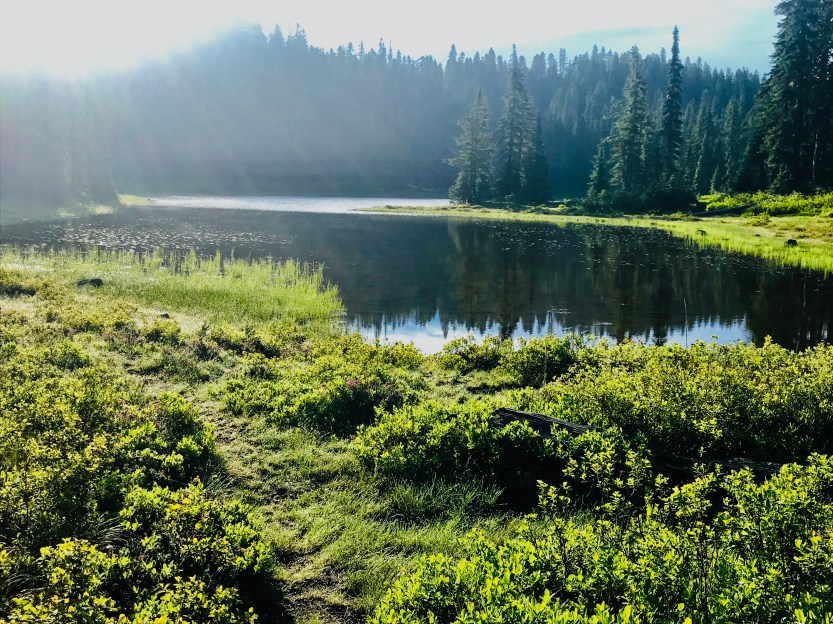
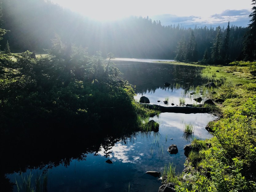
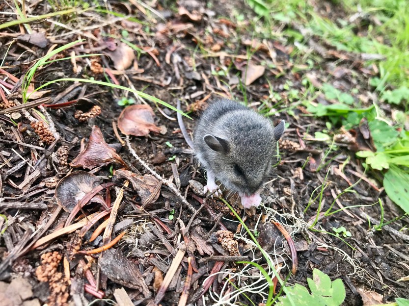
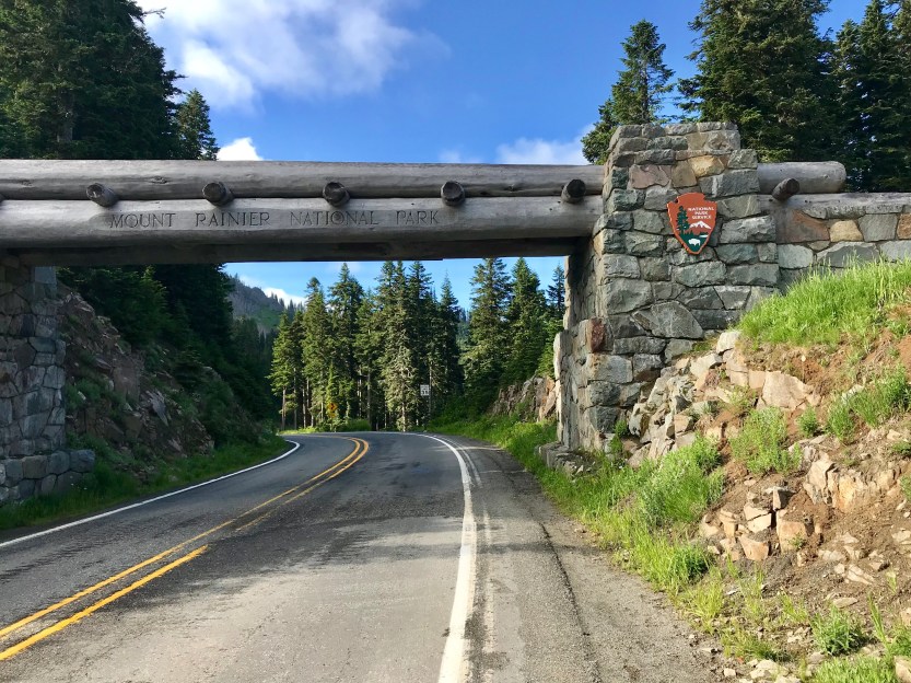
Day 94- 23 miles hiked. We woke up to rain-soaked tents, but no rain! It was cold and foggy, so we made some tea for breakfast and had a slow-moving morning. There were some downed branches all over on the ground around us, and using these, I made a sign to mark 1200 miles, despite the fact that we were now closer to 1250 than 1200. Today’s trail was very muddy, what with all of the recent storms that had just passed through. Thankfully there were many boardwalks, so we were able to keep mostly clean as we passed through. The scenery today was not nearly as stunning as what we had just passed through, and most of the morning was spent in a forest with no epic views. We crossed a river and discovered a baby mouse roaming around at our feet. I think he was blind, as he made no effort to get away from me when I stopped to take his picture. From the river, it was a climb up to the next section of the trail. As I was climbing, I saw Beast up ahead hugging and chatting with someone walking south, as I approached, I realized it was Goose! Goose is/was one of my absolute most favoritist people I met in the desert, and I was beyond excited to see him and catch up. Goose was in the middle of training for a much longer hike (yes, that’s right, the PCT is Goose’s training hike) where he plans to hike all of South, Central, and North America! After chatting for an hour, we hugged and bade him goodbye and good luck! We continued up the hill and were rewarded with some beautiful views all around us. We had entered into Mt. Rainer National Park, but the clouds obscured any views of the Mt. Rainer. Instead, we caught glimpses of the surrounding mountains, and what was likely the base of Rainer. At one-point Beast was in the lead and saw several elk that all scattered almost as soon as he saw them. With this in mind, I took the lead, so that I might get to see some elk too! The sun set, and we were hurrying to get to camp. As I was climbing the last hill for the night, I looked up and saw a mom and baby elk on the trail ahead of me. As soon as I recognized what I saw, they were mid-dash down the mountainside, with their crashing through the trees sounding like thunder. I stopped to take a picture of their tracks, and continued on to get to our stopping point, Dewey Lake, before dark.


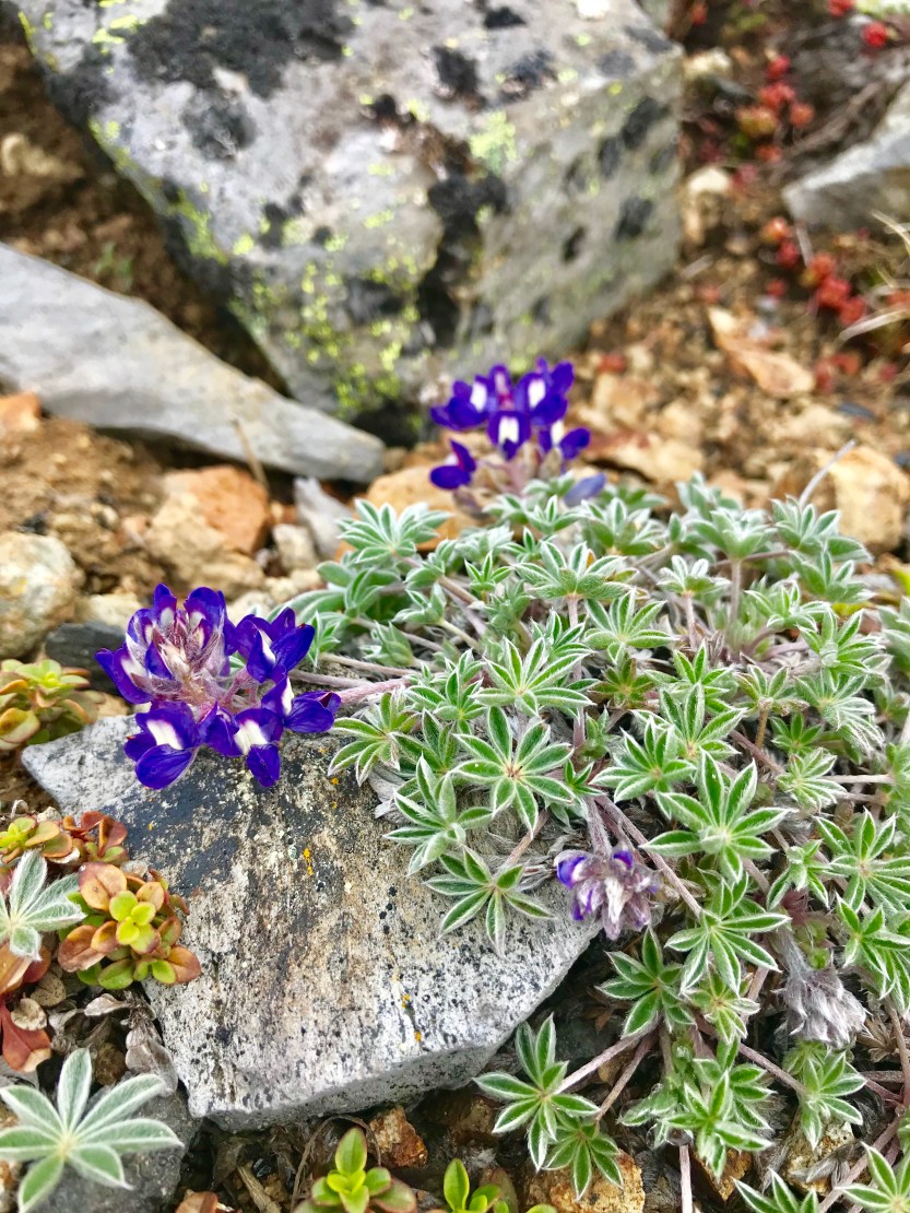
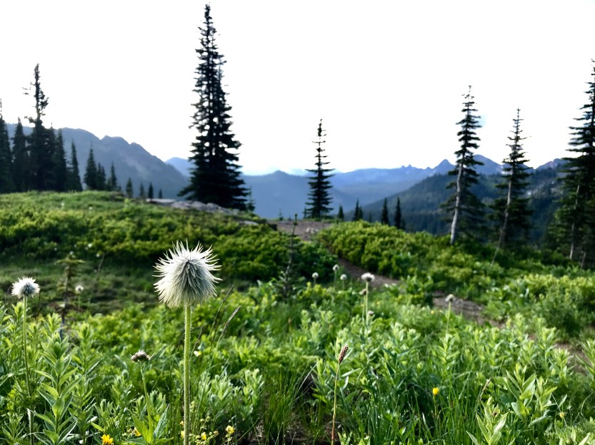
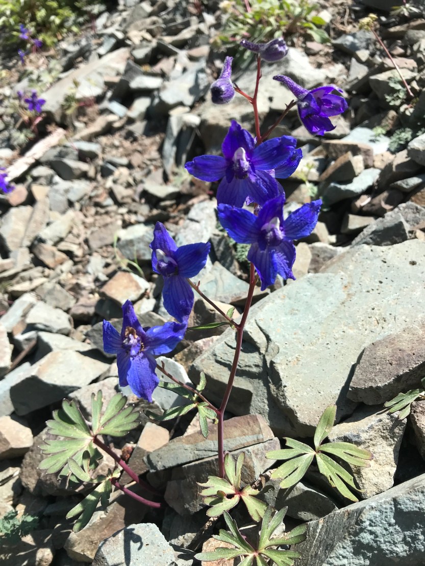
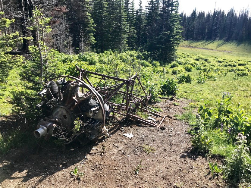
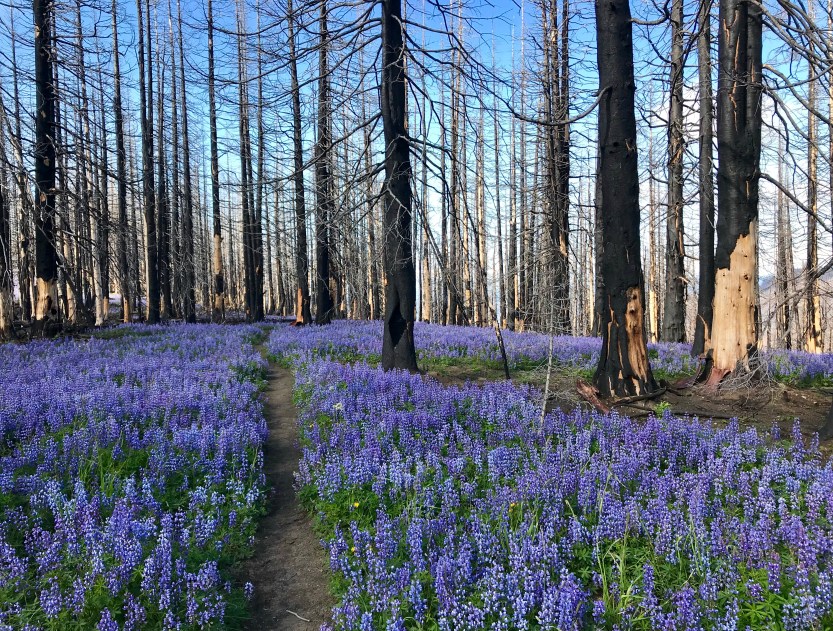
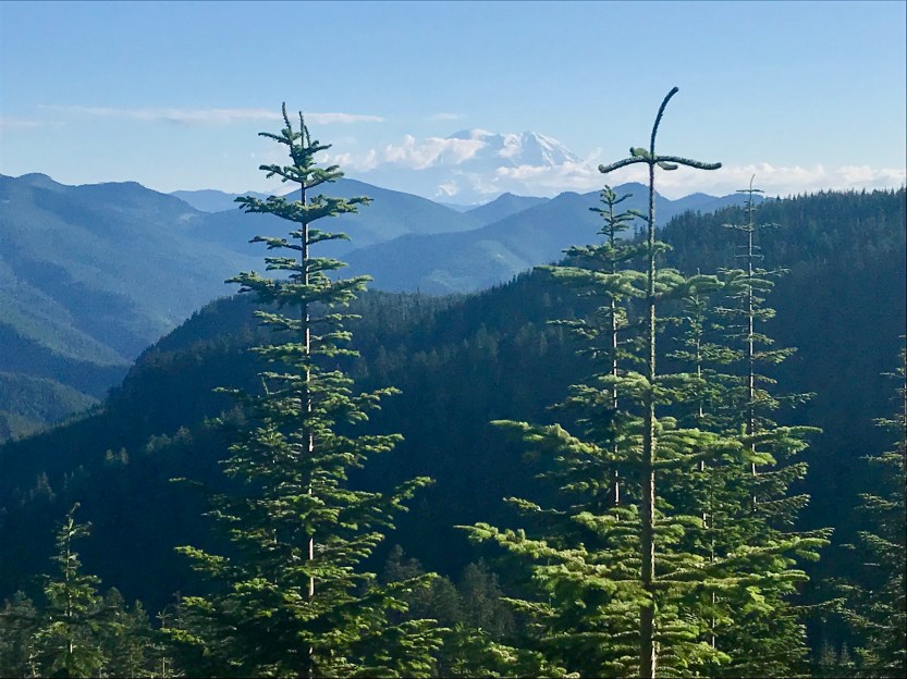
Day 95-26.4 (new PR) miles hiked. We woke up with a little over a marathon between us and a shelter that we could sleep in. We were all tired of our tents and the condensation associated with sleeping in them, so we were extra motivated to get to the shelter for bed. I left well before the guys, as I was super motivated to get to Chinook Pass (a mere 3 miles away), where there were trash cans, pit toilets, and a parking lot where we might get some trail magic. The morning views were beautiful, with my favorite Truffula Trees everywhere. I love these seedheads, because they all look like a person that’s having an epically bad hair day, which, as a person who was showering once every 3-5 days, I genuinely appreciated. At one point, I passed by a group of boy scouts. They asked me where I was headed and I replied “Canada” and they all began to laugh, thinking that my ridiculous answer was actually a joke. I then said I was serious, and that I had already done over 1200 miles and was now only about 300 miles away from the border. They stopped laughing, and their faces turned to incredulity, and I sensed that some might have thought I was lying to them. As we parted ways, some mumbled “good luck”. Beast caught up to me right as we were reaching the highway. I asked how his morning was going, and he said he got stopped by a bunch of boy scouts that were asking him if he was going to Canada and had a bunch of follow up questions. 🤣 We made our way to the parking lot right outside the entrance to Mt. Rainer NP, and we got to cleaning out our packs of all of our trash. We were approached by someone who asked if we were PCTers. Her name was Sloth, and she had attempted the John Muir Trail this summer (the JMT is 200+ miles through the Sierras), but had to stop because the snow was too dangerous. She changed her plans into road tripping along the PCT and was giving away all her hiking food to hikers she met along the way. We snacked on some goldfish and fruit snacks while chatting, and eventually parted ways. From Chinook Pass, we had a steep four-mile climb ahead of us. We got to the top, and found an amazing view of the valleys around us. We had some weak cell service, and the guys walked ahead while I tried desperately to download some new podcasts. I eventually gave up, and walked along ridgeline after ridgeline with beautiful views all around. I rounded a corner and was taken aback by the view of Mount Rainer that was right in front of me. I had no idea it was looming so close, as I hadn’t seen it in several days. The way it was jutting out from everything else was shocking to see! I caught up to the guys, who had found a sunny spot for lunch that was right across the valley from a ski hill. The ski hill had excellent cell service, and I downloaded many weeks’ worth of podcasts, knowing that this might be my last chance to get some new listening material before getting to Canada. We packed up and headed onward through a recent fire. There were lupins everywhere, and I got left behind to take all the flower pictures I wanted. The trail went along ridges that gave you views for miles. There were beautiful flowers everywhere, including many thistles that were taller than me! I had been hiking on my own for several hours, when I came upon a fork in the trail. I read the different comments on what was around the spot, and discovered that there were remains from a crashed airplane not too far off the PCT. I could not pass that up, and went on the detour to find the rusted body in a nearby meadow. It looked pretty old, and had someone not told me it was an airplane, I would’ve never otherwise known. I made my way back to the PCT, and continued through these amazing lupin meadows. It was really hard to walk, as the flowers were absolutely beautiful. I guess that’s one positive of constant rain… entire seas of flowers! As the sun set, I finally trudged into camp, and we had all made it to the shelter. In doing so, we set a new PR, beating our last one of 26.2 miles by a whopping 0.2 miles. The PCT does not have many shelters along the way, and I was extremely excited to sleep indoors. We got a fire going, and we were all warm and cozy. We met up with another one of our friends from our snow day in the desert, Spench, and got caught up on his southbound journey. He had a new hiking partner, and the 5 of us, plus one stranger all squeezed together to sleep in the loft (where we hoped the mice would leave us alone).

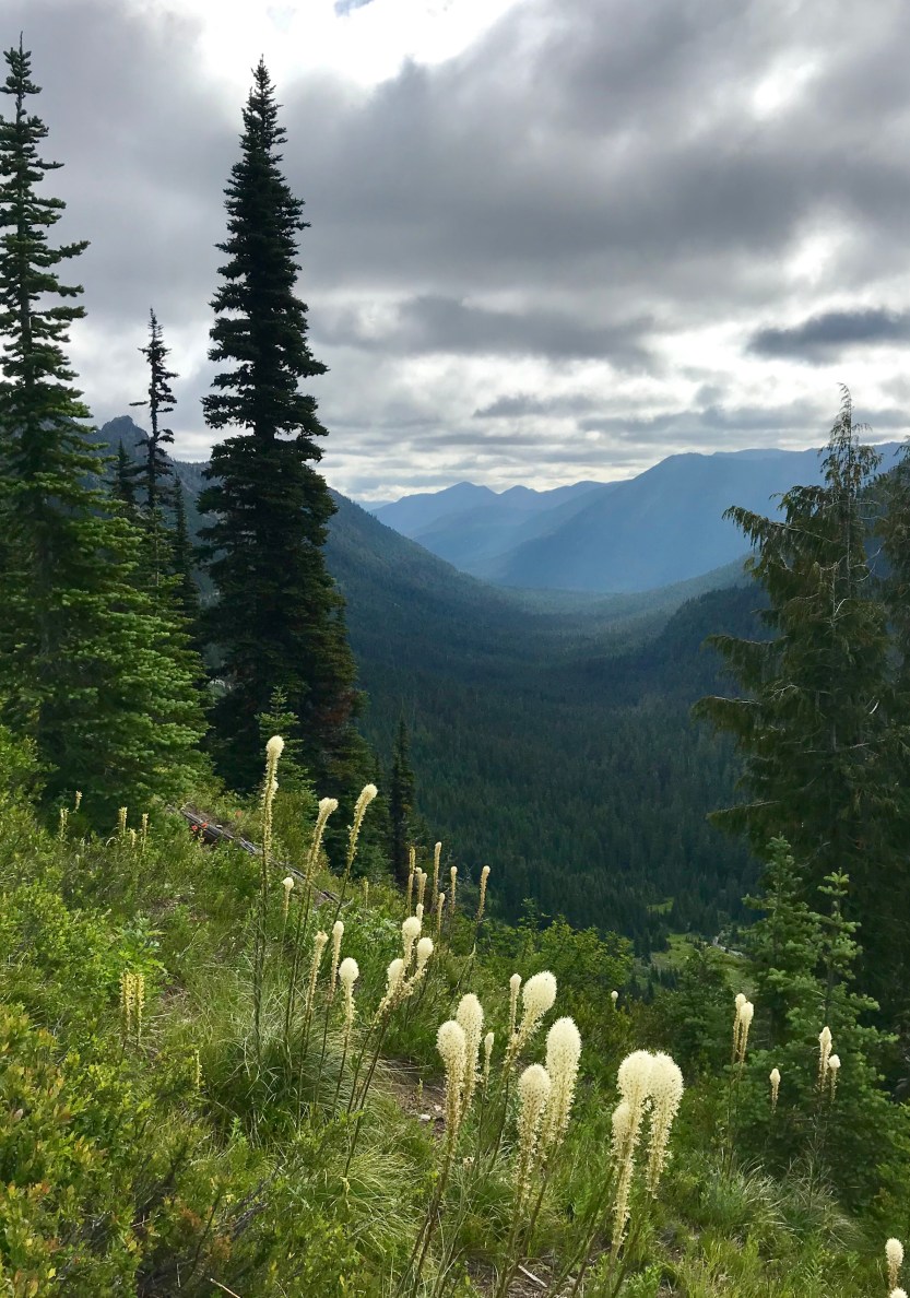

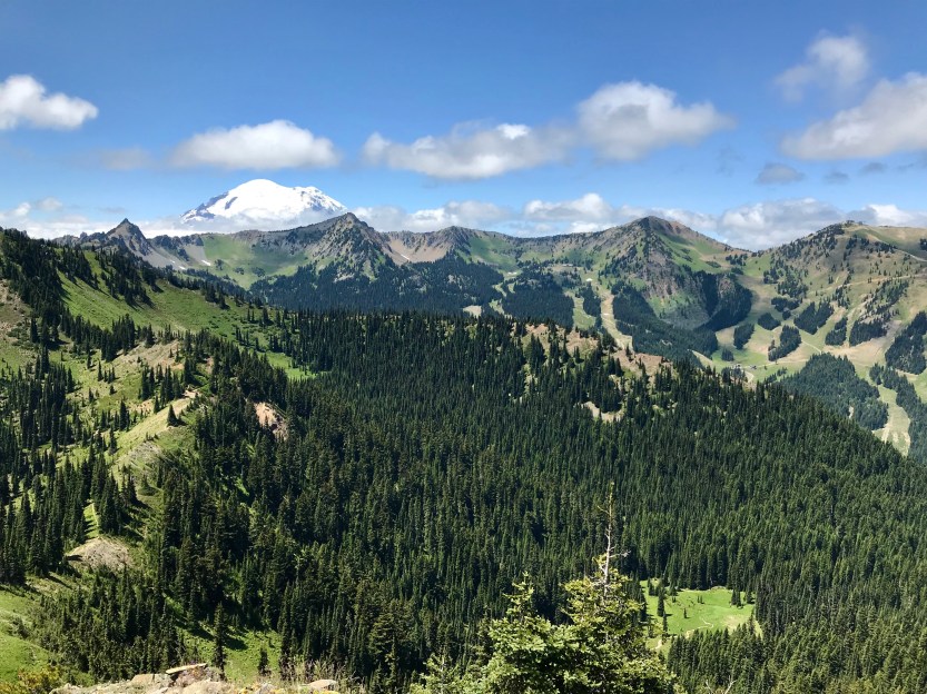


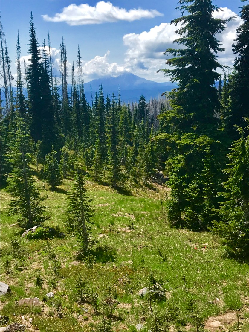
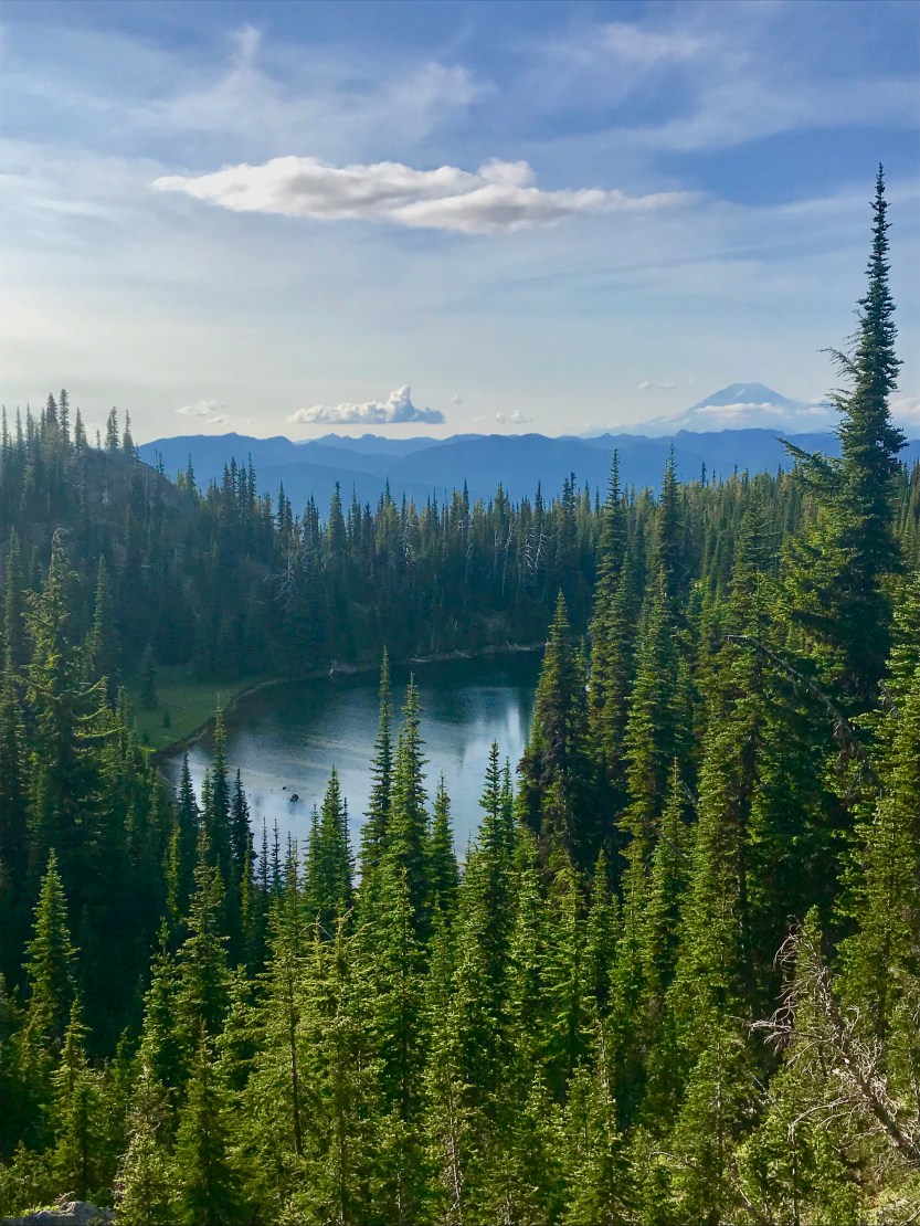
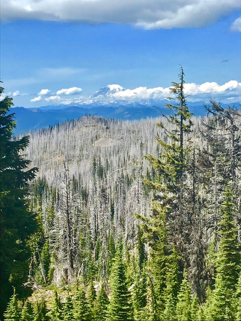
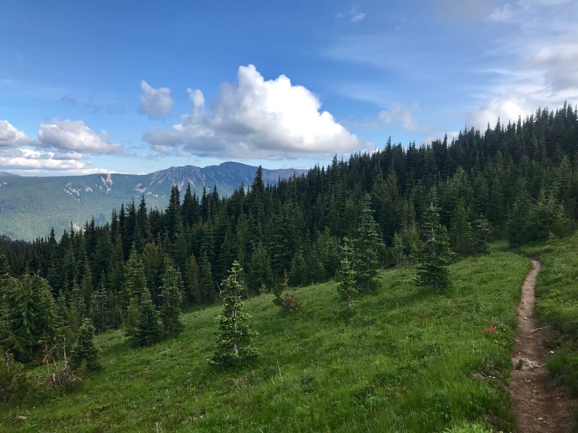
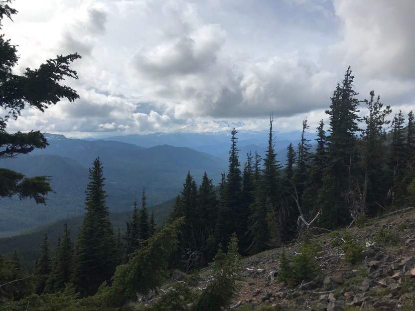
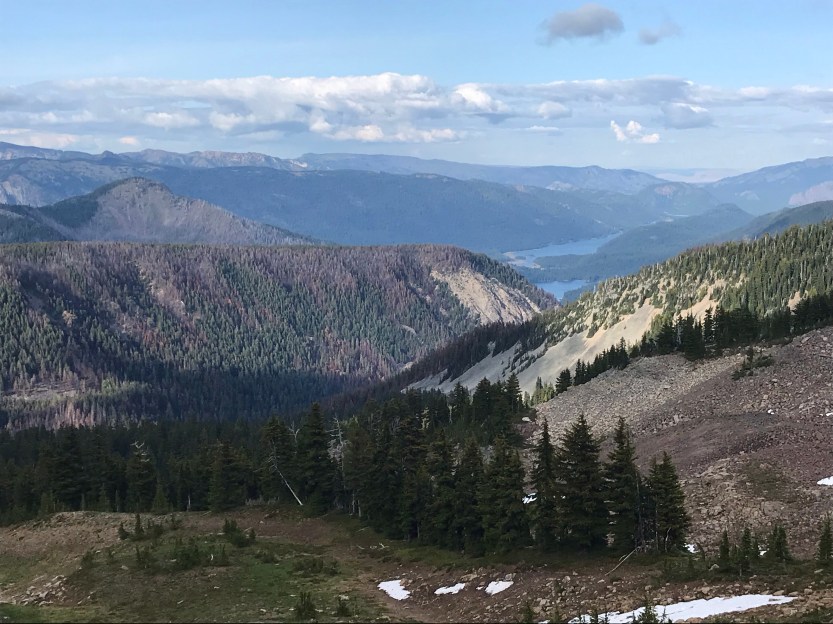
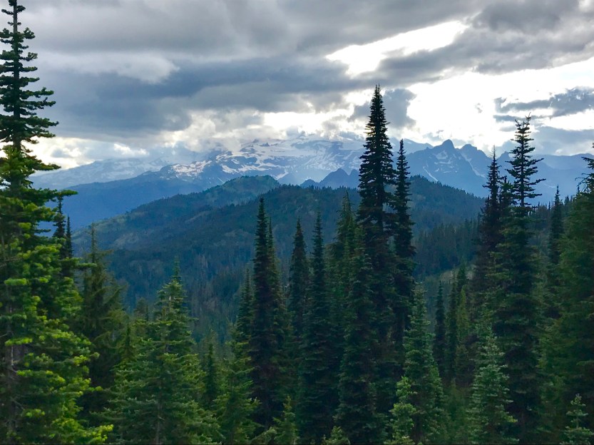
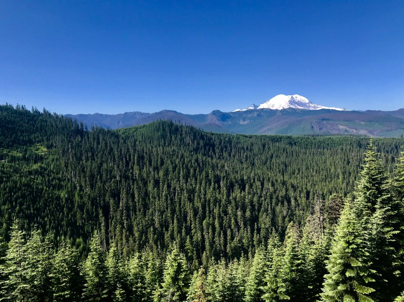
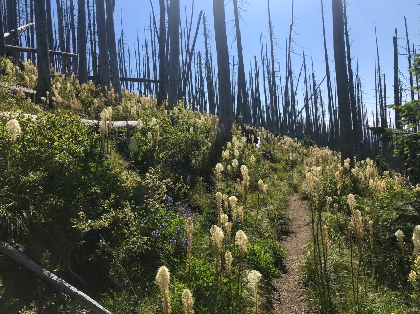
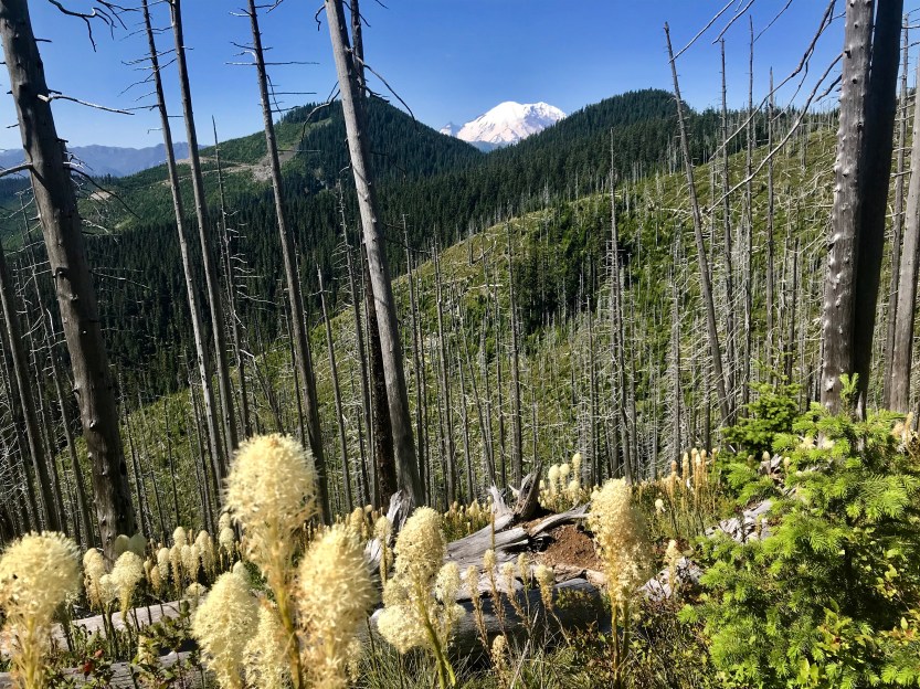
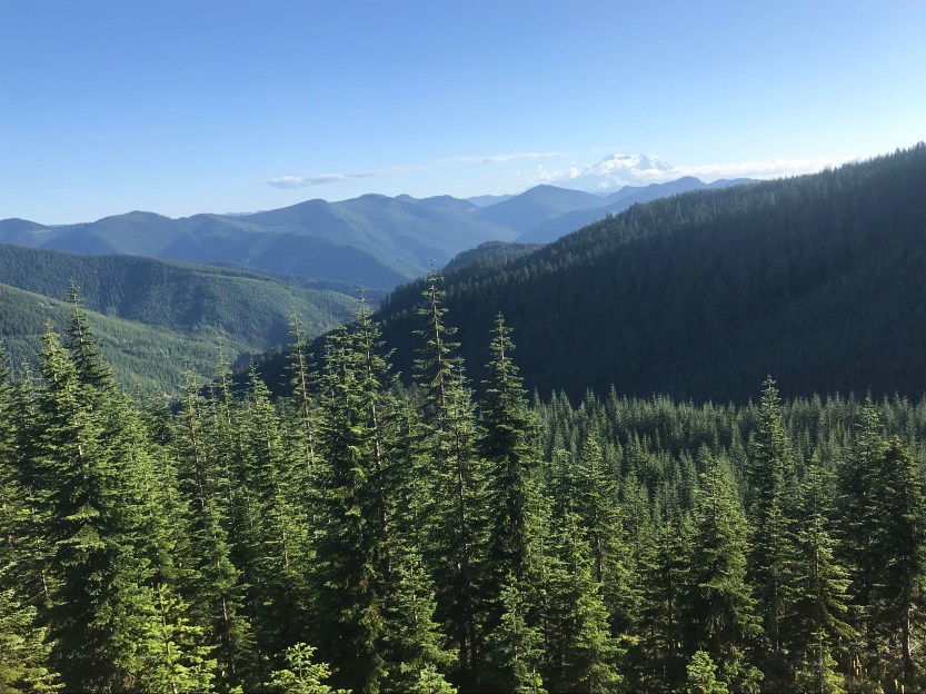
Day 96- 24 miles hiked. It was so nice waking up in a warm and dry building and not having to pack up damp things. Despite this, I hadn’t slept well the night before, as I had started to feel like I was running a fever. I blamed the warmth of the building and headed out in the hopes that I would start feeling better once I got some fresh air. Today was filled with a lot of ridge running through some heavy burn areas. Mount Rainer was every present in the background as we walked, and the absence of clouds today made it even more prominent and striking. The lack of trees meant that there was bear grass everywhere. I continued to feel pretty terrible, and started to get concerned, since my foot was still oozing from my burst blisters and looked like they were infected. Prior to getting on trail, I went to my doctor to get some precautionary medicine (antibiotics for common issues that might come up on trail) and she gave me a rundown on what I should look for and be concerned about. Given that my foot looked infected, and I felt like I had a low-grade fever, I decided the best course of action would be to start taking some antibiotics as a precaution, just in case I did actually have a fever from my foot. I had to a break every 20 minutes or so to rest, hiking while sick is no fun! It was a really slow-going day with beautiful views along a valley we were walking along. At some point, two fighter jets zoomed overhead and scared the crap out of me! The noise they made was deafening, as they were practicing their flying skills through the mountains I was hiking along. This was to be a regular occurrence from here on out, and a few times they flew so close that I could see the pilot as they flew past (a video is below of the noise after they flew by, but I was too slow to get the planes in the frame). The southbound group on the trail had been steadily growing, and today it reached its peak. Beast and I had to stop on the top of a hill and wait for five minutes as the southbounders made their way up (people hiking uphill have the right-of-way and proper etiquette is to yield to them). I’ve never been stopped in a more frustrating traffic jam… I’m hiking in the woods afterall!
At some point, we were hiking through a heavily wooded area, when I heard a dirt bike off in the distance. We must be near a road, I thought. As the noise got louder, I thought, well maybe I’m about to cross a road. I took out my map, and to my horror, realized there was no upcoming or nearby road… the only trail was the one that I was walking on! We stopped in the middle of the trail in a spot where we were would be visible. About 10 seconds later, two dirt bikers came speeding up to us on the trail. Since they couldn’t get by us, they stopped a few yards away. Words were exchanged, including some information about how not even bikes are not allowed on the PCT, and motored bikes were definitely not ok on a wooded trail with lots of hikers and limited visibility due to hills and trees. They eventually gave up on trying to get by us, and turned around, claiming to be going back to the road we had passed a quarter mile before. As we continued on, we managed to hit the 1,300 mile-point! We didn’t bother stopping to make a sign, because we knew we’d hit an even bigger milestone the next day. There were still southbounders all over the place as we tried to find a place to camp. Almost all of the spots were taken for the last several miles that we hiked, and we were hoping our goal campsite wouldn’t be occupied. As we got there, we found about 5 tents in 6 campsites. Looking at our maps, we saw that there was an abandoned road not too far away, so we made our way over it. It was nice and secluded, flat, and had a great view of the west. We set up camp, watched the sunset, and marveled at what tomorrow would likely bring.


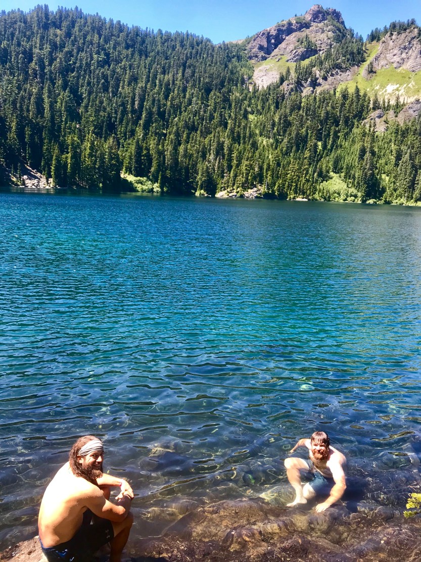
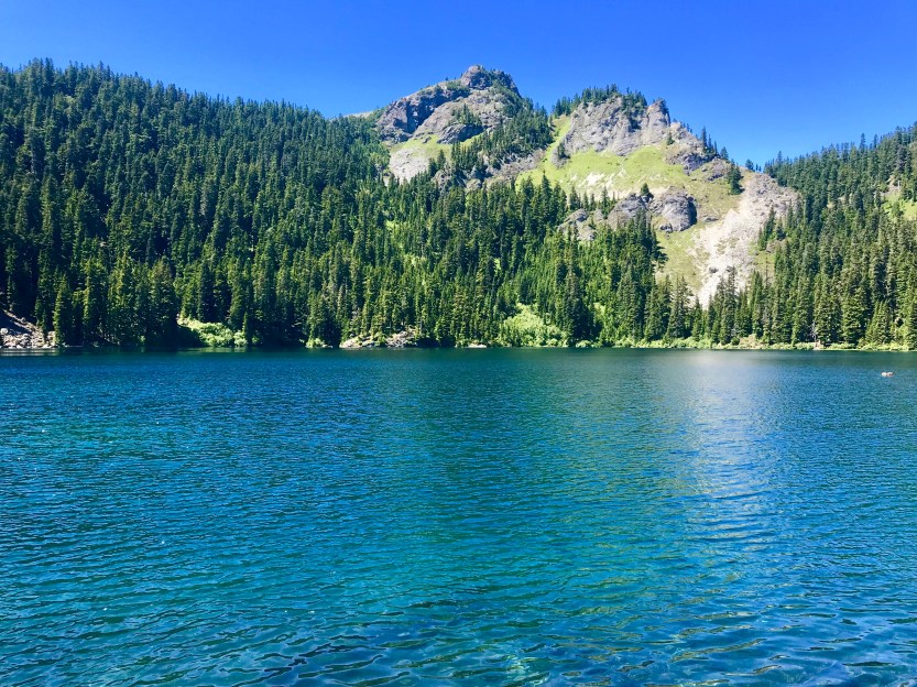
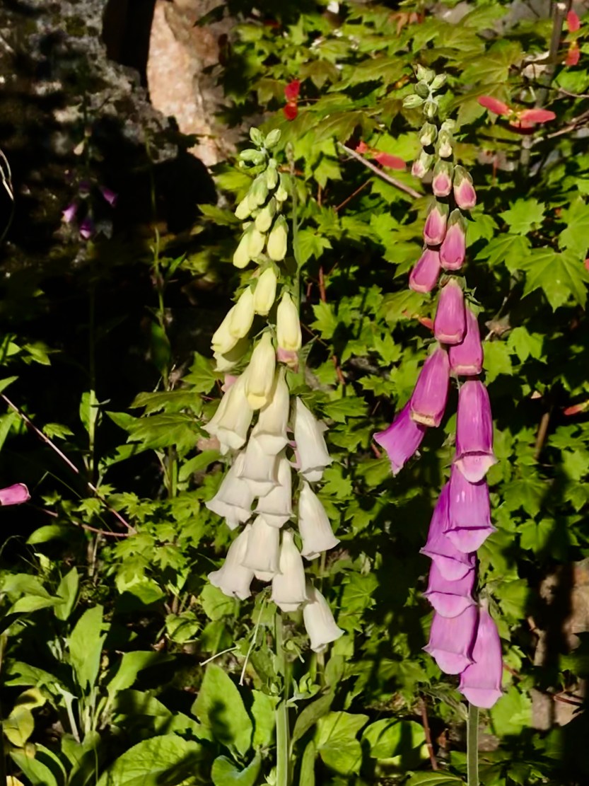
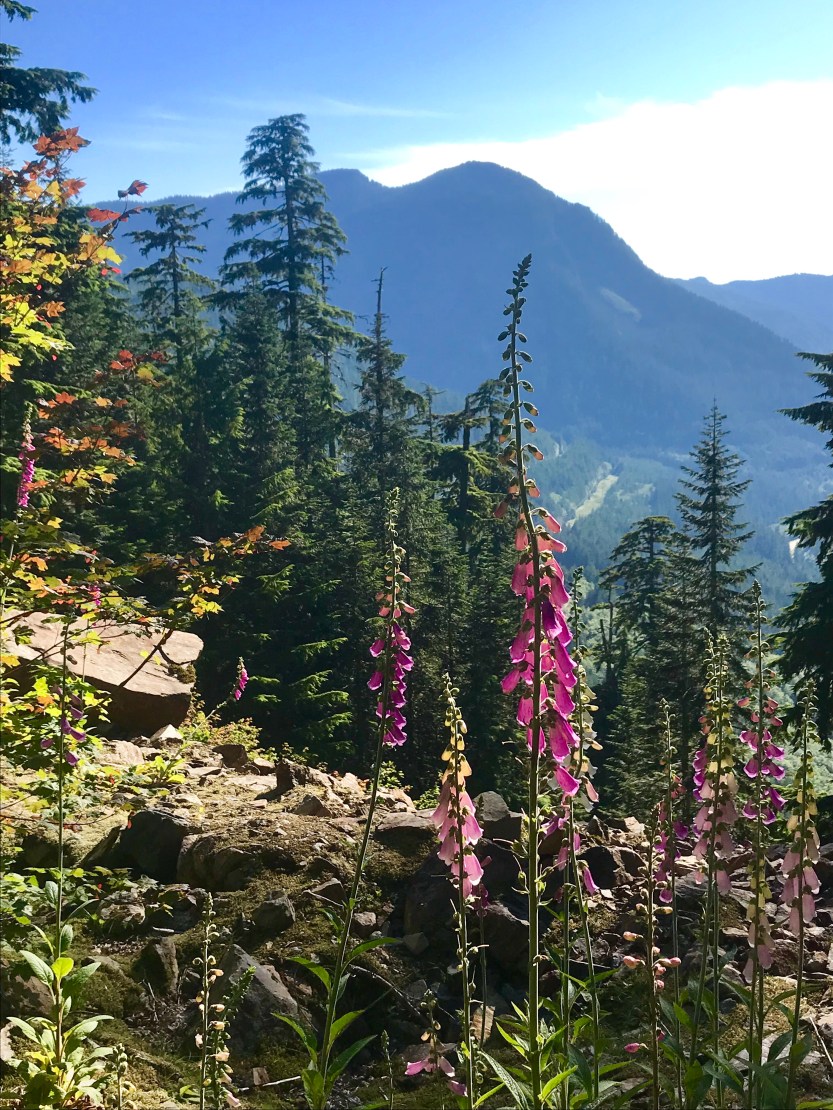
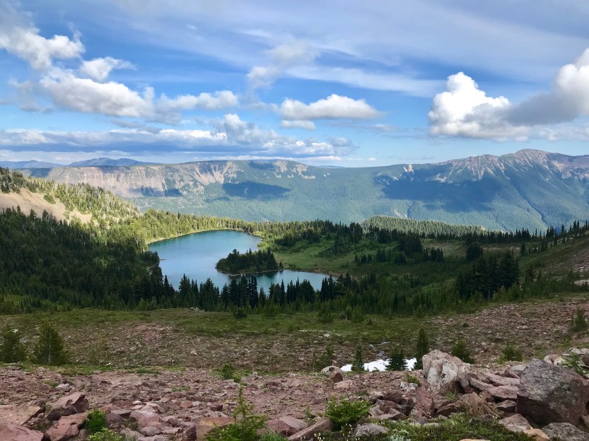
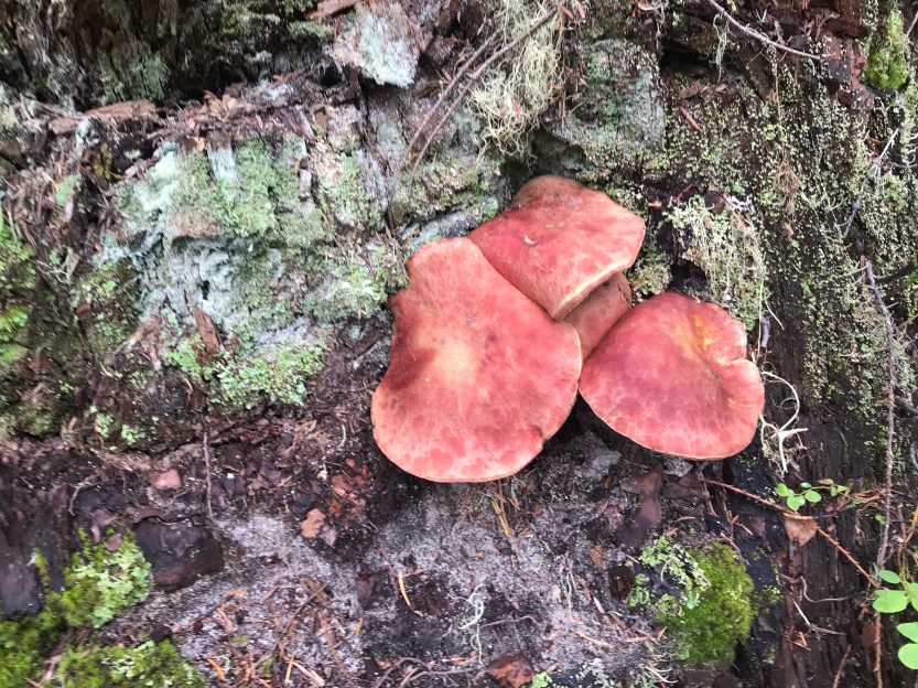
Day 97- 22 miles hiked. We got up early with the anticipation of getting into town by the end of the day. The trail was very wet today, and we walked passed several waterfalls that went across and along the trail. I also started to see giant mushrooms everywhere. It was a very hot day, and we were determined to get to Mirror Lake for lunch so that we could take a dip in the water. The trail continued to be very crowded, and when we got to the lake, we were surrounded by people. Evidently, this is a popular day hike with the locals, so there were a bunch of people hanging out at the lake (it was also apparently the weekend). We stripped off our stinky clothes and dove straight in and it was beyond refreshing! The lake was a beautiful blue! We ate lunch, and then made our 1,300-mile sign by writing it in some charcoal on a log. We continued on and made our way towards Snoqualmie Pass. We continued to be surrounded by southbounders, and were excited for the southbound bubble to die down. After several hours, we finally were able to see the pass from afar. As we walked, I continually checked my phone to see where we were, knowing that we were going to hit the halfway mark at any moment. When we finally got to 1326 miles, I called out to Savior and Beast, and we all did a cheer mid-stride, but kept on walking, with a celebratory beer ever present in our minds. As we got closer to town, we were surrounded by foxglove, both purple and white. It was beautiful to see, and the pass below was also stunning. We walked through several rivers before finally getting to the top of Snoqualmie ski hill. We walked along the ski runs, and then finally made our way down into the tiny ski town of Snoqualmie Pass. We checked into a hotel for the night, and made our way to the hotel restaurant where we bought a round of drinks to celebrate our accomplishment of making it halfway! I still wasn’t feeling great, although my fever had lessened. Regardless, I couldn’t pass up a halfway there beer! Snoqualmie also lies almost exactly halfway through Washington, so we talked about how we were almost done with another state as well. The guys were going to leave me behind here so that I could walk with my brother, so we also made plans on how we were going to meet up at the next stop in a few days. All in all it was a celebration, and we were all so excited to have made it this far!