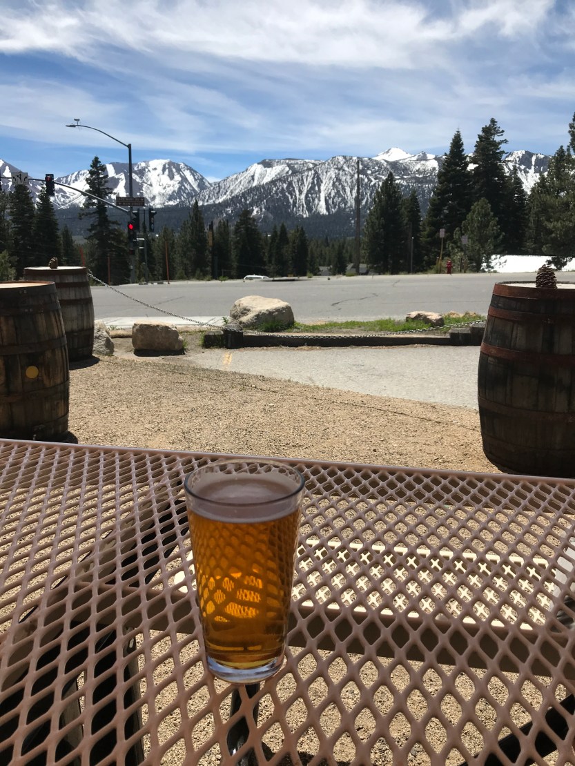
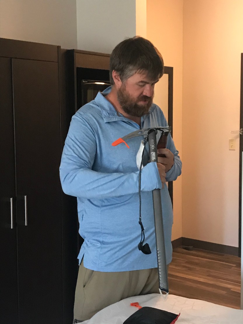
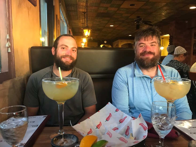
Day 55 and 56: 0 miles hiked, but we drove 630! We woke up in Ridgecrest with a full days drive ahead of us. We packed quickly and headed out. Game Over and Merlin came out to say goodbye. I teared up as I hugged Merlin, as I was so sad to be leaving her behind. We met on night 2 (25 miles in), and have been together (hiking 600+ miles) ever since. It was difficult to fathom the rest of the trail without her! As we left the town, we decided to take the scenic route that would take us past the Sierras and spots where we would be hiking in Northern California. It was fun to see all the places we were headed to, and also incredibly beautiful. After a few hours, we pulled over, where I realized I no longer had my wallet. After digging through the car multiple times, I came to the conclusion that I had left it in Ridgecrest. I called Merlin, and she found it in the room my mom and I had evacuated the night before due to bedbugs. She offered to send it to us in Oregon, so onward we went. The drive was long, and since I no longer had a drivers license, I unfortunately couldn’t help my mom drive. We stopped in Mammoth Lakes for lunch, where we met a PCT hiker that had just exited out of the Sierras and was trying to decide what to do next. He told several horror stories that included black toes from frostbite, being surrounded by recent avalanches, and snow storms that caused people to be stuck in their tents for days with little to eat. None of this sounded like fun, and I was happy we were moving on to an area with less danger. We went to the REI in Reno in order to get some gear to help us in the snow and mosquitoes (the first hatch as snow melts is particularly notorious). As Beast went to pay for his new stuff, he realized he had left behind his debit card at the lunch spot in Mammoth. We turned to Savior and told him he better hold on to his wallet, since he was now the only one in our hiking group that had access to a bank account. Thank god for Venmo! We got into Ashland late in the evening and got a hotel for the night. The next day was spent doing chores around town (like getting temporary bank cards), and eating lots of food. I believe my mom was impressed by the amount of stuff we were able to shove into our backpacks, by how little we smelled after several showers and doing laundry, and by the amount of food we were able to put away! It was a struggle to fit everything in my pack with all of the gear I added for snow travel, including an ice ax, microspikes, waterproof socks, another pair of gloves, additional sleep socks, pants, rain pants, fleece, and a warmer hat.

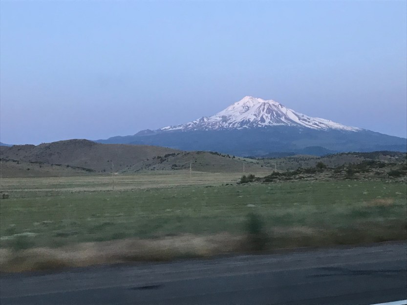

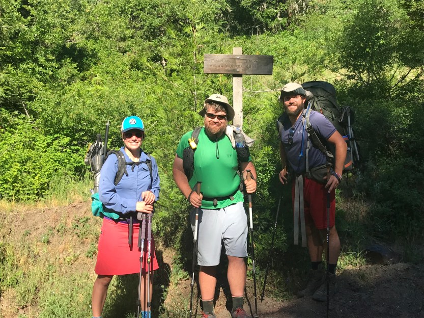
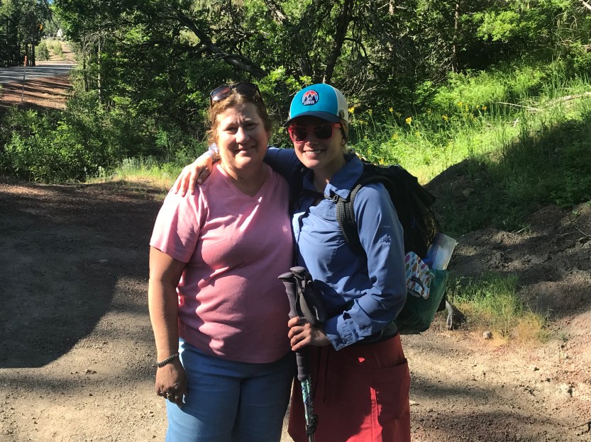
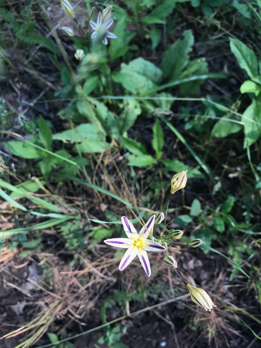
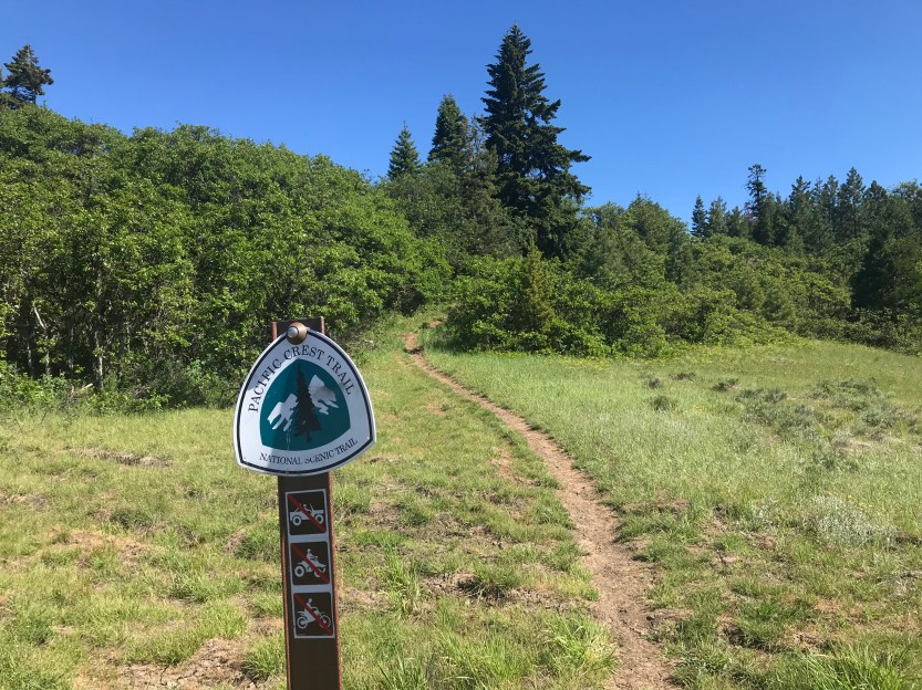
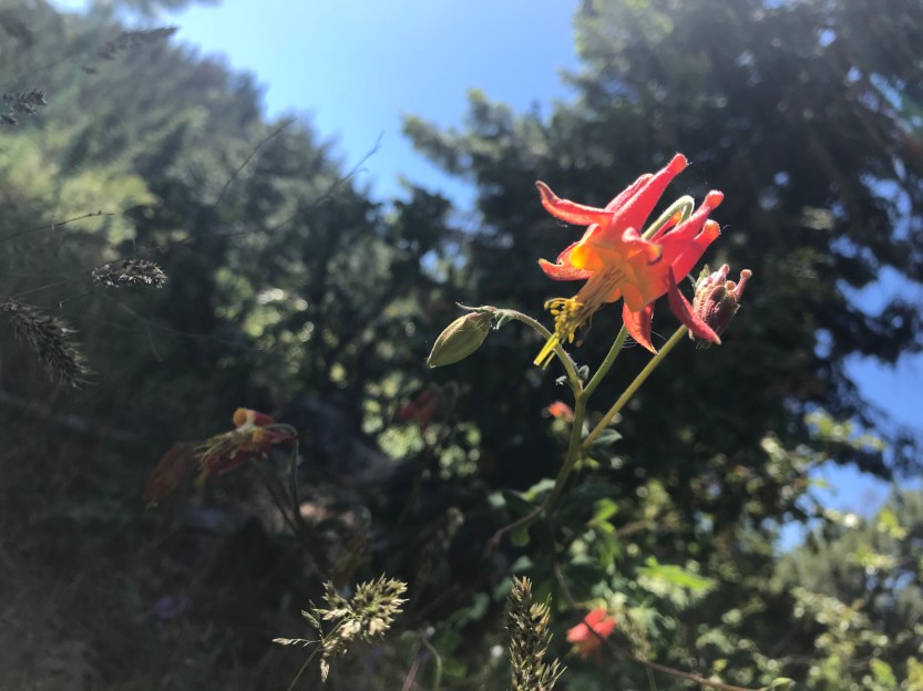
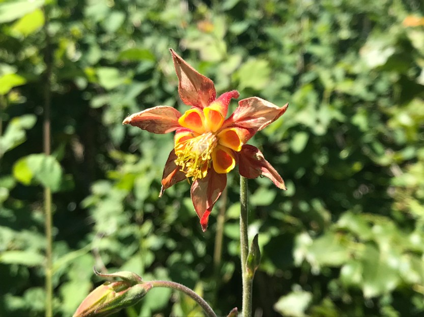
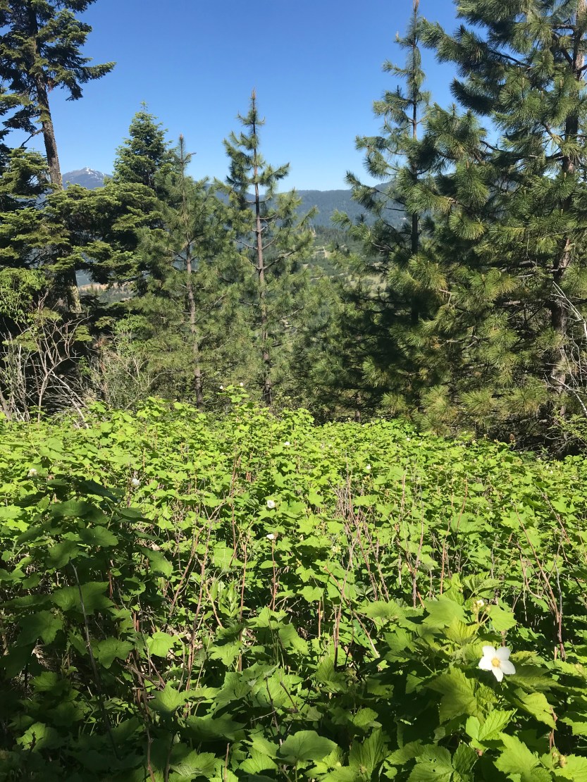
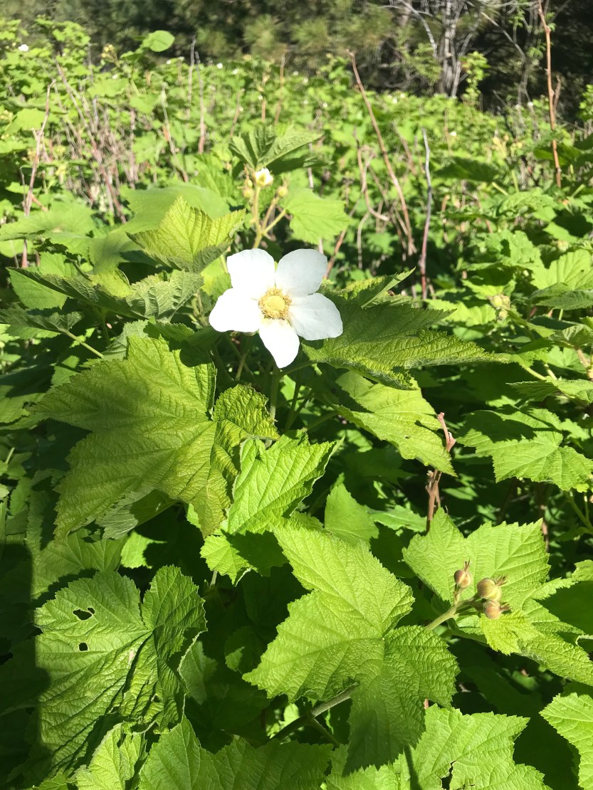
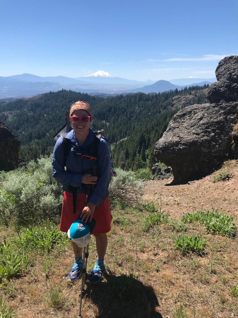
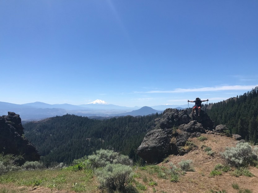
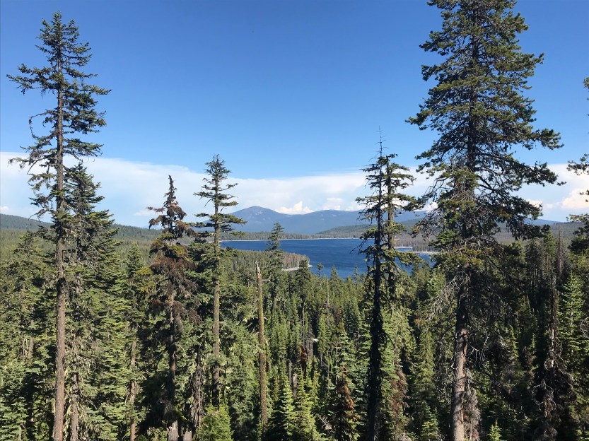
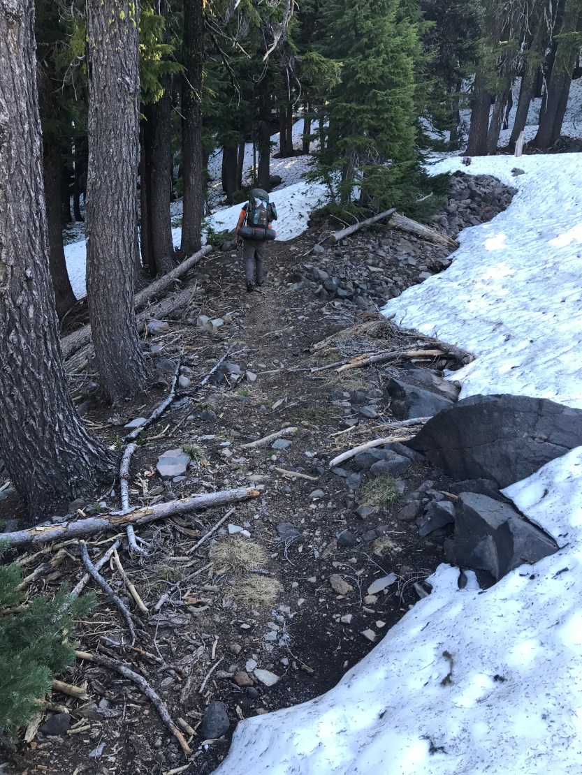
Day 57: 24 miles hiked. We woke up early and got ready to get back on trail. My mom dropped us off, but actually had the bulk of our backpacks in the trunk of her car that she then drove to our day’s destination. This is called slackpacking, and it’s where you’re carrying only the day’s essentials- food, water, etc. so your pack is a lot lighter. This was my first time getting slack packed, and let me tell you, I wish I had someone carrying my backpack for all of the trail… it was amazing! As we set out on the trail, we were all struck by how different Oregon is to the desert. There was green stuff, including grass, everywhere! Nothing spiky was trying to stab me! There are water sources everywhere! As I began, I thought to myself “have I died and gone to heaven? Is Oregon heaven?” We hiked in the forest, surrounded by trees for awhile, and occasionally it would open up and there would be thickets of thimble berry bushes (my favorite berry). Unfortunately they were all flowering instead of berry-ing, but I was excited at the prospect of eating berries later on the trail! It was hot and humid, a strange new thing compared to the dry and cold desert. I felt very foolish and questioned whether I would ever use any of that snow gear I had packed. There were flowers everywhere, and I was going extremely slow, just because I couldn’t stop taking pictures of all of them. Eventually the trees would open up and we’d have amazing views of Mt Shasta to our south, and Mt McLoughlin to our north. We eventually stopped for lunch at a beautiful spring and we all discussed how wonderful Oregon was in our first 10 or so miles! After lunch, I ran into a day hiker who told me there was an owl just ahead! I’ve never seen an owl in the wild before, and it was pretty magical to be able to see it! Eventually I got to our stopping point, Hyatt Lake, where I got my gear back, and learned that my mom, and then Beast, arranged to have us be slackpacked the next 30 miles too! What a wonderful first day in Oregon!
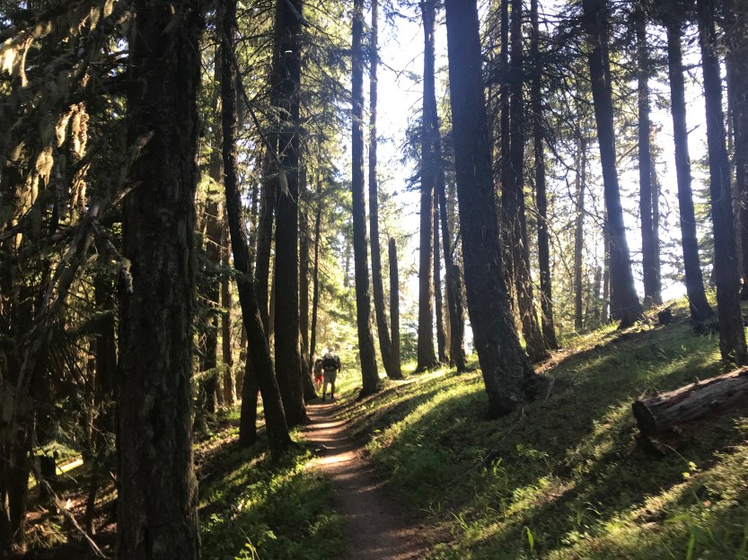


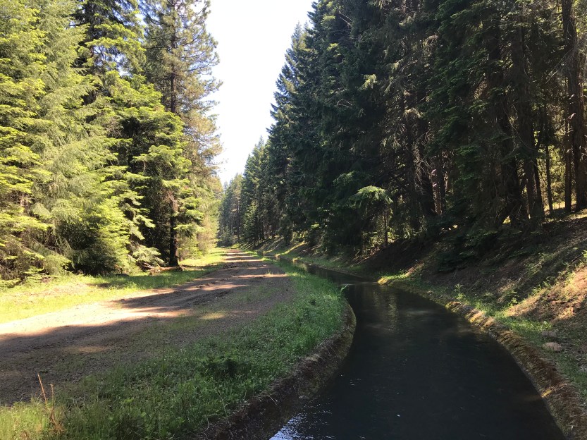
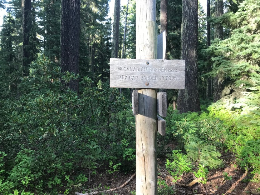
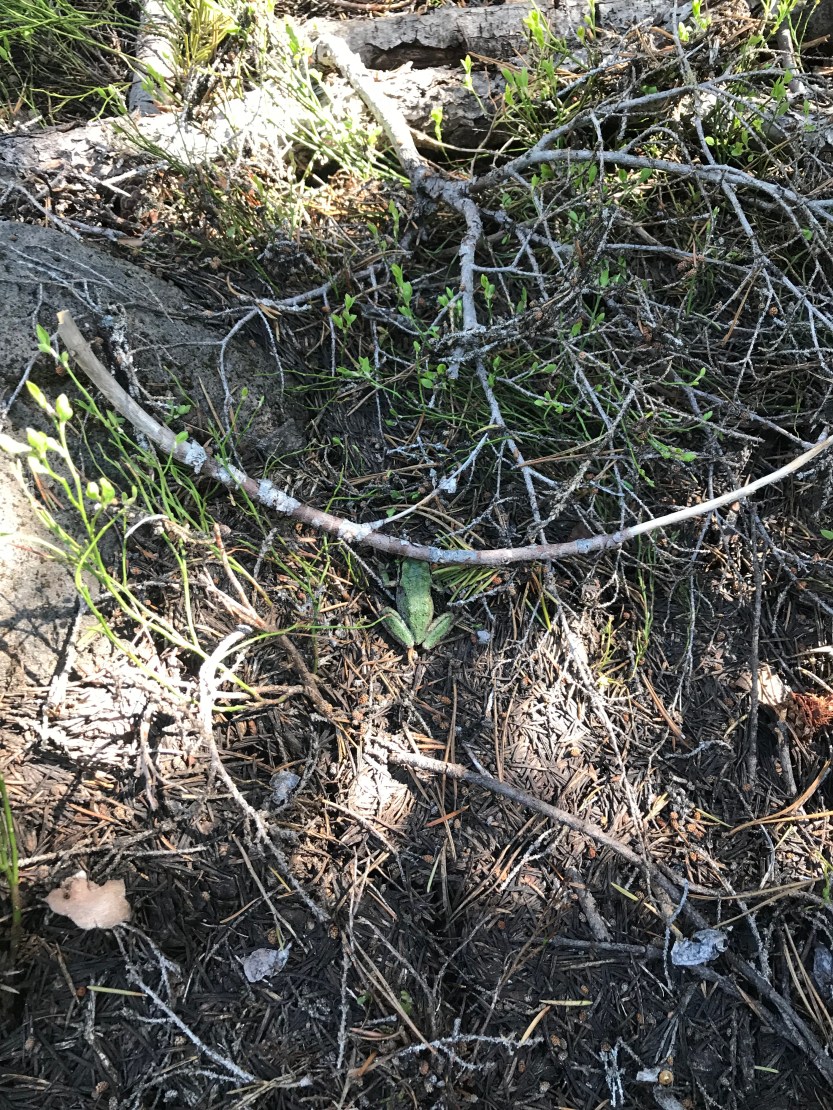
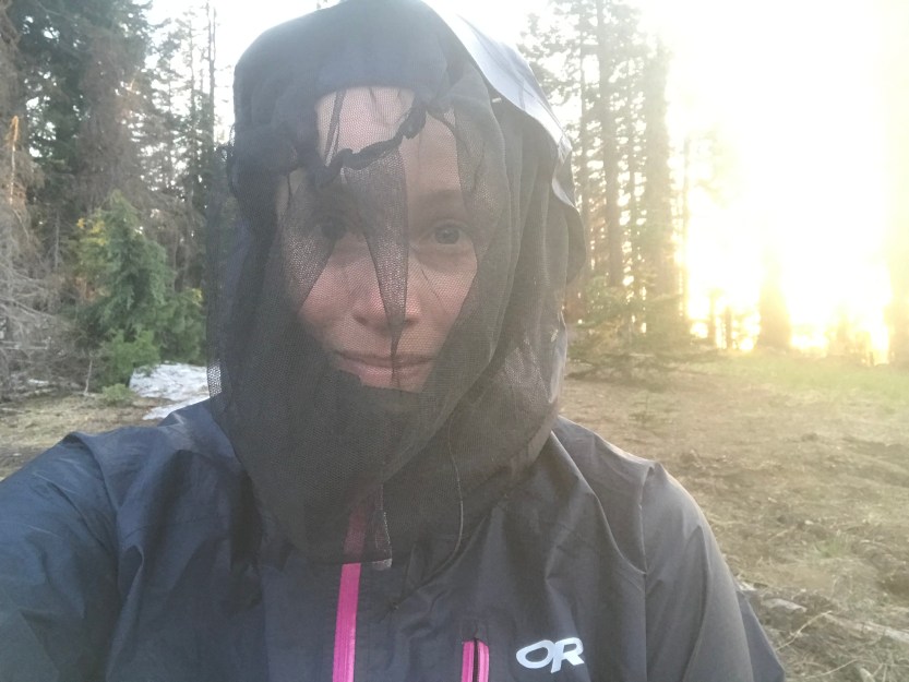
Day 58: 24 miles hiked. We packed up and gave our gear to an amazing trail angel, Corine, who was going to meet us early the next day with our stuff. We had to bring our camp gear with us this time, but at least we didn’t have to bring extra days worth of food, or our heavy snow stuff! We set out early, and the day was already hot. Every once in awhile Mt. McLoughlin would peak out from the trees as I walked ever closer to it. The day was beautiful, with fields of flowers everywhere. We eventually got to a lake for lunch, and we all decided to go for a swim, since we were sweating like crazy. At the shore, I saw a baby chipmunk half in the water and half out. It was shivering, so we coaxed it back onto dry land where it would hopefully dry off and warm up! We swam and relaxed in the water for a bit before going back on shore to eat some lunch. Almost immediately after starting up again, we found ourselves at another aqueduct, though this one was much nicer than the one in California. From there we continued through the trees until reaching a very cold spring where we got some water and iced our feet. At this point it was getting late, but we needed to make a lot more miles in order to pick up our gear first thing the next morning. We separated, and agreed on where we were going to camp that night and walked at our own paces with Beast out front, me in the middle, and Savior behind me. Our campsite didn’t have water, so we needed to get water at the last water source. The mosquitoes really picked up by the evening, and the walk through Oregon began to remind me of a walk through the U.P. of Michigan. There are trees and lakes everywhere, and you’re surrounded by mosquitoes (later when I saw snow in the middle of the summer, it was confirmed to me that Oregon is in fact, just like the U.P.). It also confirmed to me that Oregon is not heaven, because mosquitoes don’t exist there. I stopped at the last water source, but was concerned when it looked dry. I couldn’t stop to think, because I was literally being swarmed anytime I even paused, but I really really needed water too. I put my pack down and began to walk in a circle so I wouldn’t be swarmed, but I could still get somewhat of a break from carrying my pack. I decided to go upstream a bit, and I was in luck because it was flowing there! I knelt down to get water, and had to use my other hand to swat all of the mosquitoes attacking me because I had stopped moving. I then had to walk in a circle again while I was filtering, because so long as I was moving, they wouldn’t land on me. Never again will Inot know where my headnet is in my pack! I was worried Beast and Savior would miss the water, since it had appeared dry, so I got a bit extra, tried to make a sign out of sticks for Savior (the mosquitoes made this difficult), and then continued along. By this point it was 8 pm and I wanted to stop to eat dinner before walking the rest of the way to camp. The aforementioned mosquitoes made that impossible, but then, I entered into a new, and foreign looking landscape: a lava field. It turns out, the mosquitoes don’t really like lava fields, so I found a part that had a slight breeze going (double mosquito protection) and cooked up my dinner before walking the rest of the way. The sun began to set, and as I left the lava fields, the mosquitoes returned with a vengeance. I was so sick of them and so I was really happy to see Beast set up at camp. As I got there, he told me to dive into his tent and put on layers so they couldn’t bite me while I was doing my own camp chores. Savior showed up a little afterwards and we proceeded to air our grievances about the bloodsuckers. I was glad I got extra water because both Beast and Savior saw that the stream was dry and were chased away by the mosquitoes before they could investigate further. And so began our first day of forced marching through the woods. We camped at mile 700, and I’ve decided to make my own signs from here on out for the 100 mile markers.


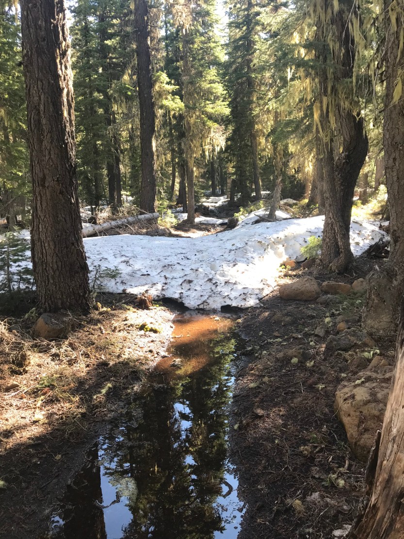
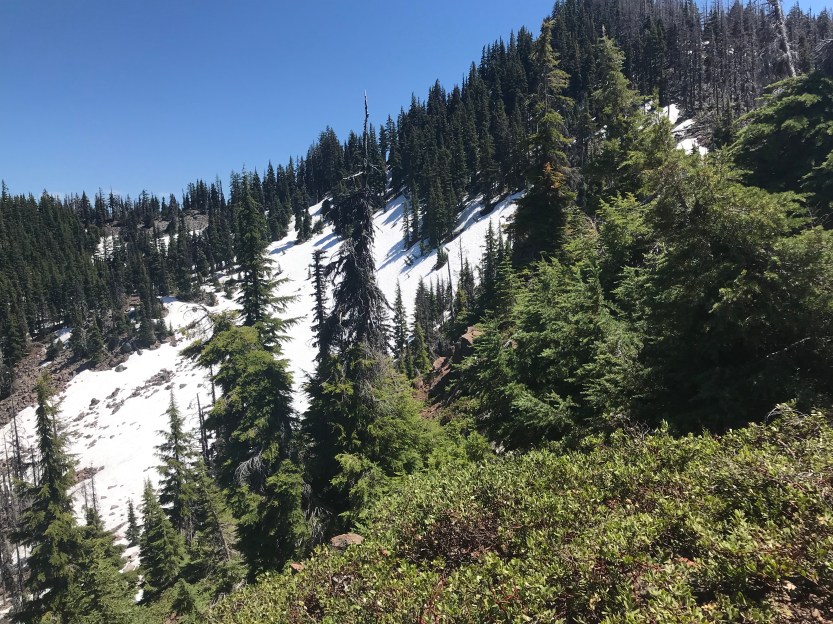
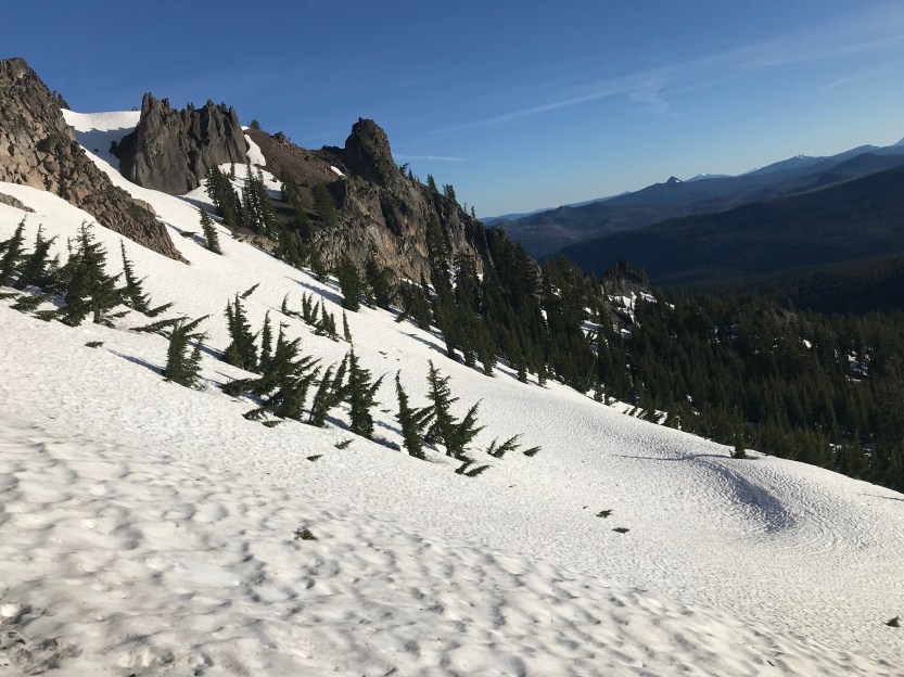
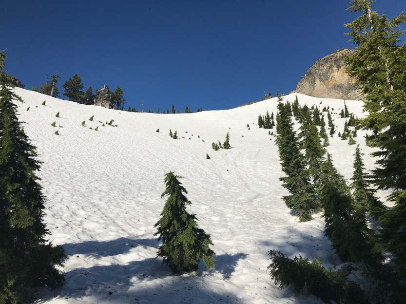
Day 59: 17 miles hiked. We woke up early because we were meeting back up with our gear at 8am and we still had 6 miles to go. The morning was filled with lava fields, which aren’t very much fun to walk on after awhile because it’s very rough on the feet. We had many great views of Mt. McLoughlin, and it was strange to walk through a lava bed while working my way towards a volcano. Here’s to hoping it’s extinct (it is…)! When I got to the road, I saw that Beast had gotten our packs, and was talking to someone pulled over in a truck. I approached and recognized the man, but couldn’t immediately place him. It turns out, it was Hoosier Daddy, who had given me trail magic on day 3 at Mount Laguna! He offered beer and chips and explained that he was dropping off boxes for his own section hike of Oregon later in the summer. We chatted for awhile, and it was great to see him again! As he left, the three of us sat by a stream to repack all of our bags now that they were fully loaded. As we packed, another car pulled over, and a lady came out offering beer and strawberries! It’s insane that we’d been hiking in Oregon for 2 days now, and have had 2 people slack pack us, and 2 random acts of trail magic, not a bad start! We eventually started up again and started to walk around the base of Mt. McLoughlin. As we rounded up to the north side, we encountered our first snow. At first it was just patchy with a few steps here and there, but occasionally it was larger batches where there was potential to lose the trail. I appreciated the snow, though, because that meant there were fewer mosquitoes following me through the woods! We eventually found a campsite with a spring that wasn’t snow covered and set up camp for the night. The mosquitoes were horrible, so we built a fire and got a bit of relief before bed.


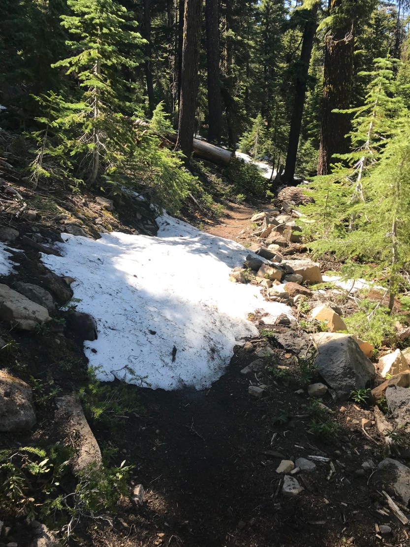

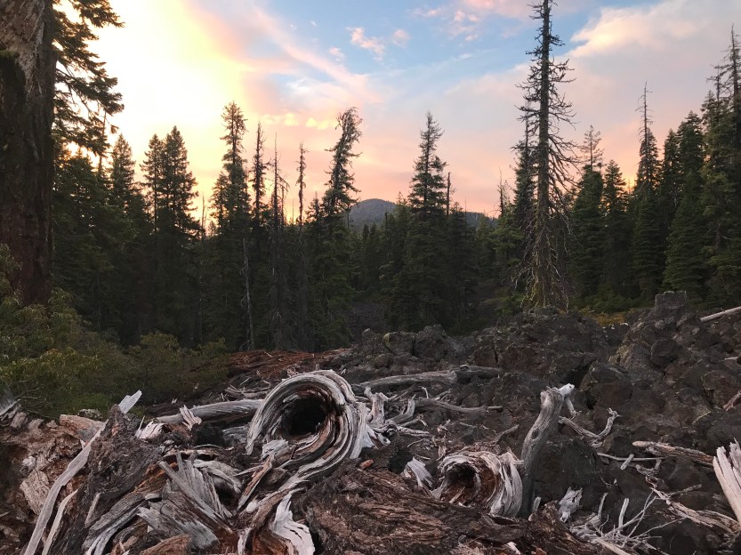
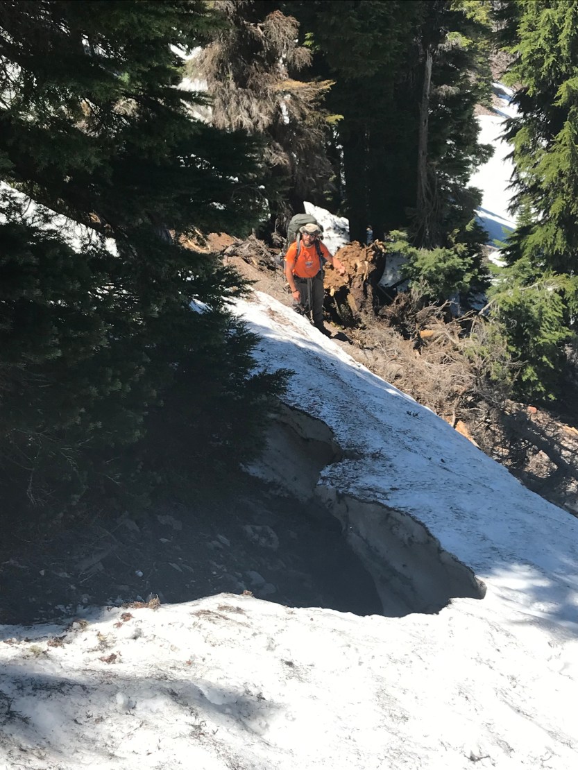
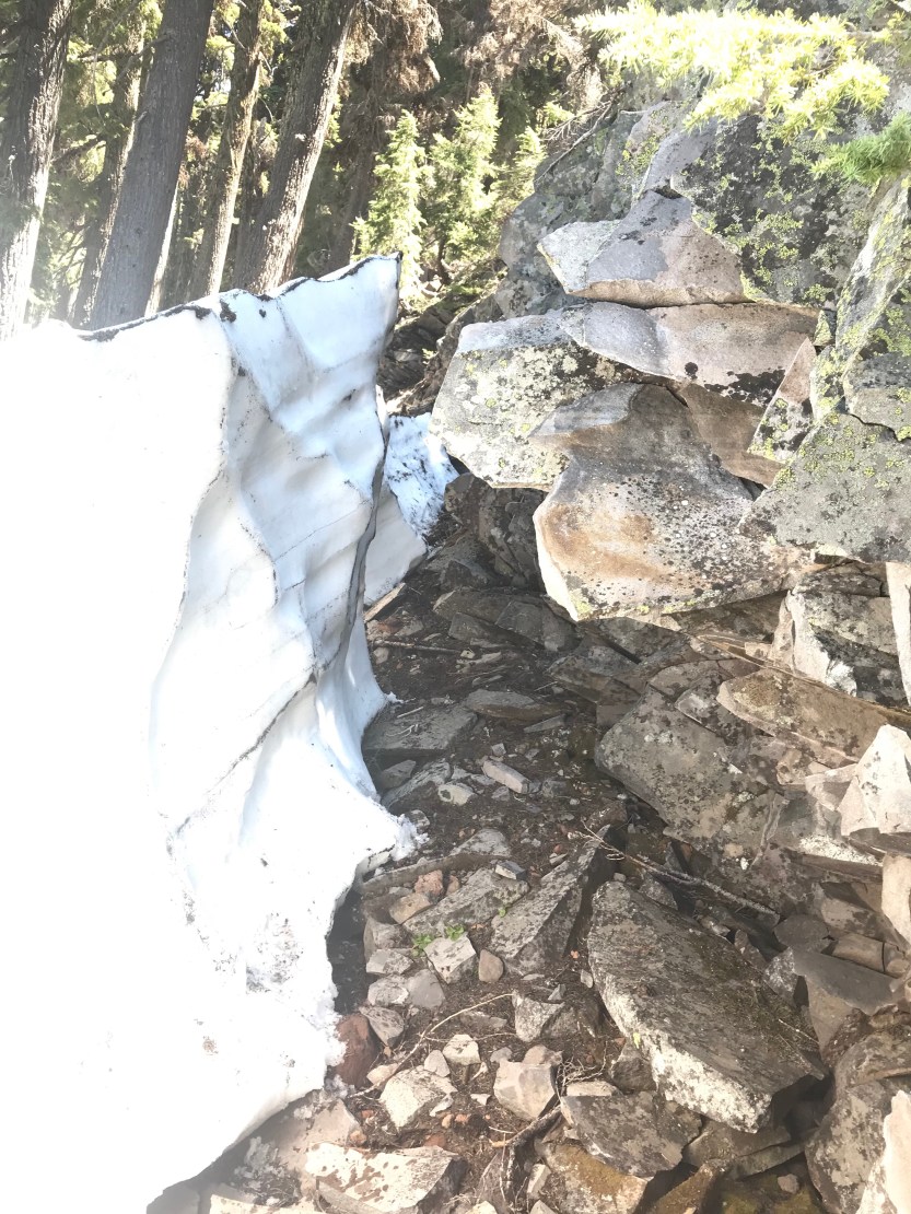
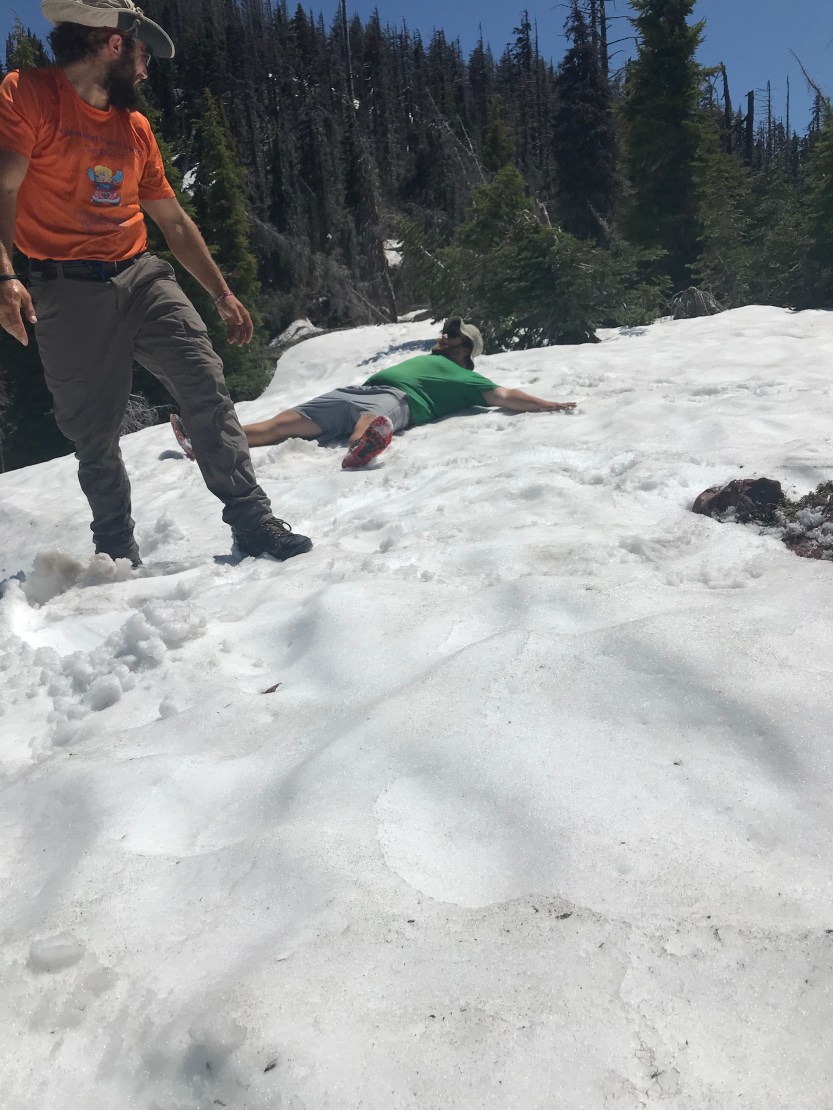
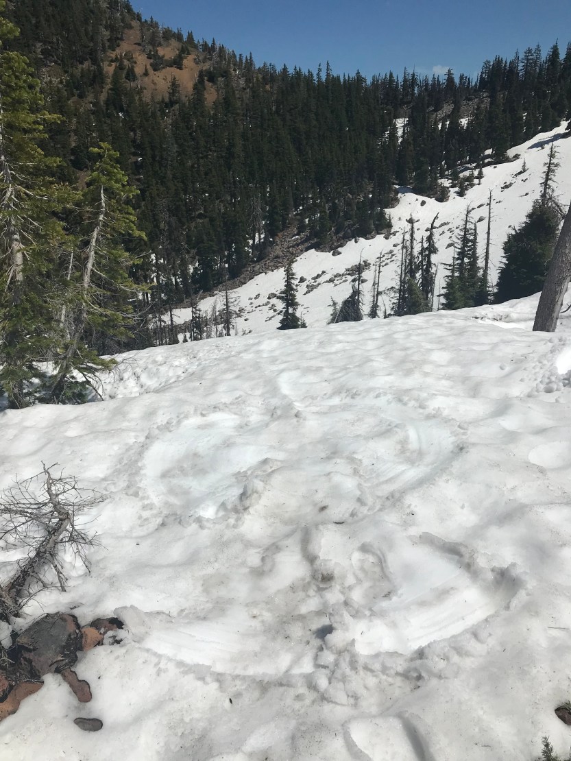
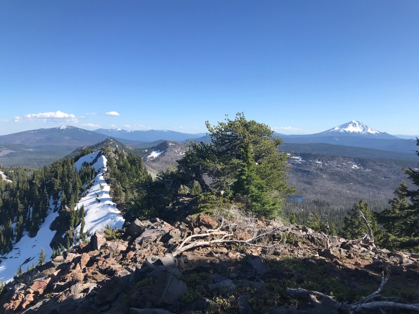
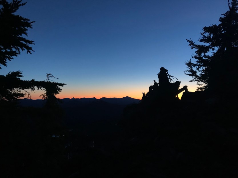
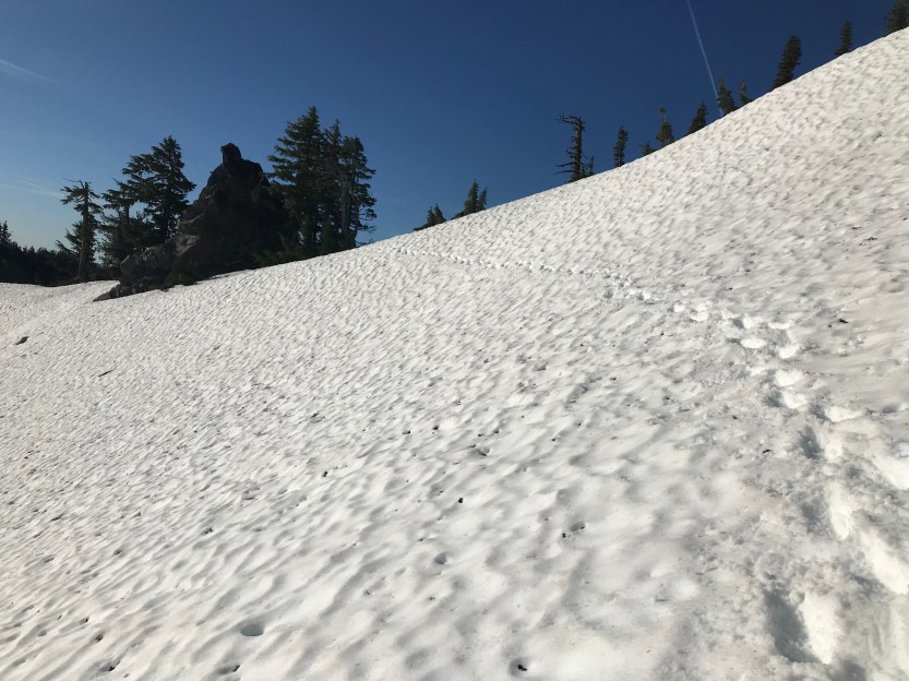
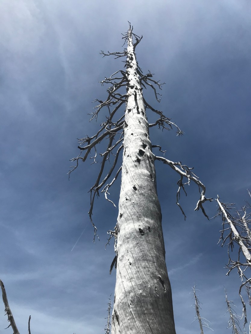
Day 60: 12 miles hiked. The mosquitoes were waking up just as we were too so when I got packed up, I immediately left camp without waiting for the guys. I realized early on that the mosquitoes don’t like the sunny areas. Unfortunately, the trail was completely covered by trees, meaning they were relentless. As I walked, I’d only see about 10 in front of me and around my hands, but when I’d look behind me, I’d realize that a cloud of hundreds were actually chasing me through the woods! Anytime I wanted to pause, I was immediately surrounded and covered! At one point, I lost the trail, as it was covered in snow and had turned sharply to the right. Our group was one of the first ones going through Oregon, so there’s not really a trail of footprints to follow. I tried to take out my phone to figure out where I was going but I immediately screamed in horror as I watched 12 mosquitoes land on my hands! I quickly realized that the pond in front of me was actually hiding the trail, and I ran across a downed tree (and in the process almost fell in, but I didn’t pause due to the aforementioned stalkers). I continued along looking for a trail before it dawned on me that the stream I was following was actually the trail, covered in a snow melt river. I usually try to mark confusing parts of the trail with arrows for others to follow, but I couldn’t pause long enough today to do so! We eventually made it to a sunny and dry spot where we could get some relief from the little monsters. It’s weird being in Oregon, as there are no other people on the trail, so we ate lunch in the middle of the trail, knowing there would be no one to interrupt us! We continued on, and we were moving pretty quickly, despite the circumstances. Then the trail took a sharp left onto the north face of a mountain and we were faced with a steep snow wall that we needed to cross. I no longer felt silly bringing all that snow gear! I put on my microspikes, took out my ice ax, and began to slowly pick my way across the ridge line. We eventually made our way to the top of the snow, where there was a melted out narrow strip that we could walk between the rocky cliff and snow. It was very tiring trying to path find through the snow, so when we got to the top of our climb, we celebrated by taking off our packs and making snow angels! From there we walked through a recent wildfire burn area that was completely snow free. It’s a bit eerie walking through all of the dead trees! We made our way to the next water source, snow lake, where we saw our first fellow PCT hikers, a couple from Germany and the Netherlands (whose names I’ve subsequently forgotten 🤦♀️)! Savior took a swim, and we chatted for a bit before heading out to the next challenge. We had a 2.5 mile climb between us and our intended campsite, Devils Peak. As we worked our way there, the trail turned from rocky shale (we were rounding Shale Butte) into dangerously steep snow. We decided to bushwhack our own path on the western side of the ridge, as that side was snow free, unlike where the trail was. We got to the top of a peak, and realized we were all exhausted and needed to camp before we had wanted to. There happened to be a small campsite near us, at the top of Lucifer Peak, and we squished our tents together and set up camp for the night. The view from up top was spectacular, and we were able to witness a breathtaking sunset!
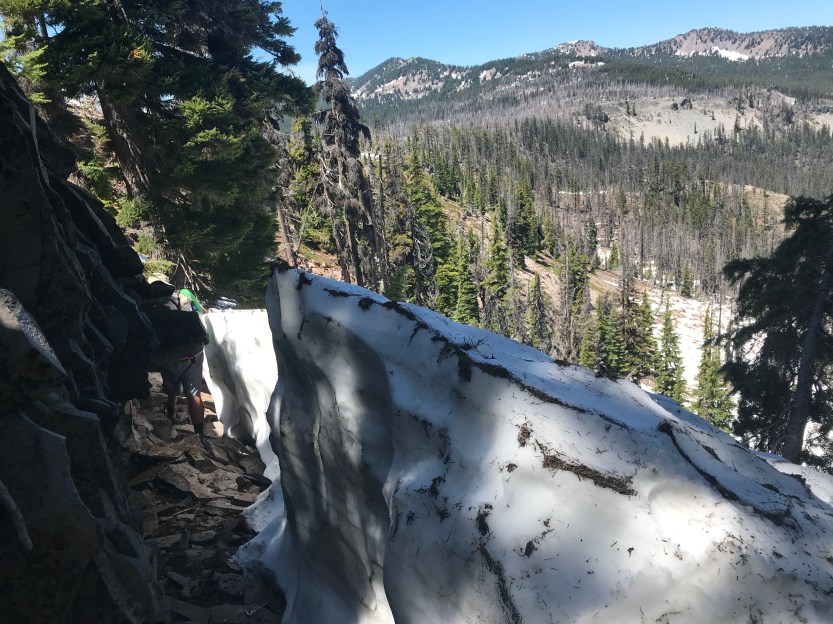


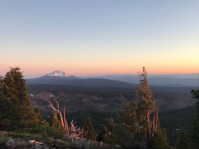
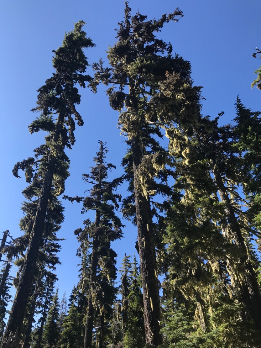
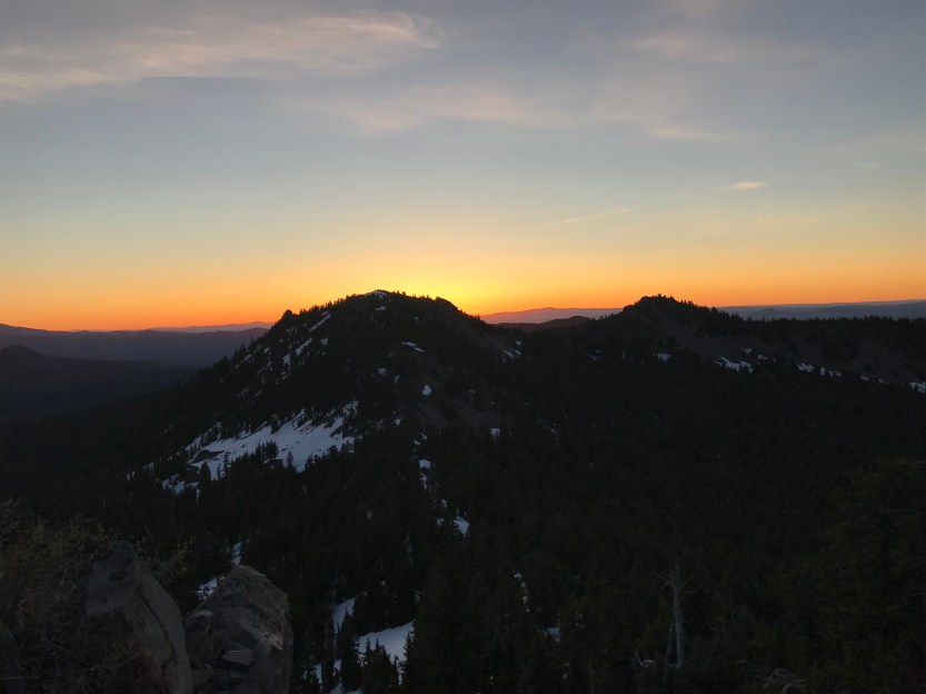
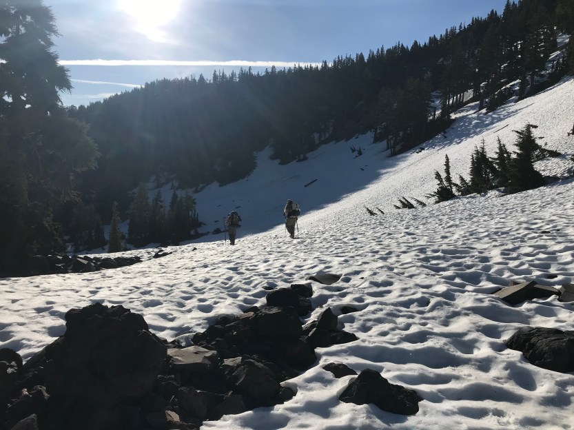
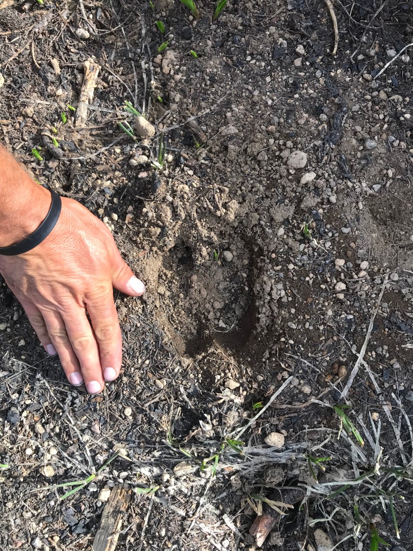
Day 61: 17 miles hiked. My alarm went off before the sun rose, as we were trying to get through the next section before the sun warmed up the snow too much. I opened my tent door and was instantly stunned by the view. The good thing about being up so high in the mountains means amazing sunset and sunrise opportunities, and this one did not disappoint! The trail was off and on snow as we made our way to Devils Peak and much of it was slick, so we put our microspikes on as we descended down Lucifer, and then up the ridge to the pass. As we got there, we found that the couple we had met the previous day had camped right on this ridge, and they were unsure of if they could descend. Looking around, I understood their hesitation. We were looking at a steep bowl full snow, with no tracks to help lead the way. The three of us looked at the conditions, and decided on what we thought would be the best route down. Off in the distance there was a patch of trees, and we determined that it would be best to make some switchbacks on their tree wells, as they were more solid, and it would give us the chance to easily switch directions. Savior and Beast went first in order to cut the steps, which meant I was able to take some pictures and video along the way. We made it down to the bottom and yelled out in celebration, and the couple above cheered us on as well! From there we continued on snowfields where we kept getting on patches of dirt that were getting more and more frequent. The snow melt was creating some epic rivers, but nothing too scary or dangerous to cross over. Eventually the snow thinned out and we were walking on solid ground again! We went through another burn area, and started to also see some elk tracks (my first time seeing them!). The burn area was nice because the mosquitoes didn’t like it, but it was also very hot without any shade protection. We had hoped to make it all the way to Crater Lake that night, but we were exhausted from all the snow travel and had to pull up short. Unfortunately we didn’t have enough water to camp and there was no water around us in the recent burn area, but there was a big snow pile next to where we were going to sleep. We decided to melt some snow and then filter it. This ended up being a terrible decision, because the snow was in a recent burn area and it tasted smoky. This in turn ruined some of our filters, as they always tasted of smoke afterwards, even after being cleaned. The mosquitoes were again insane, and we started a fire to keep them away while we ate dinner. It didn’t really work though, unless you were standing directly in the smoke cloud. I learned that they couldn’t bite me if I wore 2 layers of everything, so I put my rain gear on over my wool, wore 2 pairs of socks, had my headnet on, and with these measures I only had my hands exposed. I ate some dinner, and then jumped into my tent in order to get some relief, because even with these measures, it was still maddening listening to them buzz and having 5 on my headnet right in front of my eyes.

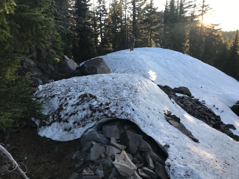

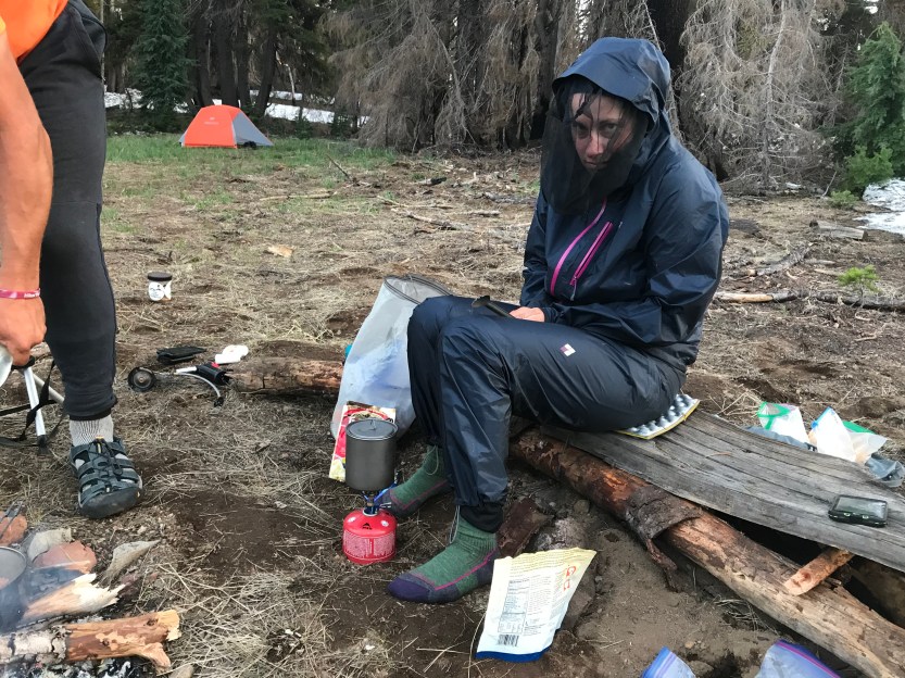

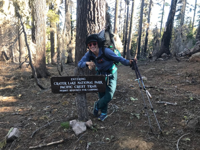
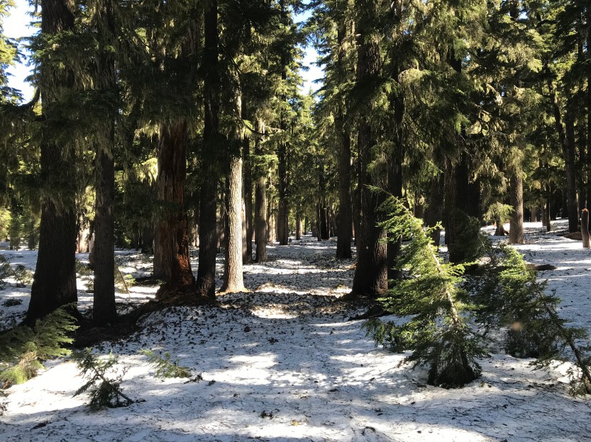
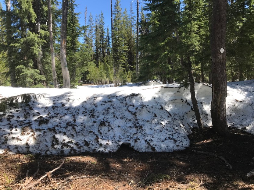
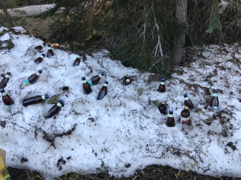
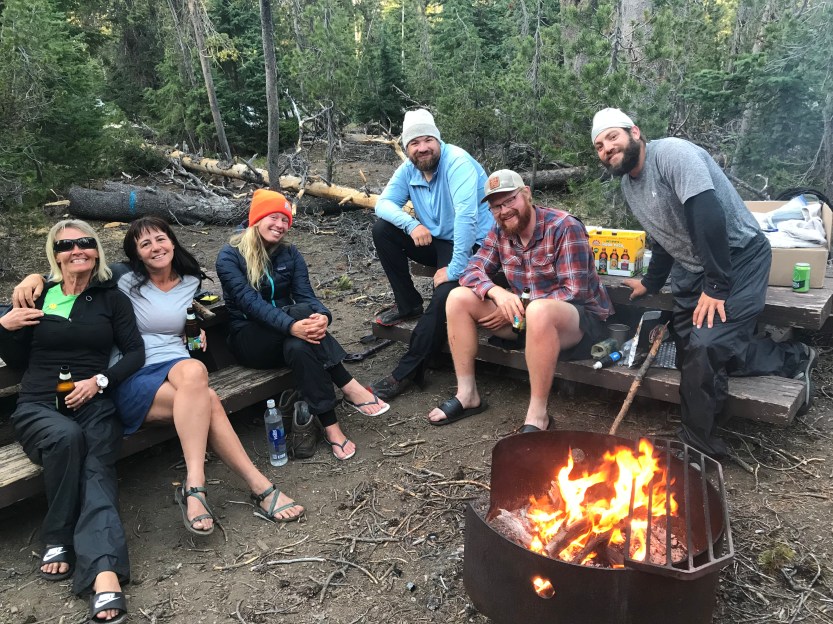
Day 62: 6 miles hiked. Since the beginning of this trip, I’ve been extremely excited to go to Crater Lake because it’s been a place I’ve been trying to get to for awhile now! We camped yards away from the national park border, so we entered right as we started the day. We had hoped to make it all the way to Mazama Village (6 miles away) in enough time to eat breakfast at the restaurant. This turned out to be a daunting task, as the trail was completely snow covered, and the trail was not blazed on the trees. This meant we had to stop every minute or so to find our way. I got lost constantly, and it was extremely tiring. Every time we got to some dirt trail, it meant going up and down snow banks that were up to my chest, so I actually tried to stay on the snow whenever possible. Hiking on snow is also really difficult , as every step can be in different conditions, based on the sun, so it’s hard to brace yourself properly ahead of time. Also, my feet were sliding everywhere, so in order to stay upright, my stabilizing muscles had to put in far more effort than they are used to. After several grueling hours, we finally made it to the highway and walked to the village. From there we made our way to the convenience store where we had sent packages and where my wallet was supposed to be. This was the beginning of an ordeal, as no one seemed to know what they were doing. It turns out the store had been purchased by a new owner a few weeks earlier, and all of the employees were brand new and had no idea of how anything worked in the store. Savior and I were able to pick up our packages with no problems, but Beast had 3 packages (including my wallet- you need ID to pick up packages, and my ID was in the mail, so we sent it to Beast to be safe. I was able to use a picture of my ID to pick up my own package, but it wasn’t guaranteed that they would allow this) and only one showed up. After significant back and forth with the store employees, they finally went back and found the second of his packages, but neither of these were my wallet! While we were trying to sort this out, we saw a familiar face, Rocket, who I’d last seen in Acton (mile 444!). We got caught up while we waited for the store employee to come back to tell me they had no idea where the package containing my wallet was. We retreated to the restaurant to try to figure out what to do next. The restaurant was not good, and I say this as someone who is now always hungry, and eats pretty much anything in front of me- this was a burger that had been in the freezer far too long, and I was pretty let down. We went and set up camp, which was also an ordeal because the store staff were saying we couldn’t camp in the PCT section, and we’d get a ticket if we did, while the rangers that would issue said tickets were telling us it was fine. This was a far more stressful day than I had anticipated, and I spent most of the remainder of it in the laundry room where I could get some peace from the mosquitoes and the heat. When I got to our campsite, I could see why it was possibly closed… there were downed trees everywhere, and it looked like a tornado had come through with the amount of debris everywhere. My fellow PCT hikers made the best of it… making a fire for the mosquitoes and a cooler for our beer out of a snowbank. We hung out and made new friends with 2 hikers named Oreo and Sunshine. Rocket was going south with her friend Xena, but Oreo and Sunshine were the second group of northbounders we’d met since getting to Oregon! It was exciting to learn we weren’t the only ones going north. We hung around the fire for the remainder of the night, though it was cut a little short, due once again to the vampires that were biting through even the thickest of our clothes! The European couple from the day before showed up towards the end of the day as well, and it turns out they are both filmmakers, specializing in documentaries. The woman interviewed me for about an hour while I sat in the laundry room, so I’ll post if I end up in their PCT movie 🙂
Day 63: 3 miles hiked. I woke up with fresh hope that my wallet ordeal would be resolved… sadly it was not. The store had record of them picking up the piece of mail at the post office, but it was not put into their storage where they keep PCT packages, and a search of the area found nothing. Apparently it was lost for good! I used the WiFi to start the process of canceling all of my cards if instead an employee had pilfered it. I also made arrangements to get my passport to me so that I would have ID. It’s incredibly frustrating to have money, but just no way to access it. My parents kept offering to send me cash a la Western Union, but that would require ID to pick up, which I also didn’t have. Thankfully both Beast and Savior have Venmo, so they could pay for things and I could immediately pay them back on my phone! Sorting all of this out was really stressful, and took a long time. It was 5 by the time this was all sorted out, which didn’t leave much time to hike. We hitched a ride to them rim, and I FINALLY got to see the lake, 30+ hours after I had crossed the national park boundary! It was, of course, beautiful! We walked around the rim to our home for the night, and admired the views along the way! The air was crisscrossed with trails from planes, which was also cool to see. As I started to walk again, the stress about my missing wallet melted away. Yes, it was annoying to ask my friends to pay for things for me, but I knew that it wouldn’t last long and that they were happy to help! We had to camp a mile away from the rim, so we traveled across the snow to a spring and uncovered campground. We again made a fire to help with the bloodsuckers. The Oregon PCT section has been either on fire or under thick smoke for the last several years during hiking season, so it’s a bit odd to be making fires with such frequency. It’s been such a wet summer this year that everything was either wet or covered in snow at this point, and there were plenty of ways to drown the fires. It still felt weird making fires after walking through so much burned down forest!


Hi. I had dinner with Jo recently and she shared your blog with me. Congrats on your PCT adventure. You’re my inspiration. I’ve done distance hikes in Europe but not backcountry and I’d love to take time off work do it someday. Happy trails. -Nerissa
LikeLike